Posts tagged 'Shipman Knotts'

Soloing from Patterdale

Posted by on December 15th 2011 in Great Escapes, Lakes Escapes, Testing for review, YHA

After Friday's nightmare seven-hour drag up the M6 I was glad to be back on the familiar A591. The further I drove the deeper the surrounding snow was, and I was unsure as to whether the Kirkstone Pass would be navigable. In the end, after discussing the conditions with a few local folk, I decided to go for it and found that although the road-snow at the top hadn't iced over it was beginning to do so on the leeward side and that made the descent into Patterdale quite interesting.

After getting installed at Patterdale YHA the evening was spent planning routes, chatting with a Mary and Paul (a nice couple staying at the hostel) and going out into the frosty night to take some pics of the amazingly clear sky.

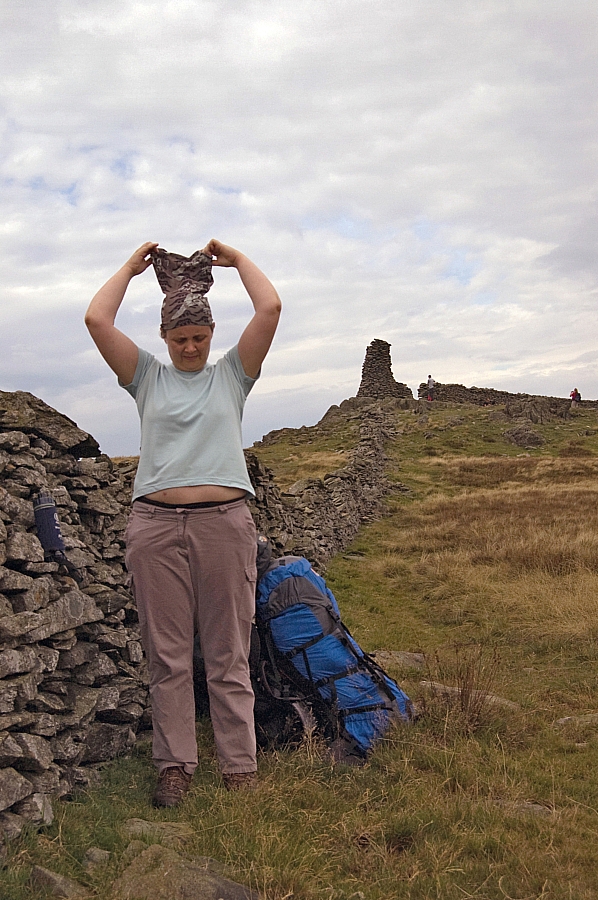
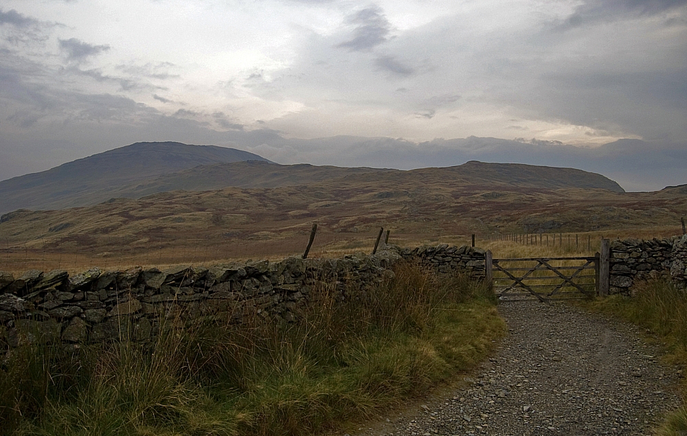
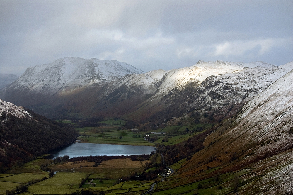
Saturday was cold and windy but dry with the odd bit of sunshine - perfect weather for taking in a few easy fells. I decided to nab Red Screes and Middle Dodd via Caiston Glen and the Scandale Pass. Not too far a journey, but walking into the wind and spindrift on the way up towards the Pass and then with a strong ice-laden side-wind on the pull up to Red Screes made it seem twice as far. I'll let the pics do the talking for a while...

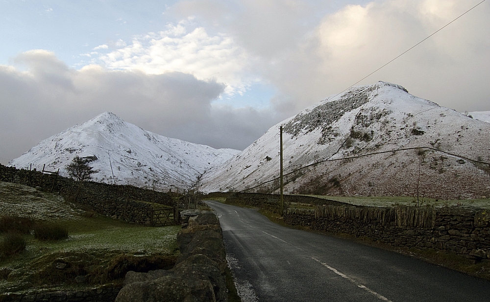
Middle Dodd and High Hartsop Dodd from the Kirkstone Road.


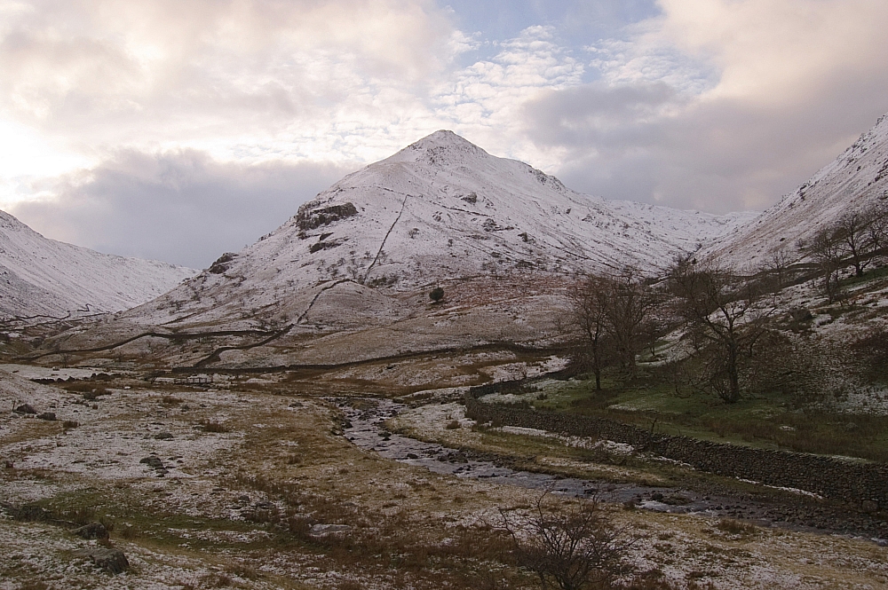
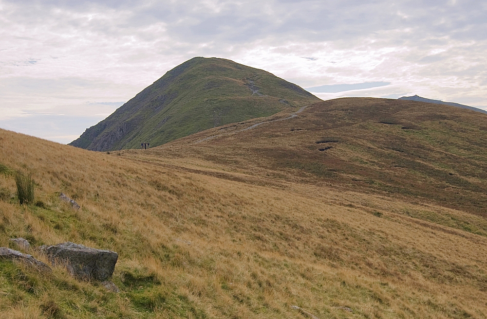
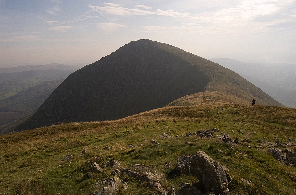
A better view of Middle Dodd.


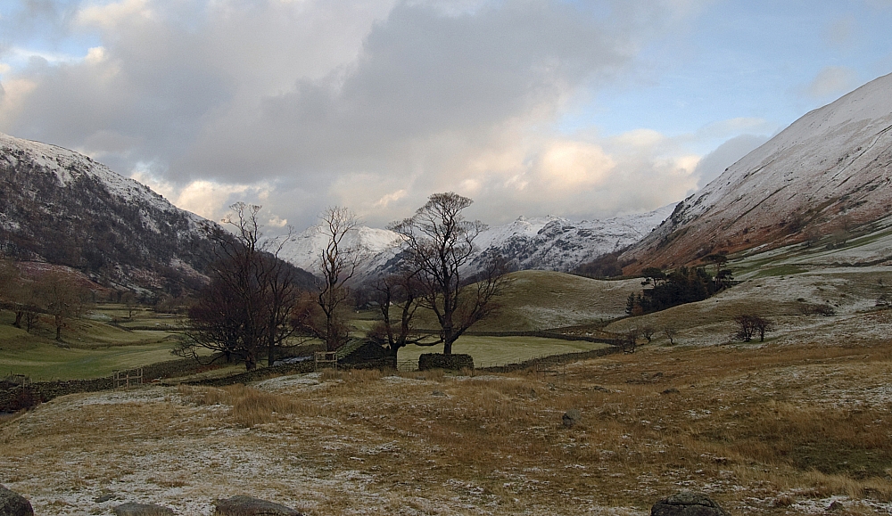
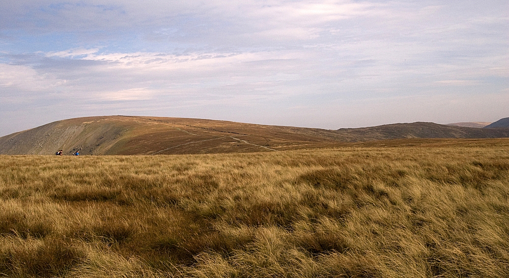
Looking back towards Hartsop.
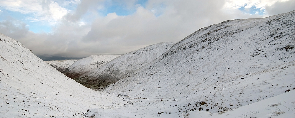
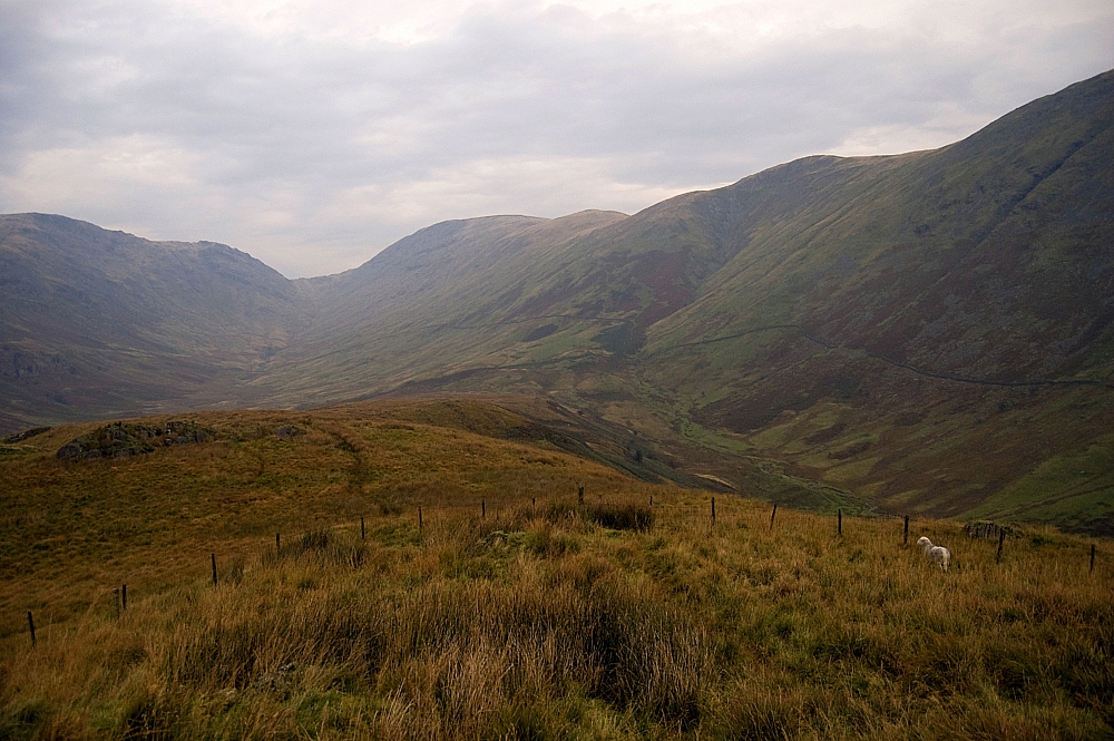
 

Caiston Glen.


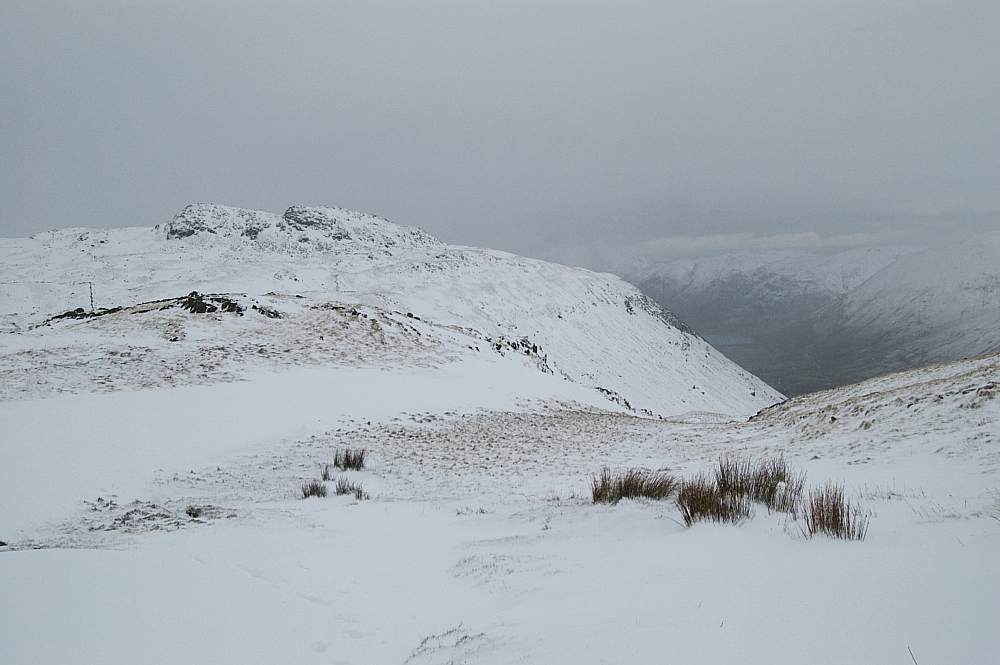
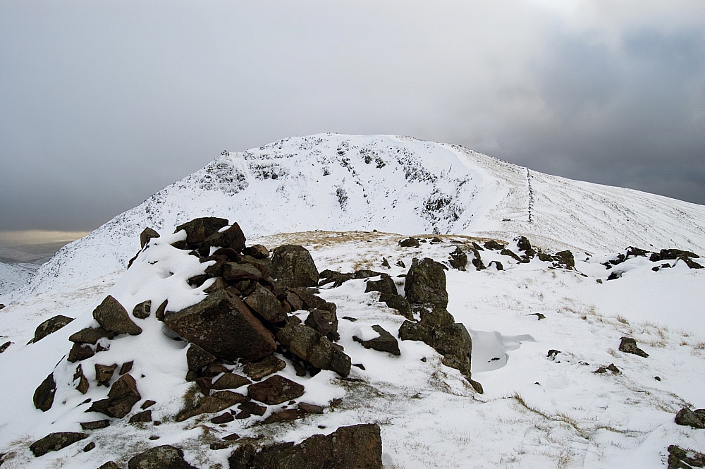
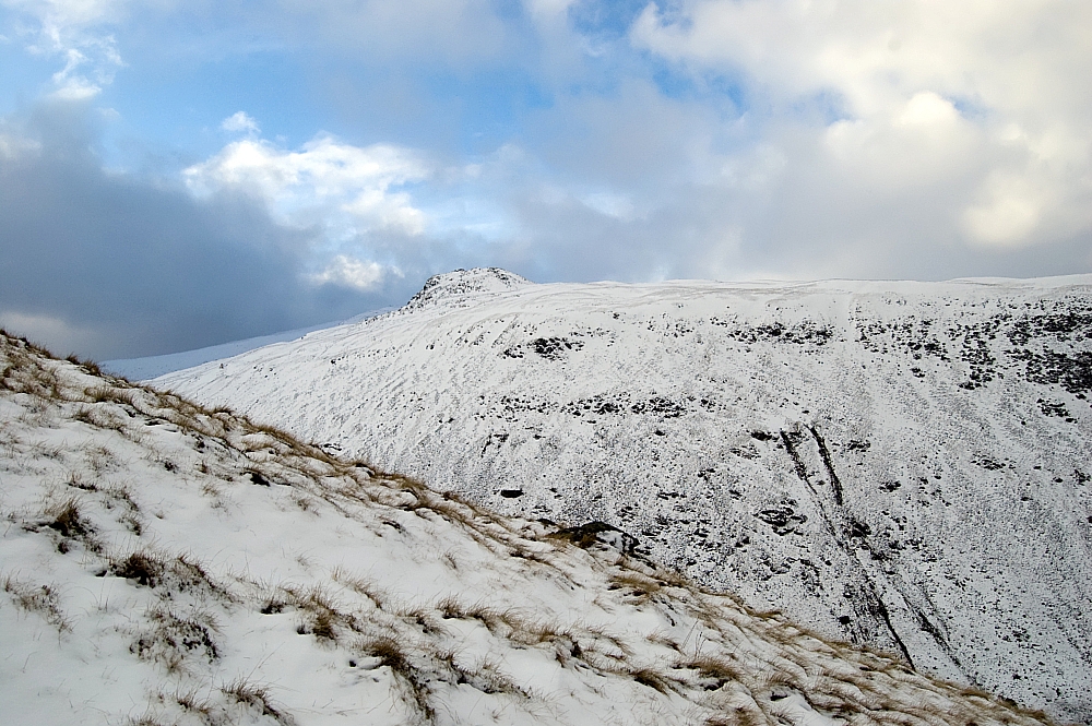
Little Hart Crag and High Hartsop Dodd from Broad Crag.


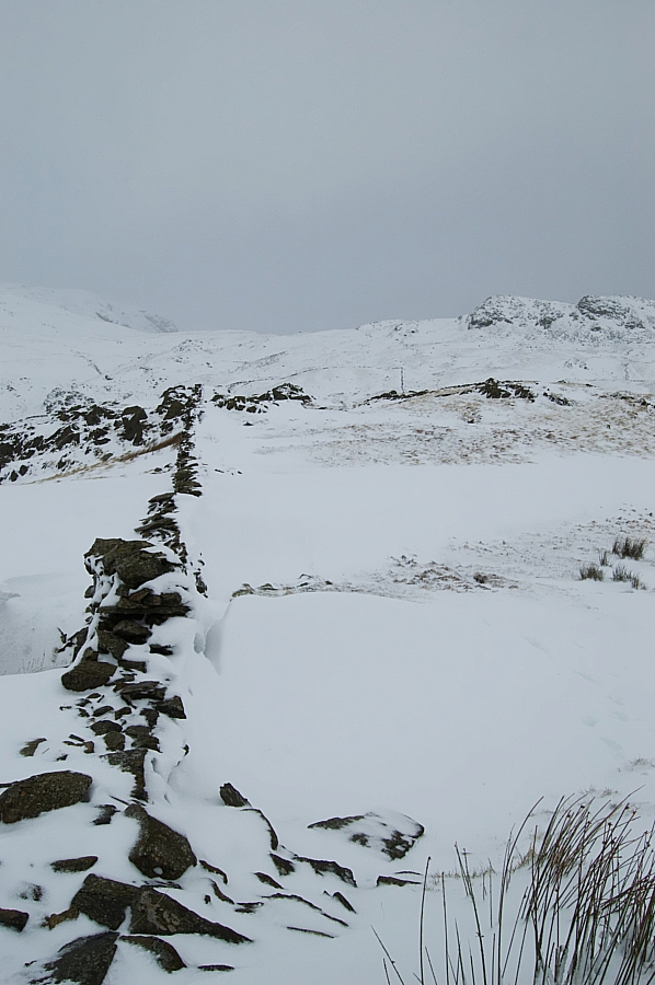
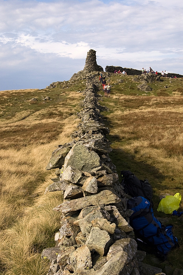
The wall above Broad Crag.


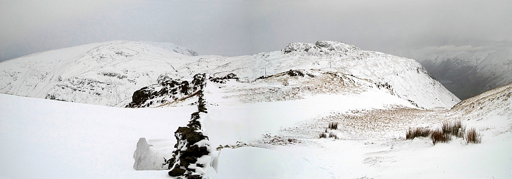
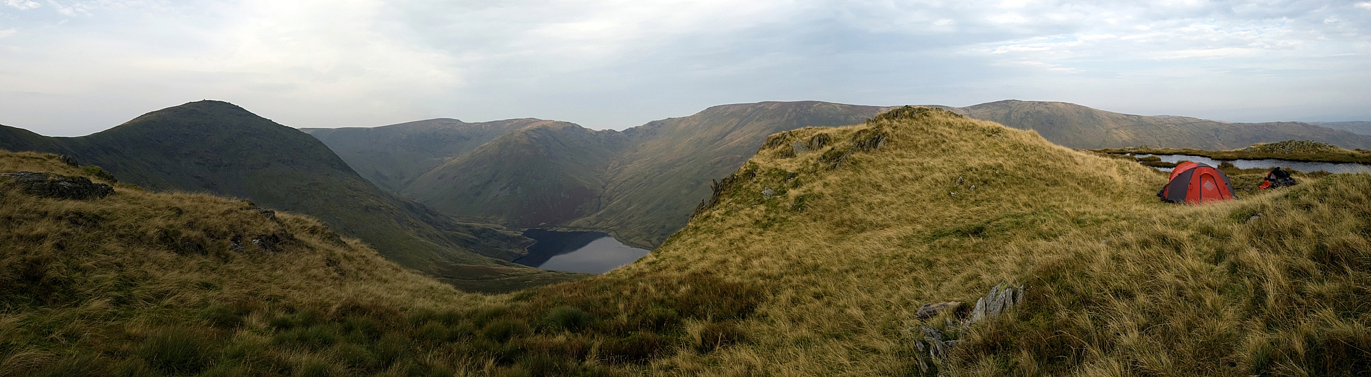
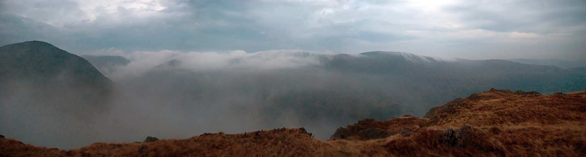
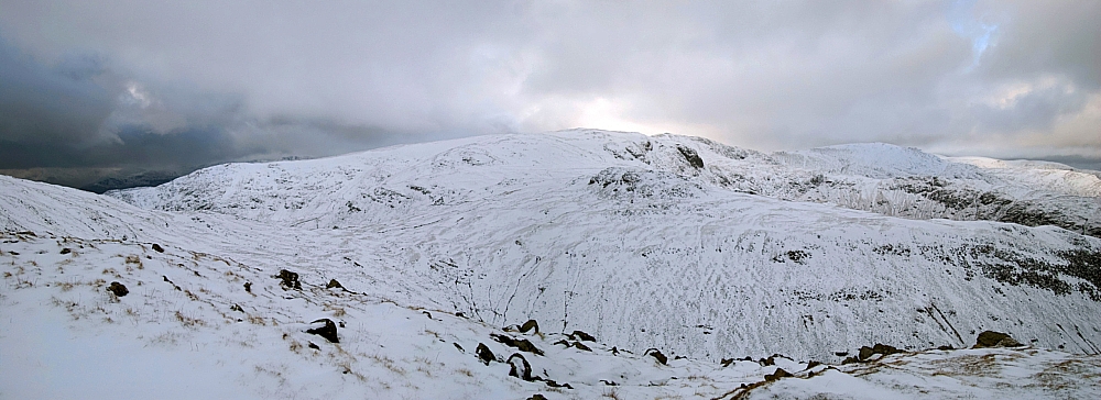
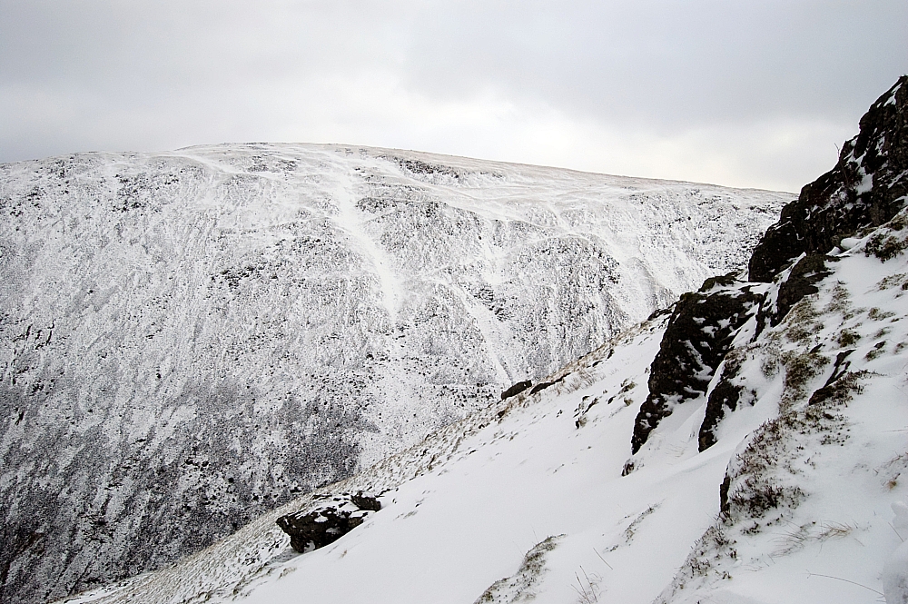
A wider view of Broad Crag and beyond.


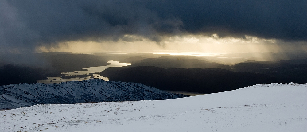
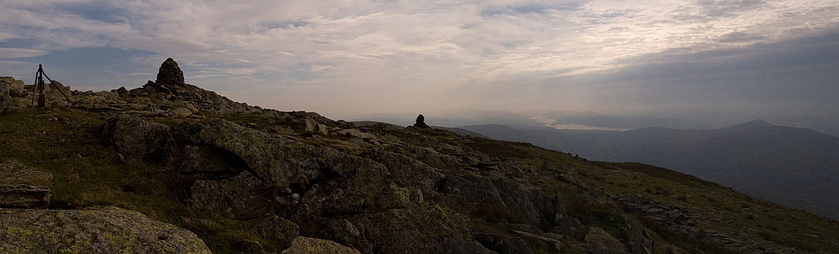
Light over Morecambe Bay.


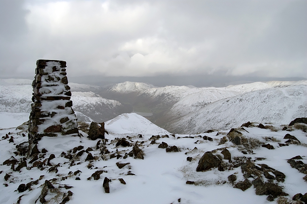
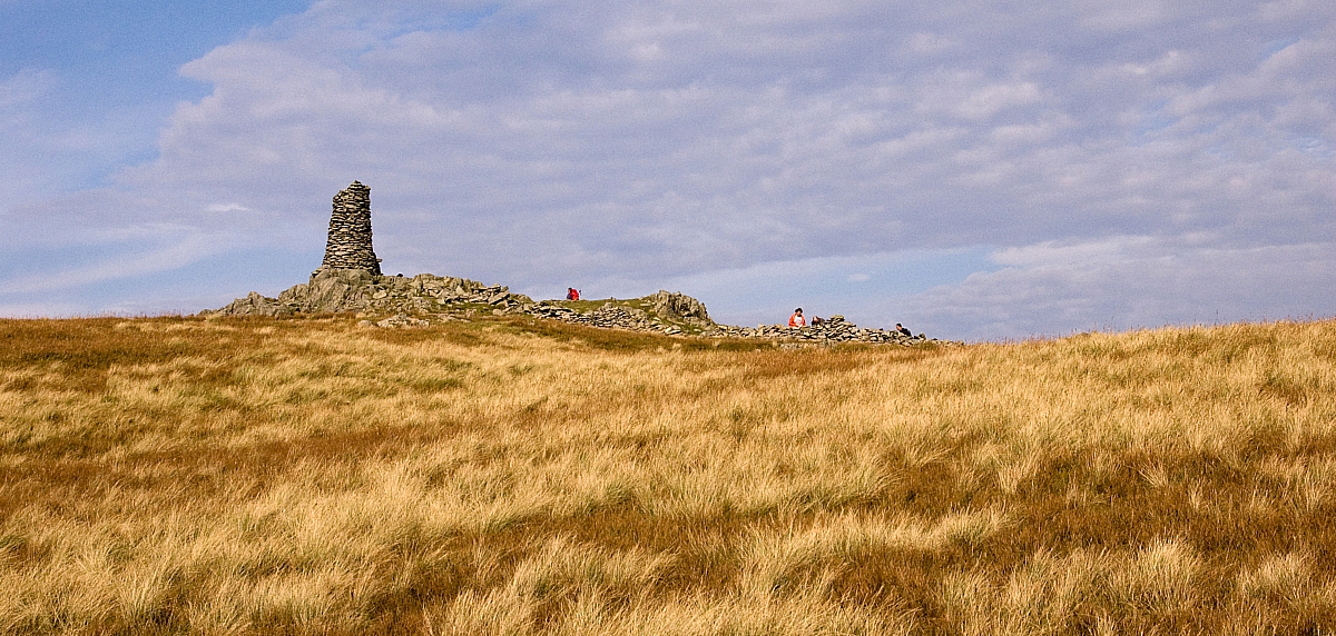
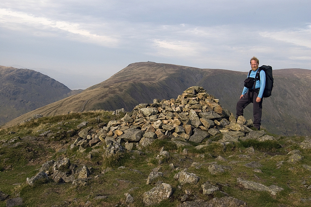
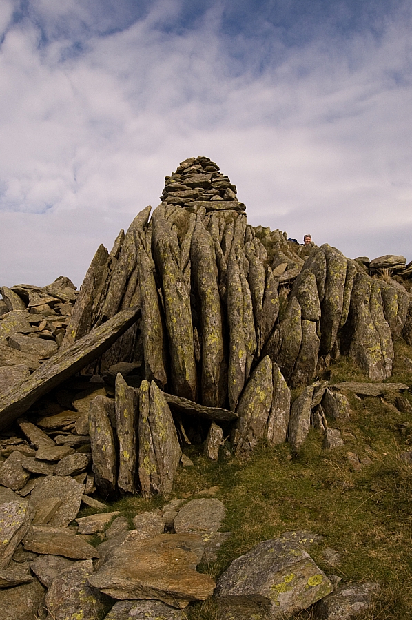
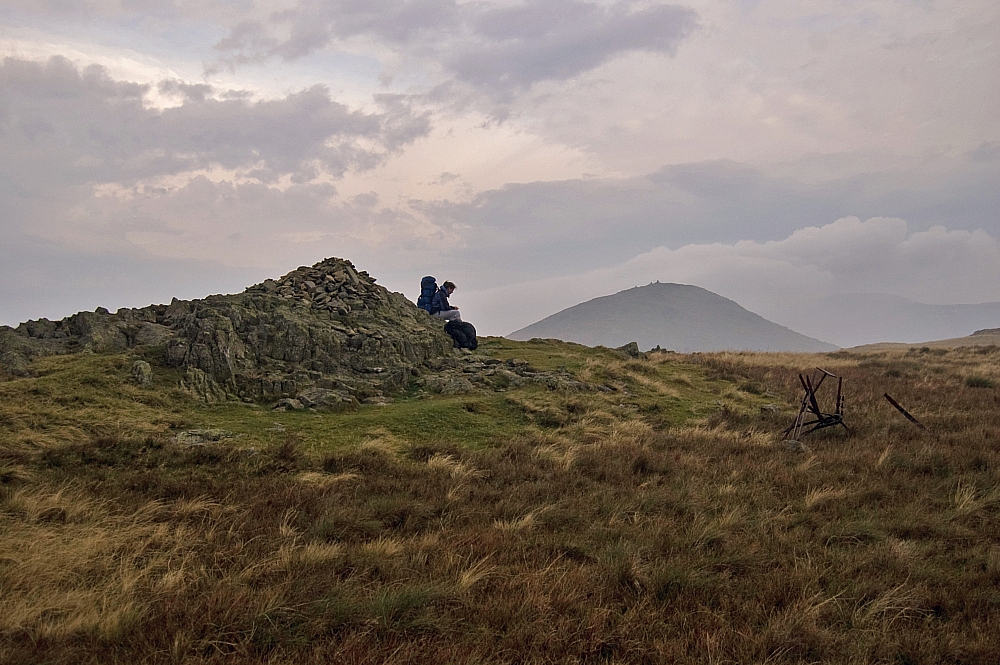
The Red Screes trig-point.


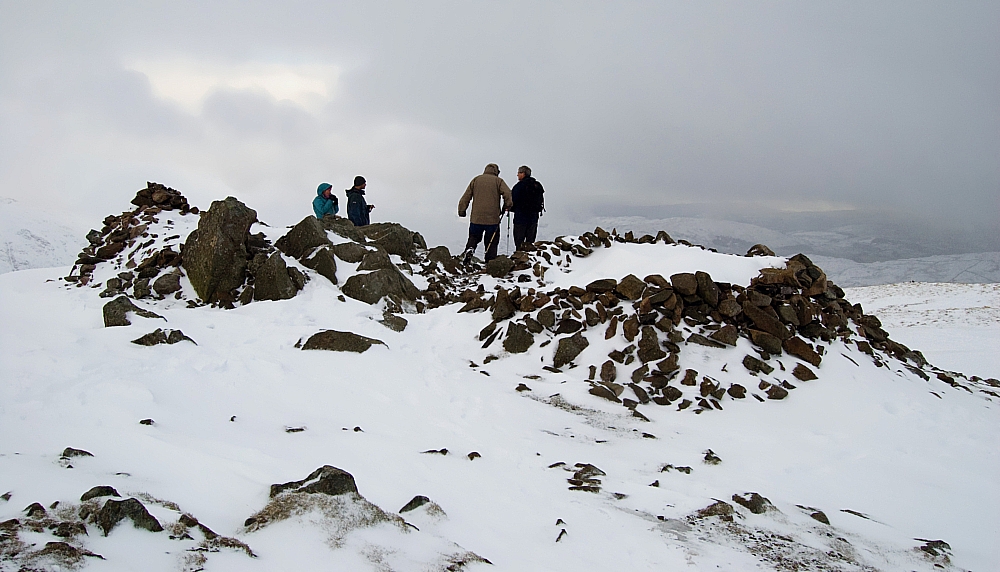
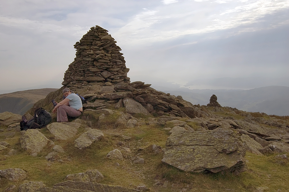
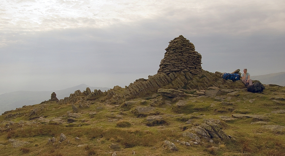
The Red Screes summit-cairn and shelter.


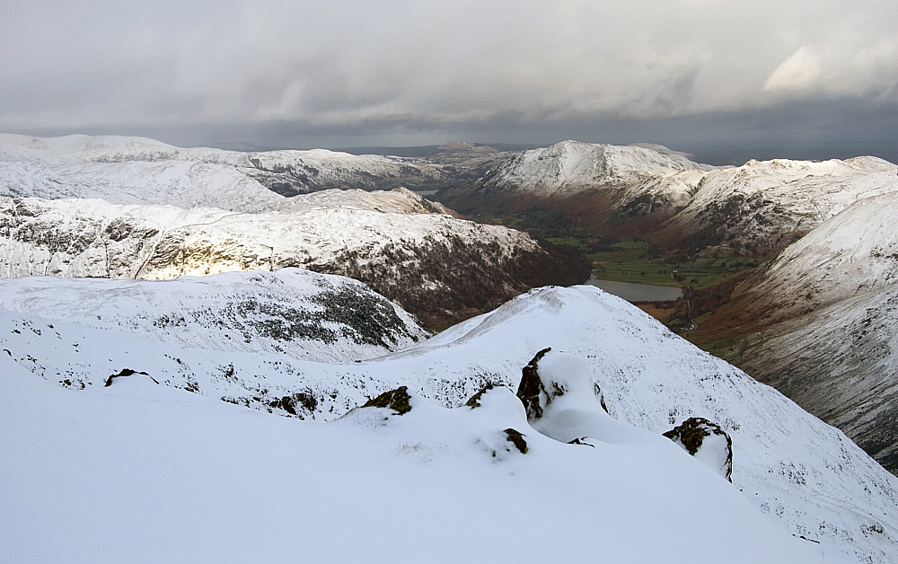
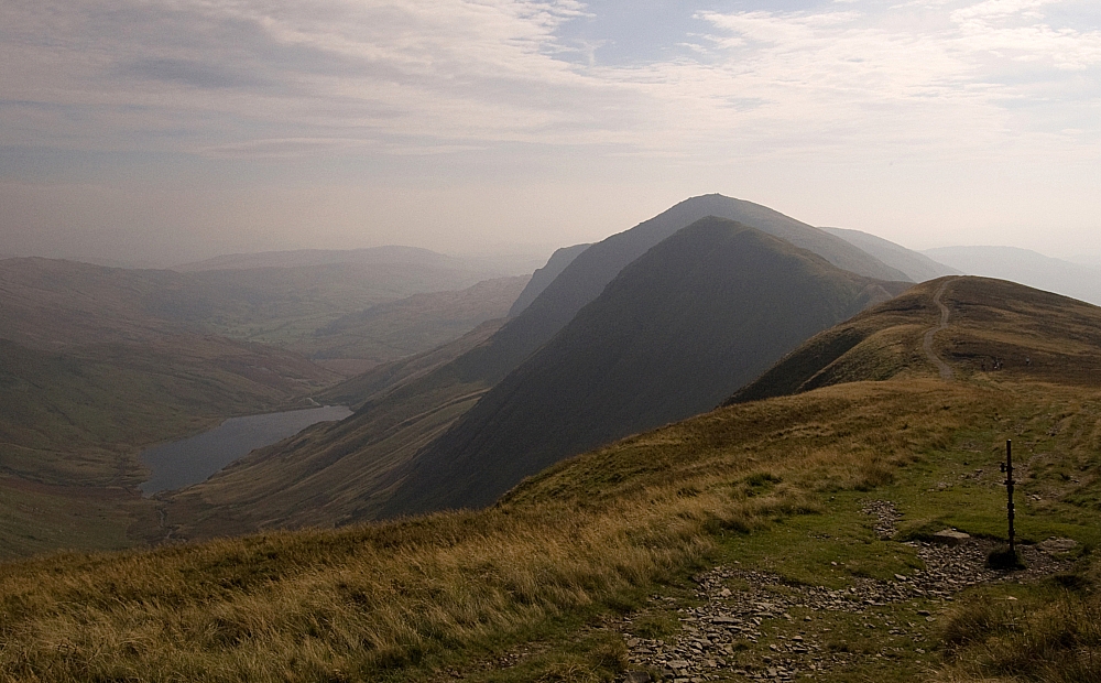
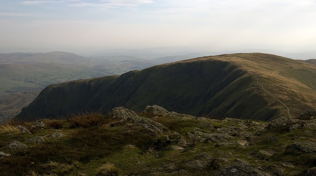
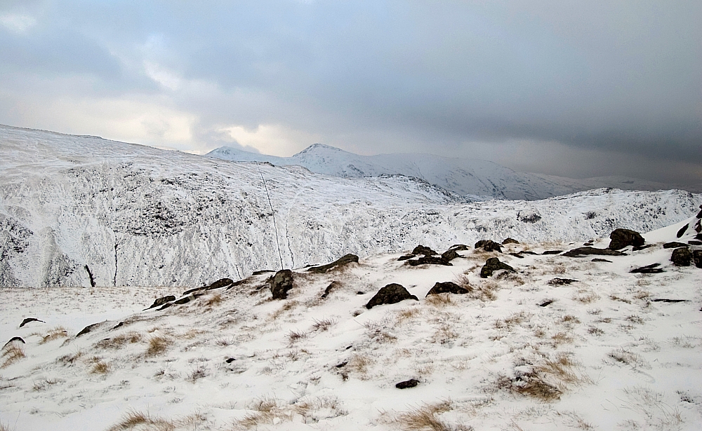
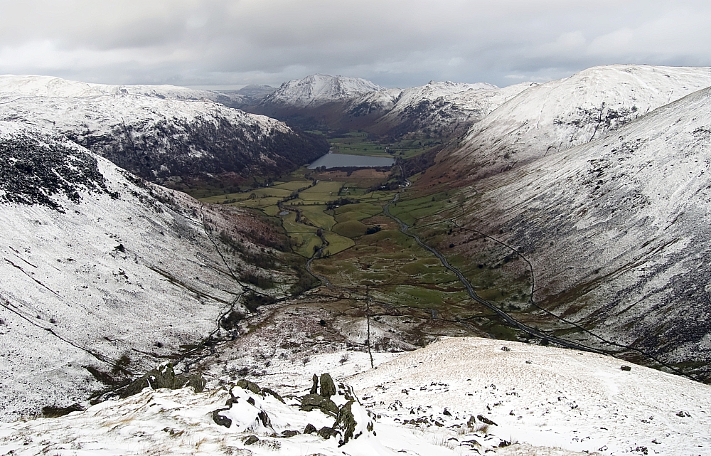
Looking down Smallthwaite Band towards Middle Dodd and Brotherswater.


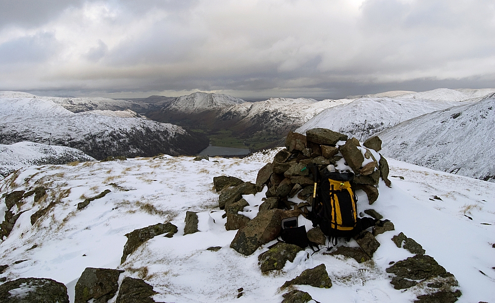
Looking northwards from the upper cairn on Middle Dodd.


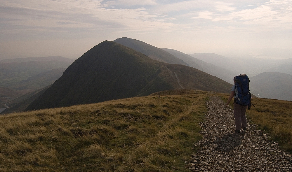
Red Screes from the upper cairn on Middle Dodd.


Westwards towards the Little Hart Crag and the Fairfield fells.


Eastwards - a glimpse of the Ill Bell ridge.


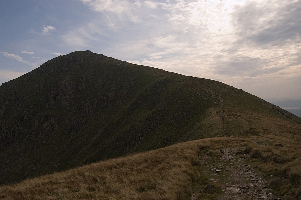
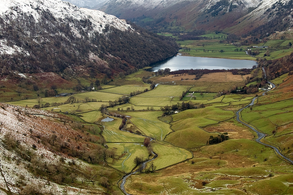
A better view from the lower cairn on Middle Dodd.


Steep ground on the descent.


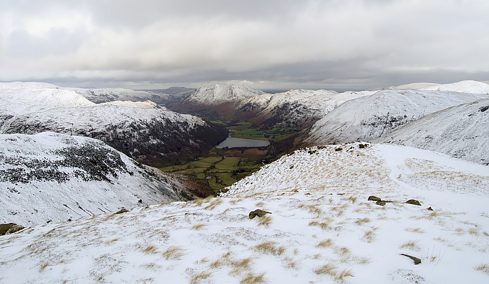
As the descent got steeper, the views got better.


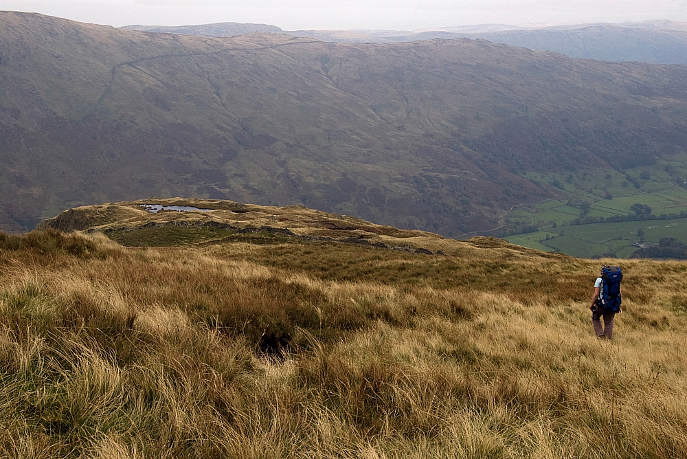
Moraines and fields.


A bit of blue sky above Little Hart Crag.


Sunlight on Angletarn Pikes.


The evening was spent much as before but without the photo-opportunities - rain had set in and cloud-cover was almost total. After a fine hostel meal and hours of chin-wagging with Mary and Paul I turned in for the night.

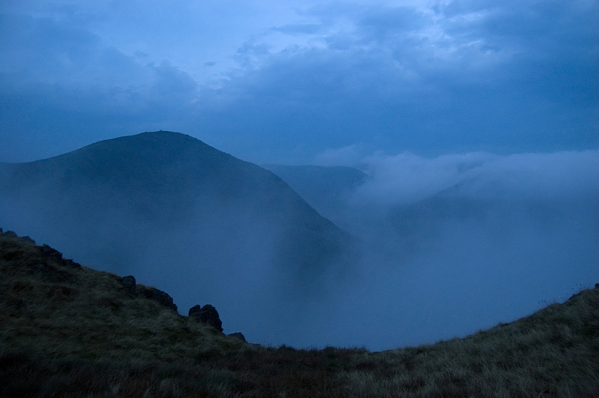
Sunday morning was different again - full of incessant driving rain and low clouds. Looking out from the hostel during breakfast I had half a mind to bail to the shops of Ambleside and Windermere, but managed to summon enough gumption for a quick slog up to Shipman Knotts. Another minor walk, but the clag, the wind and the abundant run-off made it quite an ordeal. There was still plenty of deep snow up there but sorry, there are hardly any pics from this walk - for most of the time the conditions were just too wet to risk soaking the camera. Here's what you get:


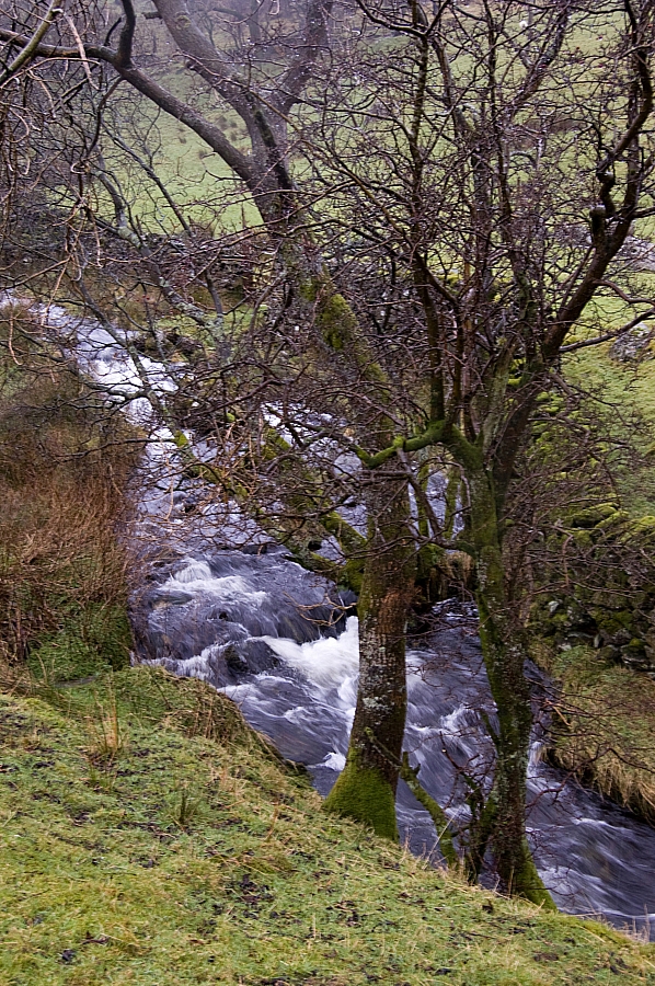
Plenty of water in Stile End Beck.


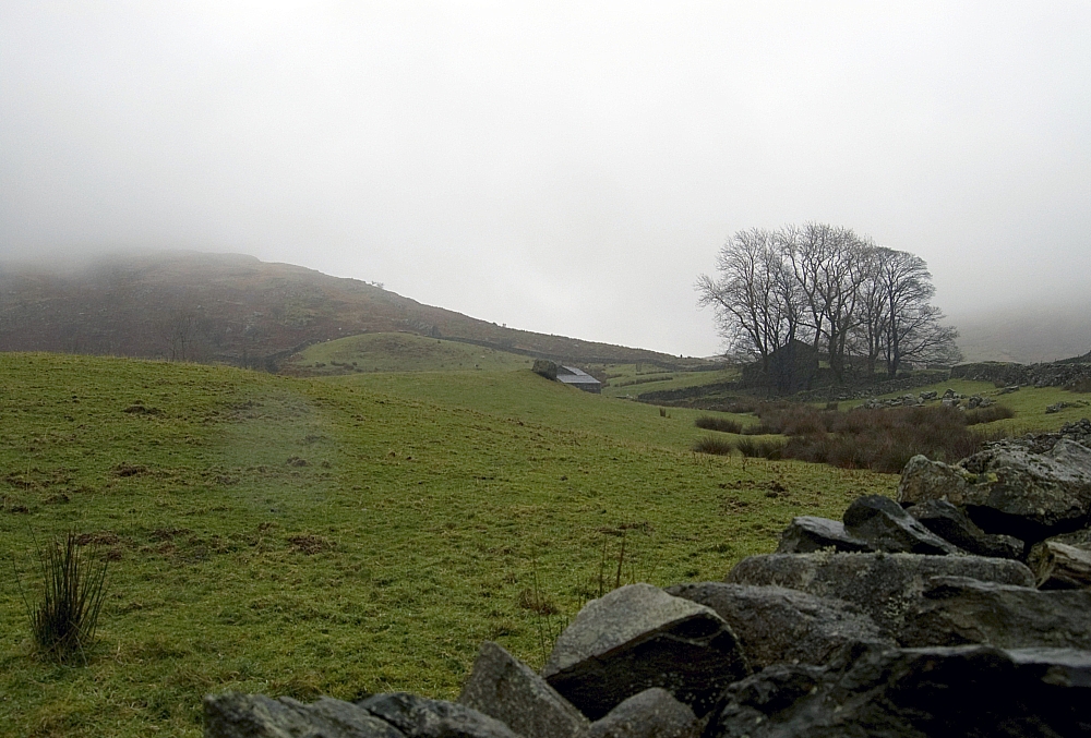
A clagged-in Shipman Knotts from near Stile End Farm.


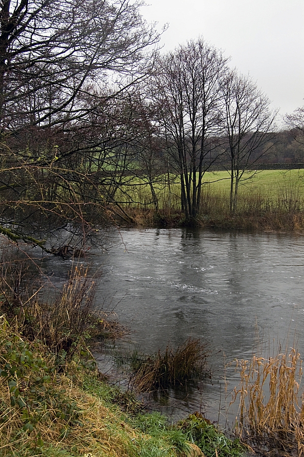
In spate - the Kent in Staveley.


And that's about it. I negotiated the A591/M6/A5 and was home in time for tea and a long session of sorting/washing/drying the gear. Job done.

Summary:

Wainwright tops reached: Red Screes (2541 ft), Middle Dodd (2106 ft), Shipman Knotts (1926 ft). All first-ascents for me.
Number of Wainwrights still to do: 9

On Saturday I was expecting that the overnight freeze would mean that the tops would be more icy than snowy, so I carried crampons. My expectations were wrong, though, and I didn't need them. I really should have taken the snooshows and the clackysticks instead - they would have saved a lot of post-holing in the seriously-deep drifts. The axe saved me several times on the steepest bits of the descent of Middle Dodd. On Sunday I took no such metalwork, I'd have been better-off taking a diving-suit and flippers!

Regarding gear taken for test-and-review... I took one item supplied by Adam Smith representing Go Outdoors. Yes, I actually got around to properly using that Montane Lite-Speed H2O jacket that I've had for months! Conditions on Sunday's walk were so wet and windy that I decided to use it as a shell over my Rab VR Climb jacket as an extra layer of defence. It kept out most of the driven rain and the hood worked well underneath my L.A. Mountain Cap. My only gripe with it is that because there are no pockets in the Lite-Speed I had to resort to gloves, and the cuffs of the jacket aren't glove-friendly. On the plus side, it kept me warm and dry and I didn't have to walk around with pockets full of water!

I was also trying out some base-layer stuff, but more about that later.

More Far Eastern Fells Wildcamping

After the Friday drag up the M6 and the traditional fill-up at the Ings Little Chef we nabbed a roadside car-parking space at Church Bridge, Troutbeck. Having changed into our scruffs we hoisted our packs and set off past the church and along field-paths past High Green and Town Head, using Ing Lane to access the fells via Hagg Gill.


Church Bridge church.


On the field-path heading towards High Green.


Ing Lane with the lowering Sun lighting up the tops of the Ill Bell Ridge.


As before.


The view from Ing Bridge.


The white sheep of the family.


Looking back down the Troutbeck Valley from Hall Hill.


We had intended to nip up to the top of Troutbeck Tongue and to walk off the ridge northwards to find a suitable pitch near the sheepfold. Unfortunately we were losing the light and Chris wanted to get settled for the night, so we continued up along Hagg Gill and found a nice place to set up camp. While setting up we noticed that we weren't alone - there was a small tent set up a bit further up the Gill, so I went off to ask if the owner minded if we set up where we had chosen. The owner was Linda, she said that she didn't mind where we pitched and we had a fine chat about fellwalking and other stuff. After a while I returned to finish setting up camp while Chris went off for a chinwag with Linda.

After dark we stood outside watching the sky before turning in for some sleep - although there were a few small clouds about, there were prolonged clear spells during which the stars were amazingly bright. We could see fantastic detail in the Milky Way, much better than we can see at home in the light-polluted Midlands.

The night was quiet and uneventful but the first light of dawn was heralded by the echoing roars of rutting deer - we couldn't see them but we were fairly certain that the commotion was coming from high on the slopes of Ill Bell, directly East of us.

After breakfast we headed off packless to bag Troutbeck Tongue before sun-up.


Looking towards Threshthwaite Mouth from the low ridge along Troutbeck Tongue.
Mouseover the pic if you want to see where our highly-conspicuous bright orange landscape-defiling tent was pitched.


Some way along the ridge Nature called so we ducked away from the track for some privacy. Attending to one of the most basic human needs, Muggins here made a stupid mistake that was to cause intense pain for quite a while, and ongoing stinging and regret for the rest of the day - I decided that, in the interests of good hygiene, it would be a good idea to use the water-free hand-cleaning gel on my arse. Trouble was, it wasn't the alcohol-free sort that I usually carry, it was the heavy-duty solvent-laced stuff that I use at work. Of course, by the time I found out, it was too late - by then I was jumping around the fellside like a madman, trousers and kegs around ankles, shouting expletives that echoed around the hills and imploring the powers above to make the burning stop! I don't know if Linda heard the commotion, but if she did I've no idea what she would have thought was going on.

Eventually I could walk again (albeit like John Wayne) and we reached the top after a few more minutes:


Chris on Troutbeck Tongue, mist in the valleys.


At the the top of Troutbeck Tongue, Chris was still giggling at the hand-gel incident.


We strolled back down to the tent to start packing up. Linda was up and about, she struck her camp and was away up Scot Rake well before we set out.


Lone tree on the slopes back down to the tent.


Striking camp next to Hagg Gill. A bit further up is Linda at her pitch.


Nearing the top of the harder-work-than-expected Scot Rake we paused for a snack-break where there was a fine view of Froswick.


Froswick from the Scot Rake path.


Although we would be going that way later, we were going to Thornthwaite Crag first. As the weather improved the crowds grew - at one point I counted 56 people around the summit. We settled behind a wall a short distance from the crowds and had our main meals.


Buff-adjustment, Thornthwaite Crag.


The Sun lighting up the beacon atop Thornthwaite Crag.


A busy place.


Easy slopes heading towards High Street (L) and Mardale Ill Bell (R).


Suitably fed and watered, we set off along the Ill Bell Ridge in increasingly-good weather.


The Kentmere Valley, Froswick and Ill Bell.


Froswick, Ill Bell and Yoke.


Muggins atop Froswick, with Thornthwaite Crag in the background. This was my 200th Wainwright.


Ill Bell from Froswick.


A closer look at the path up Ill Bell.


Ill Bell's North Cairn.


Ill Bell's Main and South Cairns.


Having a breather at the Main Cairn.


The Main Cairn.


From Ill Bell we could see one of the options for our next tent pitch - the tarn on Rainsborrow Crag, the western spur of Yoke.


Rainsborrow Crag and Yoke.
Mouseover the pic if you want to see the location of the tarn.


At Yoke's summit-cairn we paused for a while to consider our options. We could carry on down the ridge to the Garburn Road, reach the car by twilight, find a mild-camping site and walk more fells in the morning, or we could pitch early at Rainsborrow Tarn, have a leisurely evening and, if the night was clear, maybe see the Aurora Borealis that was tentatively forecast to be on show in the small hours. We took the lazy option and headed for the Tarn.


Chris heading towards Rainsborrow Tarn.


The tarn is a jewel in the hills - surrounded on three sides by long steep drops, it sits in a rut almost at the end of Rainsborrow Crag. The views from there are immense and there's a real feel of wilderness about the place. Needless to say, we saw nobody else there - it was our own little bit of Lakeland. After pitching I went walkabouts with the camera:


Looking southwards.


Wave!


Looking north towards Harter Fell.


Looking east towards Kentmere Pike and Shipman Knotts.


From Ill Bell to Shipman Knotts, with a view of Kentmere Reservoir.


After a leisurely evening meal we sat up waiting for the sky to put on a display but late on it clouded over and started drizzling. Even so, it was warm and calm, and we slept well.

On Sunday I woke just before dawn and ventured outside. The drizzle had stopped and the valleys were full of clouds being driven up and over the ridges and cols by the light breeze. It was utterly silent for an hour or so while I sat there watching in wonder and taking pics that don't do the scenes any justice whatsoever. It's times like that when I pity the folk at home in their beds:


Ill Bell, Mardale Ill Bell and the Nan Bield Pass wreathed in cloud.


Cloud being driven up and over the eastern arm of the Kentmere Round.


Breakfasted, we shook the dew from the tent and packed it away with the rest of our kit. After trudging back up the damp grassy slope to reach Yoke's cairn again we were overheating in the still, warm air so we stopped for a breather:


The summit of Yoke, with Ill Bell in the background.


A few pics later we headed down the newly-repaired path that leads to the Garburn Road. From there it was an easy downhill stroll all the way back to the car, followed by retail therapy at Windermere's Lakeland shop, another Little Chef at Ings and a manic drive back down the M6 and A5.


Looking back towards Yoke from the gate at Garburn Nook.


Summary:

Distance: 13.9 miles
Total ascent/descent: 3879 ft
Wainwright tops reached:
Troutbeck Tongue (1191 ft)
Thornthwaite Crag (2569 ft)
Froswick (2359 ft)
Ill Bell (2476 ft)
Yoke (2309 ft) twice
Those in bold were first-ascents for me.
Number of Wainwrights still to do: 12

Yes, I know that this was a walk that many folk would easily do in a day, but I'm happy that we took our time about it. I'll never forget the overnight at Rainsborrow Tarn, it's a place that few one-dayers bother to visit and I'd have regretted omitting it during a walk against the clock.
Indeed, it was Wainwright himself who said "Time is intended to be spent, not saved".

Regarding gear taken for test-and-review... I took two items supplied by Adam Smith representing Go Outdoors. While the Lifeventure Downlight 900 sleeping bag didn't have to contend with low temperatures, the mild nights meant that it had to put up with a fair degree of condensation and sweat. I'm happy to report that it fared well, at no point did it feel clammy or damp. As for the windproof, I still maintain that the mere act of carrying that Montane Lite-Speed H2O jacket is enough to deter inclement weather! I'm sorry, Adam, yet again I took it and never got the opportunity to wear it!