Archive for May 2010

Observing Report 22nd May 2010 (More Moon bits)

Posted by on May 27th 2010 in Astrostuff, Observing Reports, Pics

The skies on Saturday evening were very clear but after the high temperatures of the day the seeing was only middling. I managed to get some dSLR pics of open cluster M29 and of globular cluster M56, these will need some careful processing for which I've yet to find the time. I did get plenty of good views and camera footage of some lunar features, and I've had time to do some preliminary processing of them, the resulting images are as follows (mouseover for the occasional annotated versions):

Gambart (15 miles dia.), the Fra Mauro Highlands and the Apollo 14 landing site

 Plato (61 miles dia.)

Reinhold (29 miles dia.)

Copernicus (56 miles dia.)

Clavius (136 miles dia.)

Tycho (52 miles dia.)

Bullialdus (37 miles dia.)

Anaxagoras (31 miles dia.)

Scoresby (34 miles dia.)

Just in case you don't know your way around up there, here's some help:

Not your average BBQ

Posted by on May 23rd 2010 in In the garden

Summer's here :mrgreen:


Meat-burning made easy with my BBQNordic vertical incinerator 🙄

Northern Fells Wildcamping – Part 5 – The post-match analysis

Posted by on May 23rd 2010 in Annual Wildie, Great Escapes, Lakes Escapes, Wildcamping

Items we forgot to take = 2 (Chris's Ajungilak inflatable pillow and Petzl Zoom headtorch).

Items we forgot to bring back = 0

Items we gained = 1 (a bit of graptolitic slate from the slopes of Bannerdale Crags):


Items we lost = 0

Ticks = 0

Walkers met on the fells = 3

Injuries = 1 minor, 0 major

Losses of dignity = 1

Distance = 21 miles according to Memory-Map, probably nearer to 25 miles actual

Ascent/descent = 4526 feet according to Memory-Map

Wainwrights = 6

Pubs visited = 1 (twice)

New kit tried and tested = 1 pair (AKU Croda GTXs, rating = brilliant!)

Revelations = 1 (Sainsbury's Basics Instant Custard. A pack weighs 74g, contains 68g of powder, needs 425ml of boiling water, provides 312 kcal, serves 2 and tastes excellent. Current price: 9p a pack. Bargain.)

Northern Fells Wildcamping – Part 4 – Finishing Off

Posted by on May 22nd 2010 in Annual Wildie, Great Escapes, Lakes Escapes, Wildcamping

The next morning we were clagged in again so we had a prolonged breakfast waiting for the wind-driven rain to abate. Eventually we packed up and checked out the vacated pitch to ensure that we'd left no trace of our temporary residence. Other than the dry patch uncovered as we struck the tent there wasn't any sign that we'd overnighted there, and we were confident that the ensuing rain would soon deal with that:


Without a trace

We headed back to and over the col and took the path beside the Glenderamackin to the footbridge below White Horse Bent:

Descending beside the Glenderamackin


While we were on our way down the wind picked up and lashed rain at us, so I packed away the camera to keep it safe. Declining the option to continue down the path along river, we crossed the bridge and went up the easy slope and along the deceptively-long ridge to the summit of Souther Fell. After a few minutes of map-checking just below the summit, we went off-piste down the eastern flank to intercept one of the diagonal tracks back to Low Beckside. We'd met no other walkers that day until we reached Mungrisdale.

At valley-level the wind and rain had ceased and the temperatures were rising fast, so we took the opportunity to rehydrate at The Mill Inn at Mungrisdale. Well, it would have been ignorant to have passed by without going in. That, and the fact that it would have been cruel on the wild horses needed to drag me kicking and screaming up the road:


The Rehydration Station


From there it was but a short mile back to the car at Bowscale Moss. Thankfully the local equine population weren't there to give us a send-off:

The final stretch back to Bowscale Moss

Just one more post to follow, then we're done.

Northern Fells Wildcamping – Part 3 – Rises and Falls

Posted by on May 21st 2010 in Annual Wildie, Great Escapes, Lakes Escapes, LMAO!, Wildcamping

So there we were, on Carrock Fell, trying to figure out which way to go next. As I saw it, we had three options:

  • Stay up high - take in Knott and Great Calva, drop down to Skiddaw House, cross the Caldew dryshod at the bridge, head East up Mungrisdale Common;
  • Take a middling route - ascend Knott, drop down Snab, ford the Caldew, head South up Mungrisdale Common;
  • Take a direct route - descend the flank of Carrock Fell to the bottom of Grainsgill Beck, follow the Skiddaw House service-road to the base of Snab and then proceed as per the middling option.

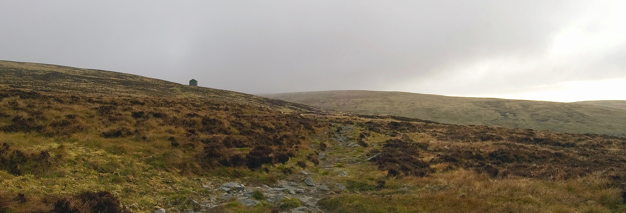
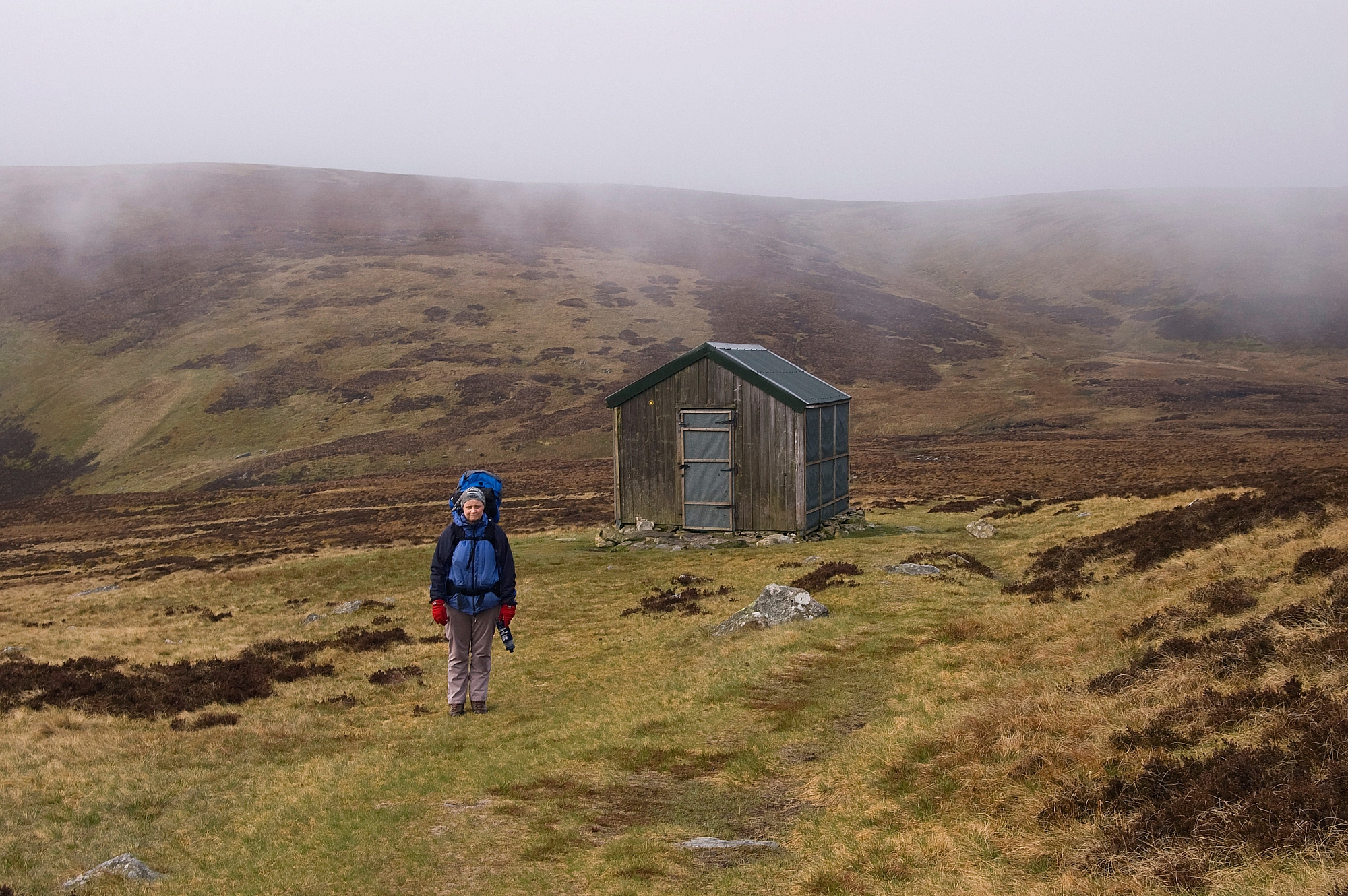
Predictably we couldn't agree, so we delayed the decision and took a short-cut back to the bothy-shed, where we made a brew and reassessed the situation.

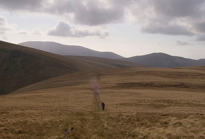
Chris didn't fancy slogging up Knott and Great Calva, and I'd been up them before, so we resigned ourselves to backtracking down the beck and fording the Caldew at some convenient point. At least I had the opportunity to grab some pics on the way down, and we met a couple of walkers heading up the Cumbria Way. These were the first folk that we'd met, and by strange coincidence the bloke worked for the same company as Chris, albeit in the Netherlands not the UK. A bit later on we met another bloke sweating his way up the beck, we didn't chat for long as he seemed intent on gaining the ridge. Anyway, back to the beck pics...


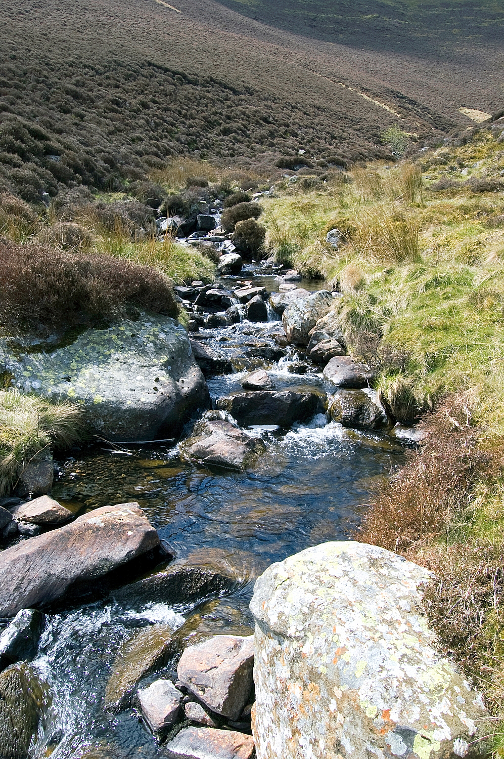
Falls in Grainsgill Beck

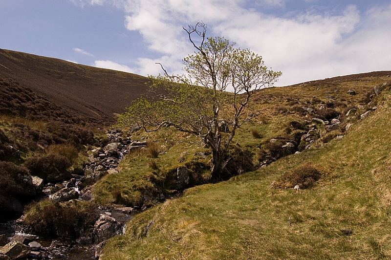
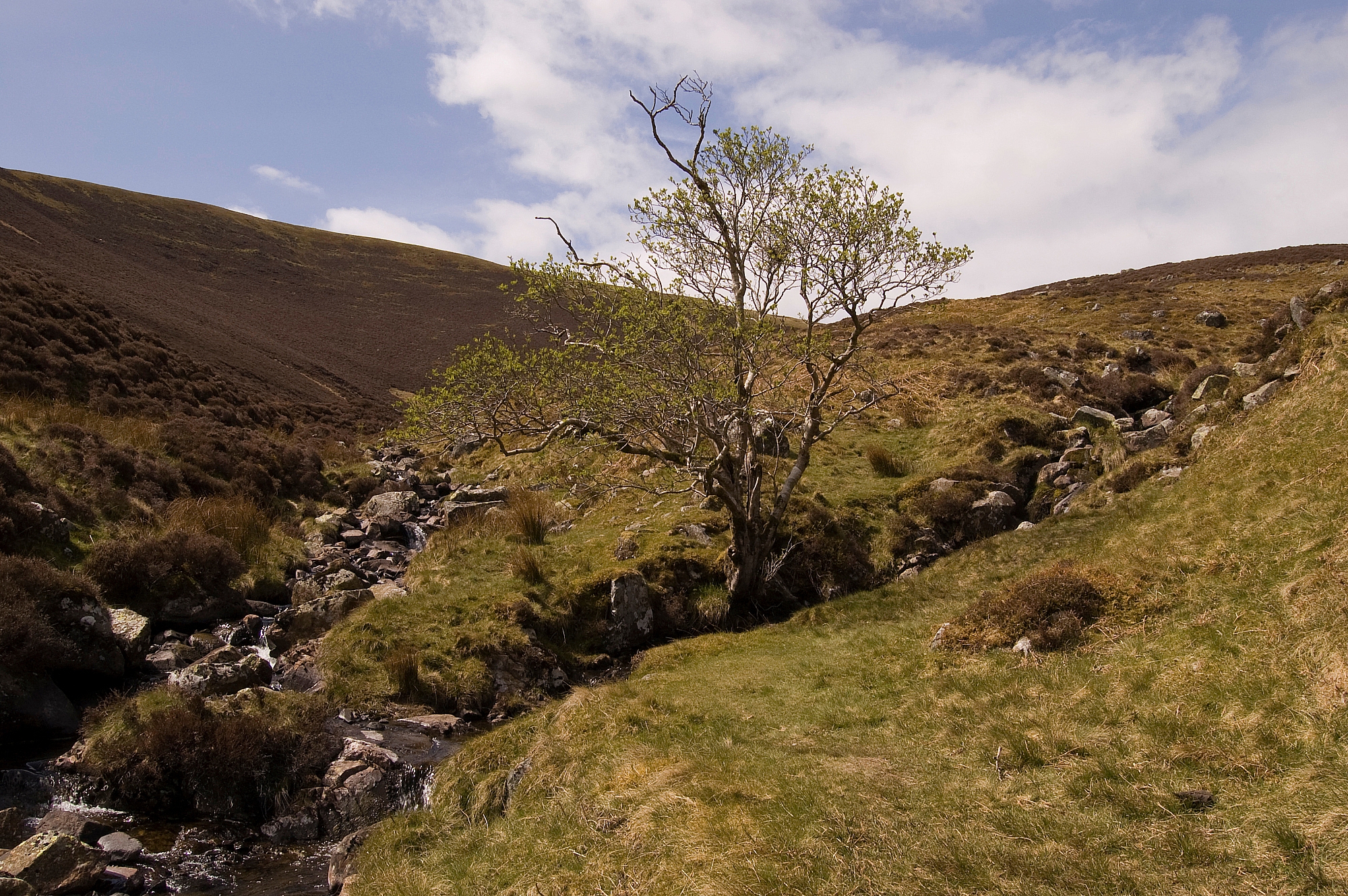
A beautiful watersmeet

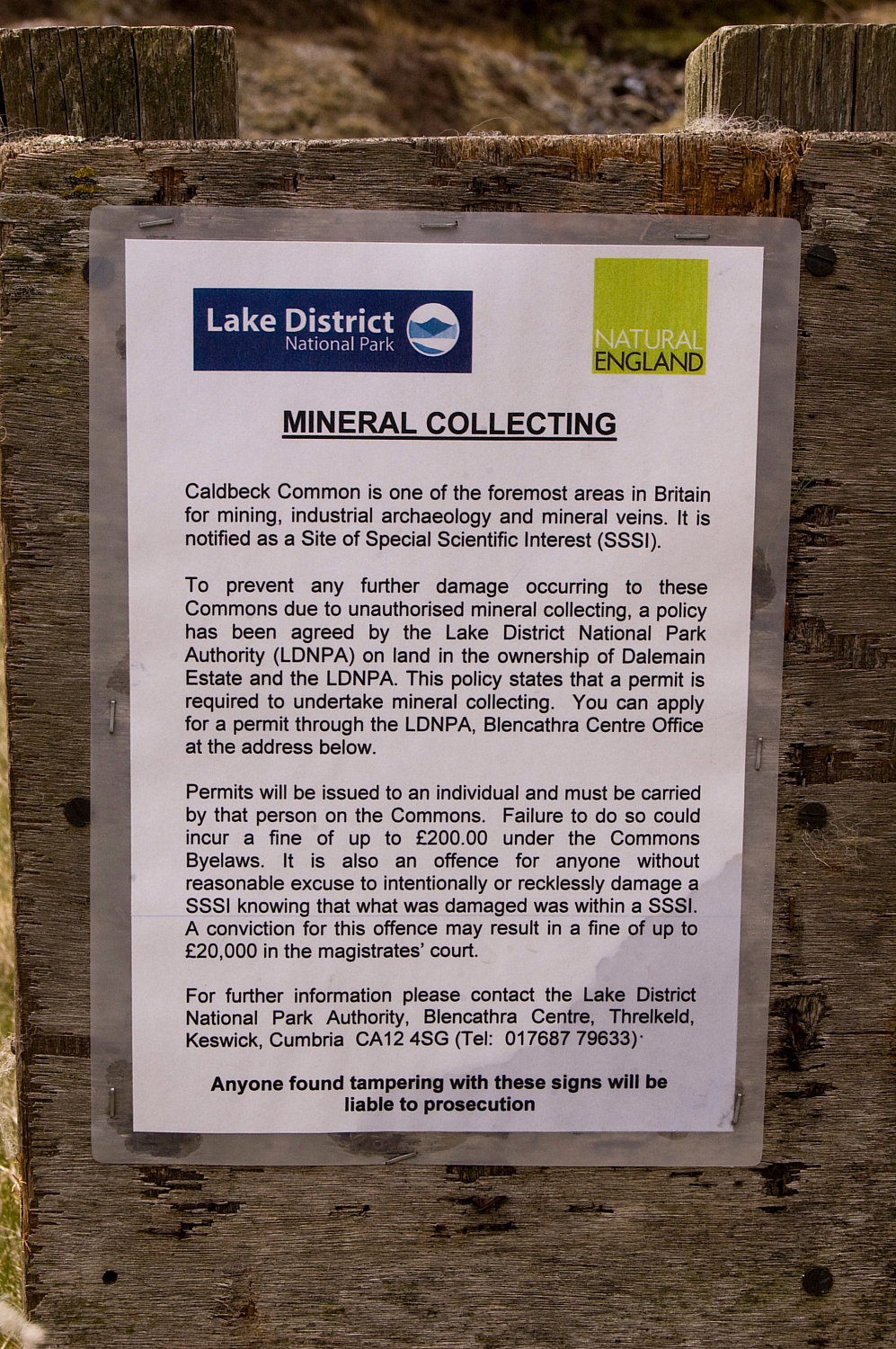
Passing the old mines, we decided to read the sign that we'd disregarded on the way up:

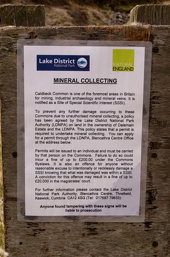
Don't disturb the rocks!


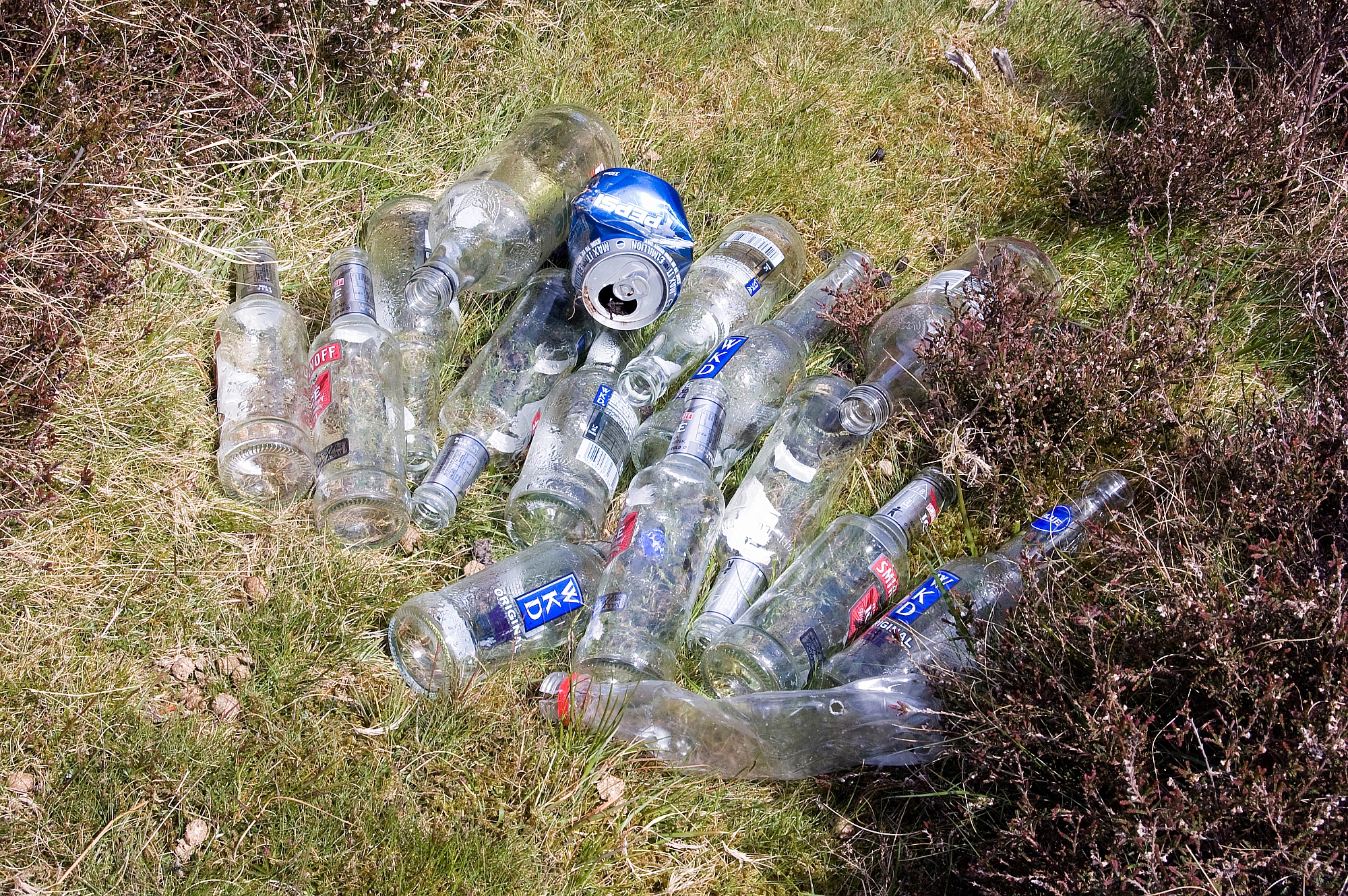
On reaching the Caldew we walked along the service-road looking for a place to ford the river. I was dismayed to find this stash of empties at the side of the road - FFS, if some twats have gone to the trouble of driving all the way up there for a session on the vodka, it wouldn't have been much extra effort to have taken their empties back down in the same car, would it? These lazy inconsiderate arseholes should be banned from the fells, IMHO. If we'd been heading down, we'd have carried the rubbish out, but we had to leave it.


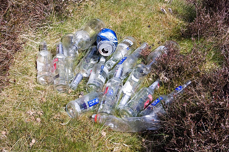
Evidence of arseholes


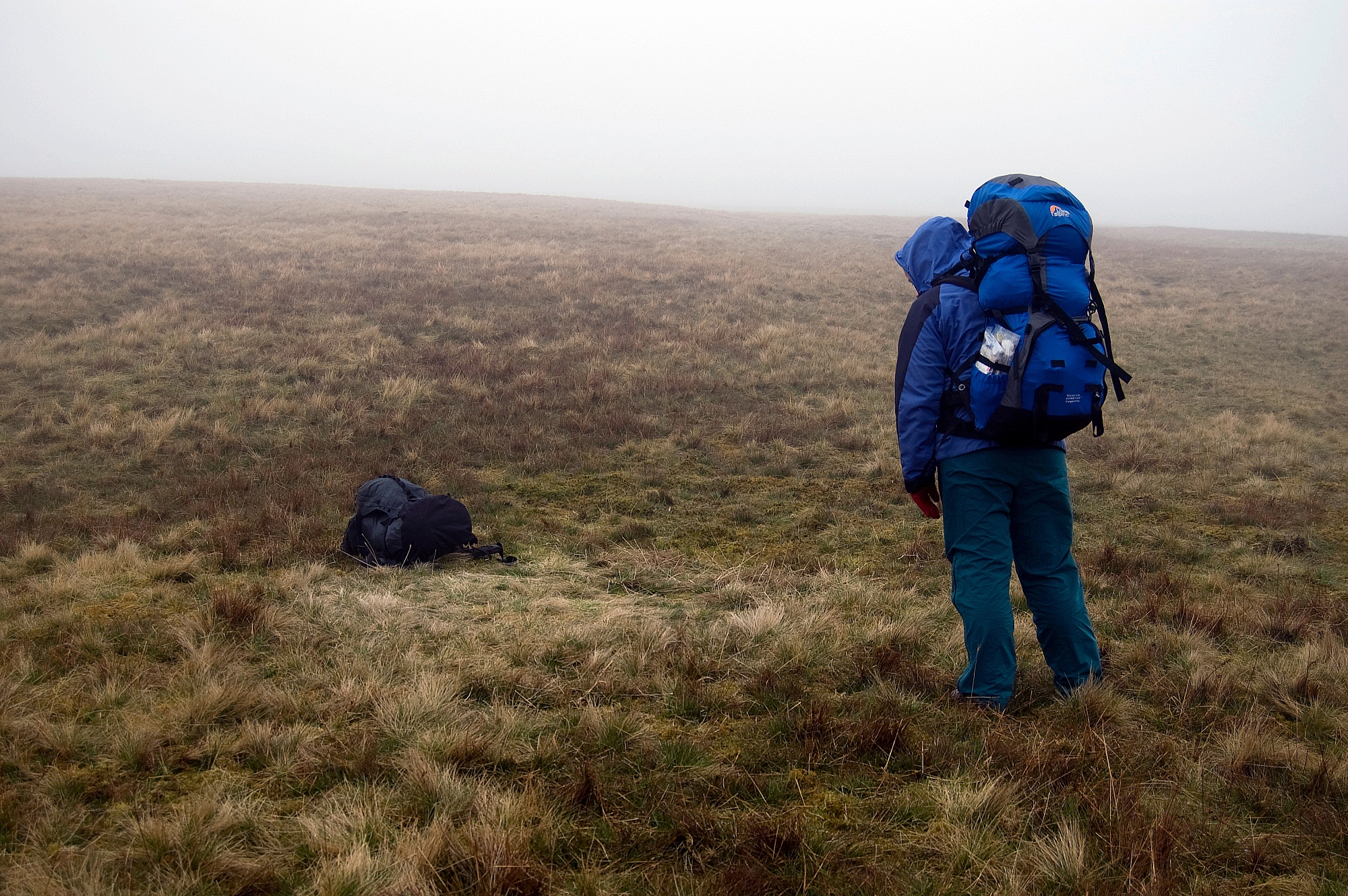
Shortly after that we found a suitable fording-place. I rock-hopped to the middle and balanced on a slippery flat rock, looking for the next dry step, but there was none. With a quick two-step in the calf-deep water I was soon on the far bank, with damp boots and socks but no other ill-effects. I warned Chris about the slippery rock and advised an alternative, but she stepped on it anyway and it got the better of her. In slow-motion she leaned too far, her pack dragged her over even more and she ended up lying in the water. She was fairly-well drenched. I didn't dare to laugh. OK, OK, so I did laugh. Lots. And loud. Being a decent, caring sort of chap, I raced off downstream to retrieve the dropped water-filter bottle and left Chris to find her own way to dry land. She was wet but uninjured, so we sat in the warm breeze and had lunch while she dried herself and her kit. Oh, and we laughed a bit more, just for good measure:
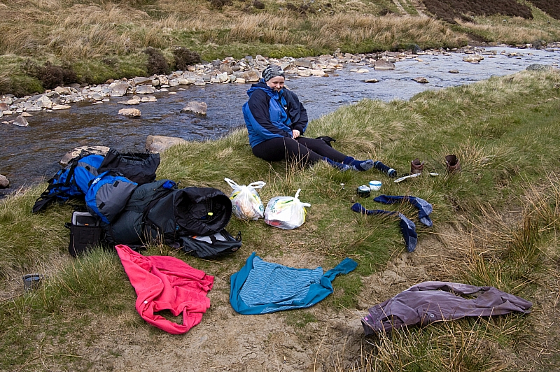
Chris drying off

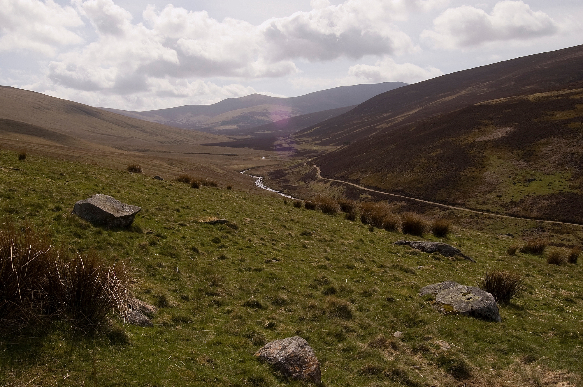
We were at the bottom end of Long Gill, and looking at the map we figured that the best thing to do was to go straight up to Bowscale Fell. Redressed and fit to go, we had one last look up the Caldew towards Skiddaw House. A bit further up the river we could see something that looked like a bridge, and Chris gave me some stick based on that impression. Luckily for my reputation, subsequent investigations indicate that there isn't really a bridge at that point, so the soaking wasn't in vain:


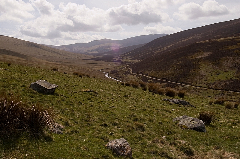
Looking up the Caldew

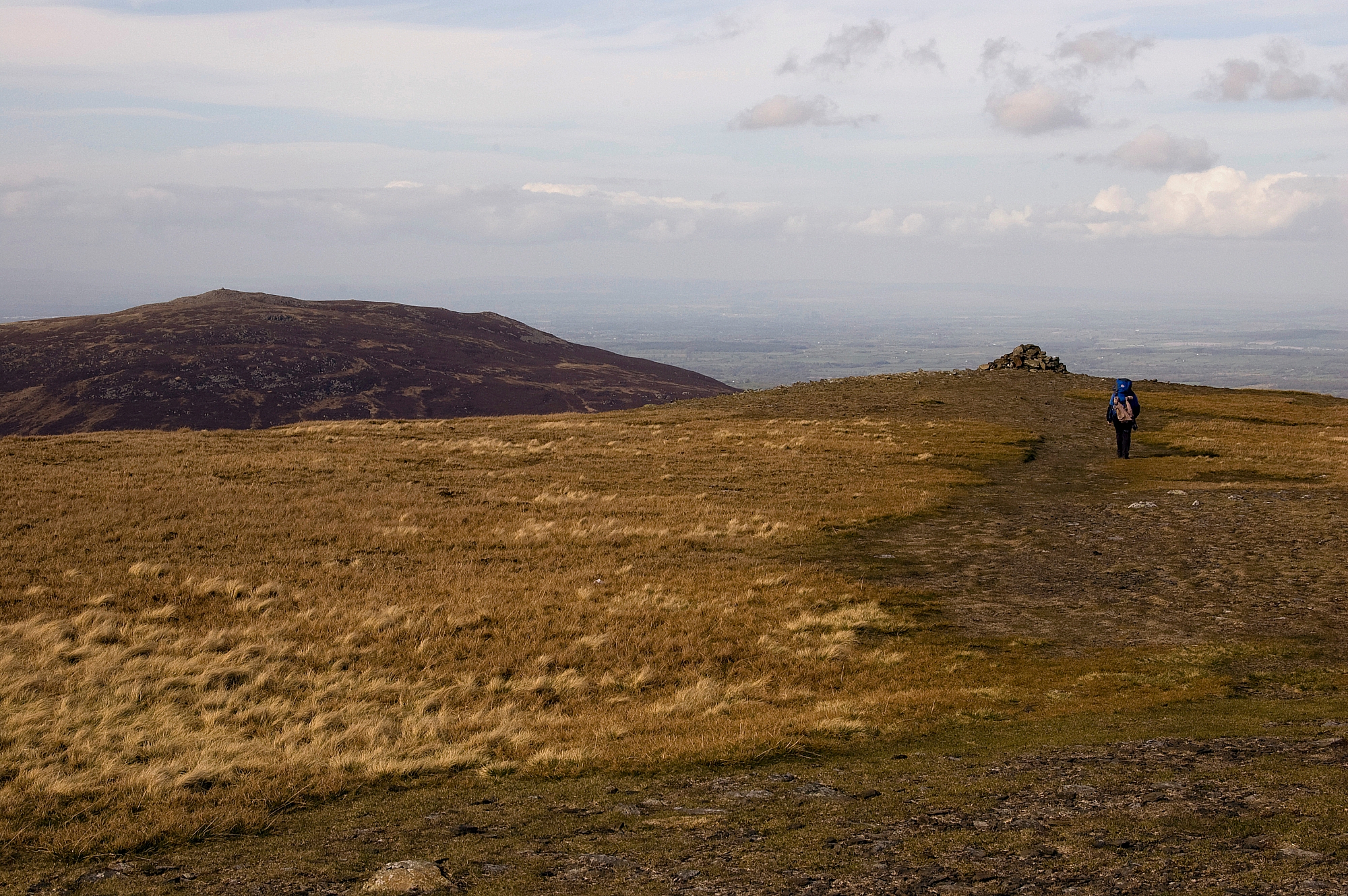
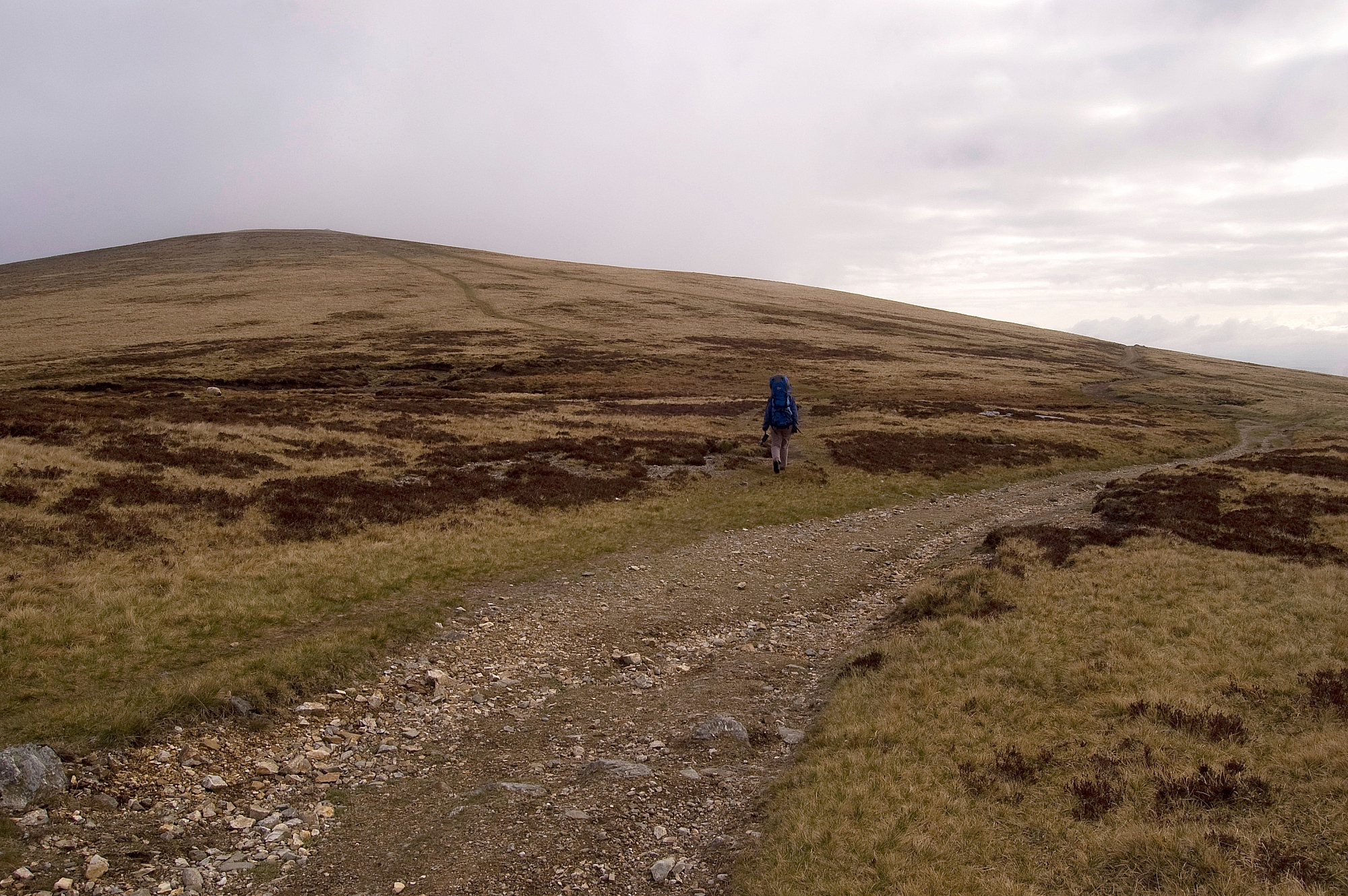
The walk up to Bowscale Fell was a real hard slog with no paths through the tussock-grass and mossy ground on the unremitting slope. Over an hour later we reached the top:

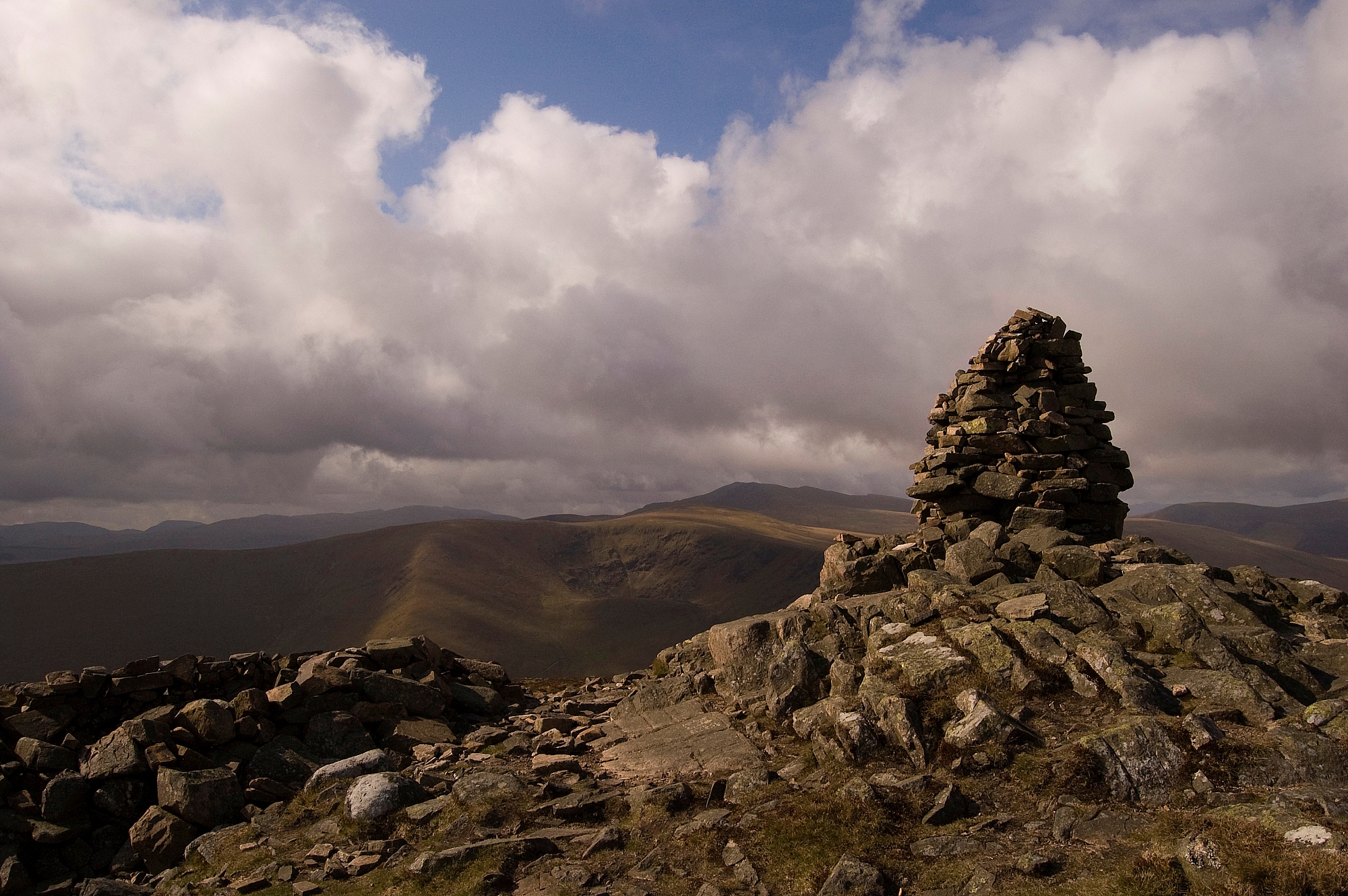
Chris approaching the viewpoint cairn near the top of Bowscale Fell

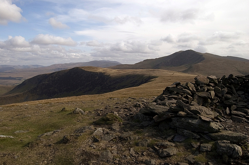
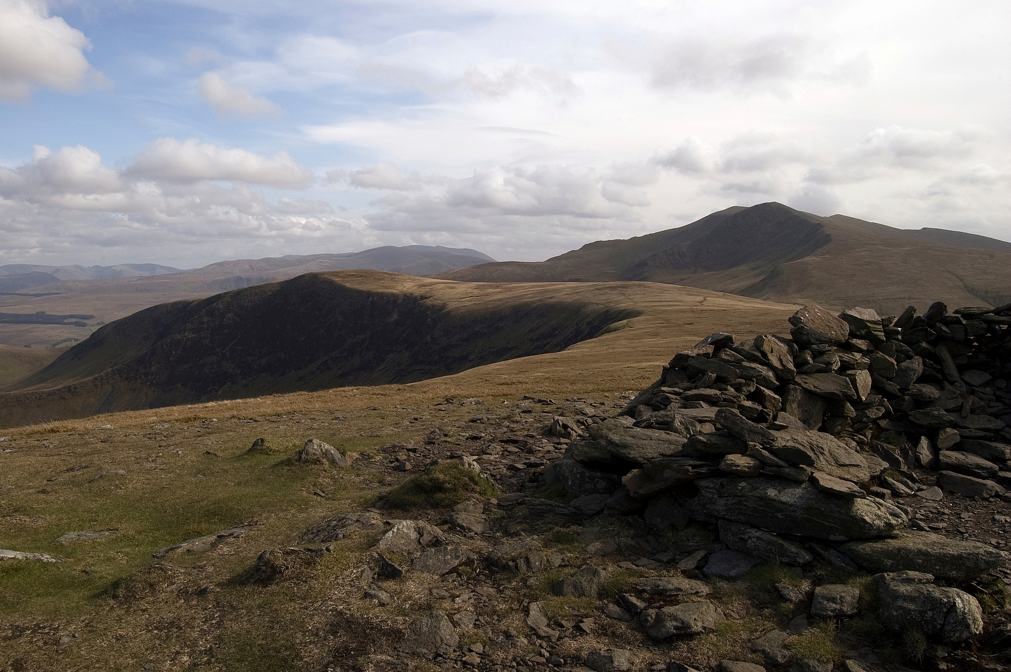
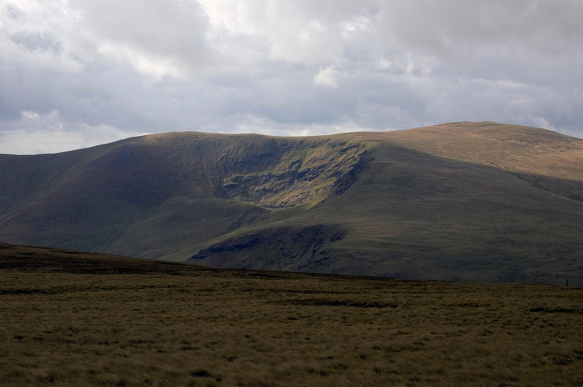
Bannerdale Crags and Blencathra from Bowscale Fell

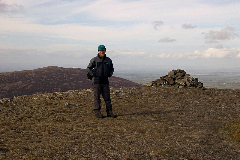
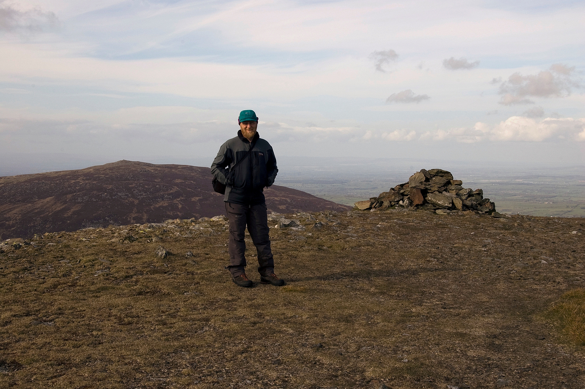
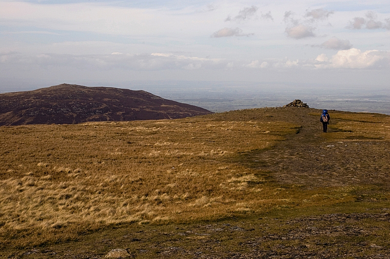
A rare picture of me

From there the next objective was a rather more easy proposition, with gentle paths skirting the drop-off and leading up to Bannerdale Crags:
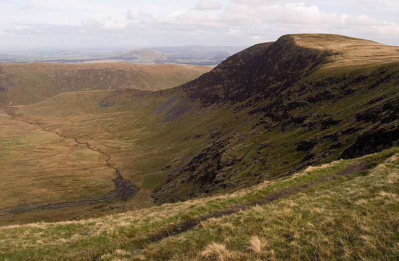
Bannerdale Crags

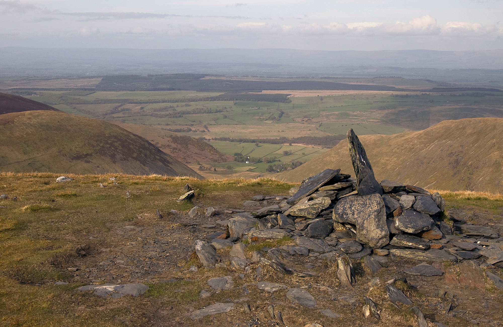
The view from the edge of the crags was worth the effort:

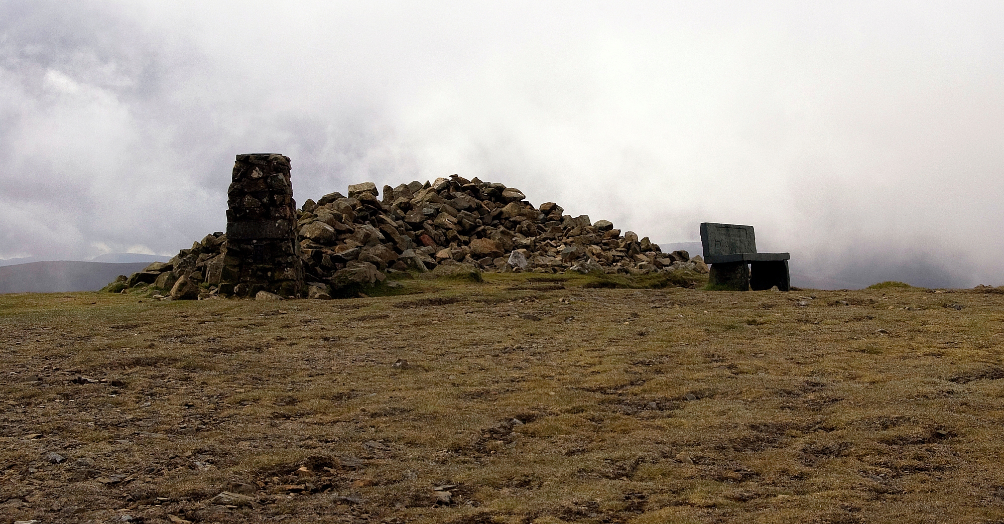
The viewpoint cairn on Bannerdale Crags

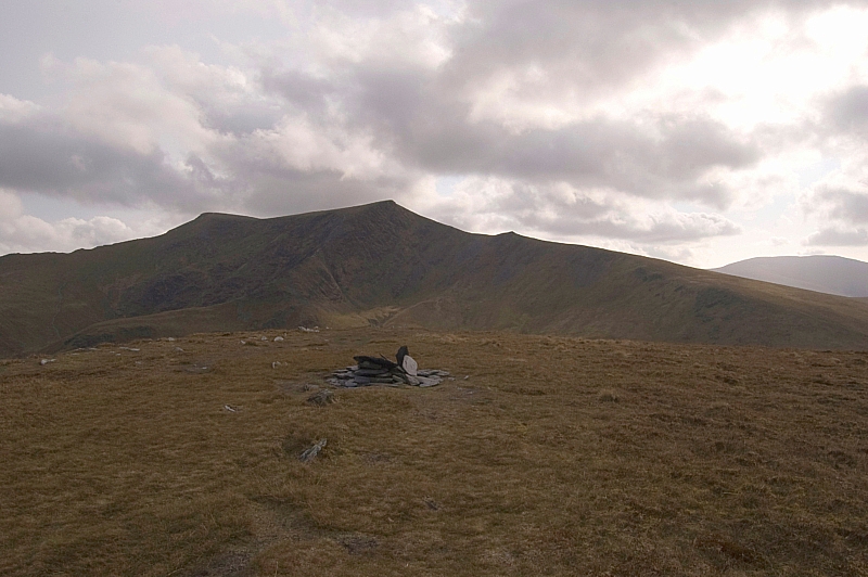
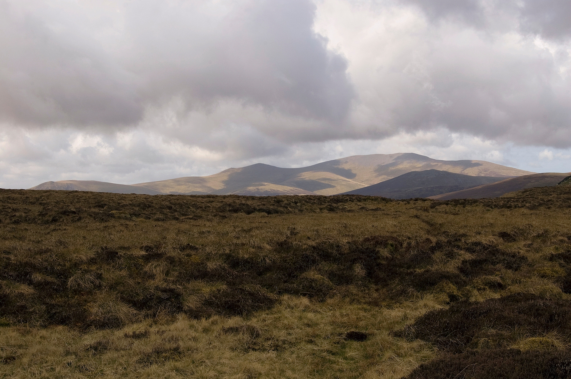
Blencathra beyond the summit of Bannerdale Crags

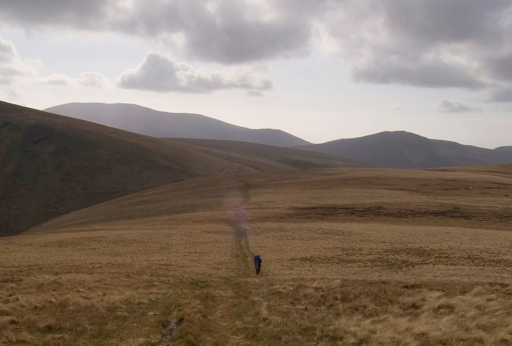
From there it was a simple and straight descent to the col at the source of the Glenderamackin...


Heading for the col

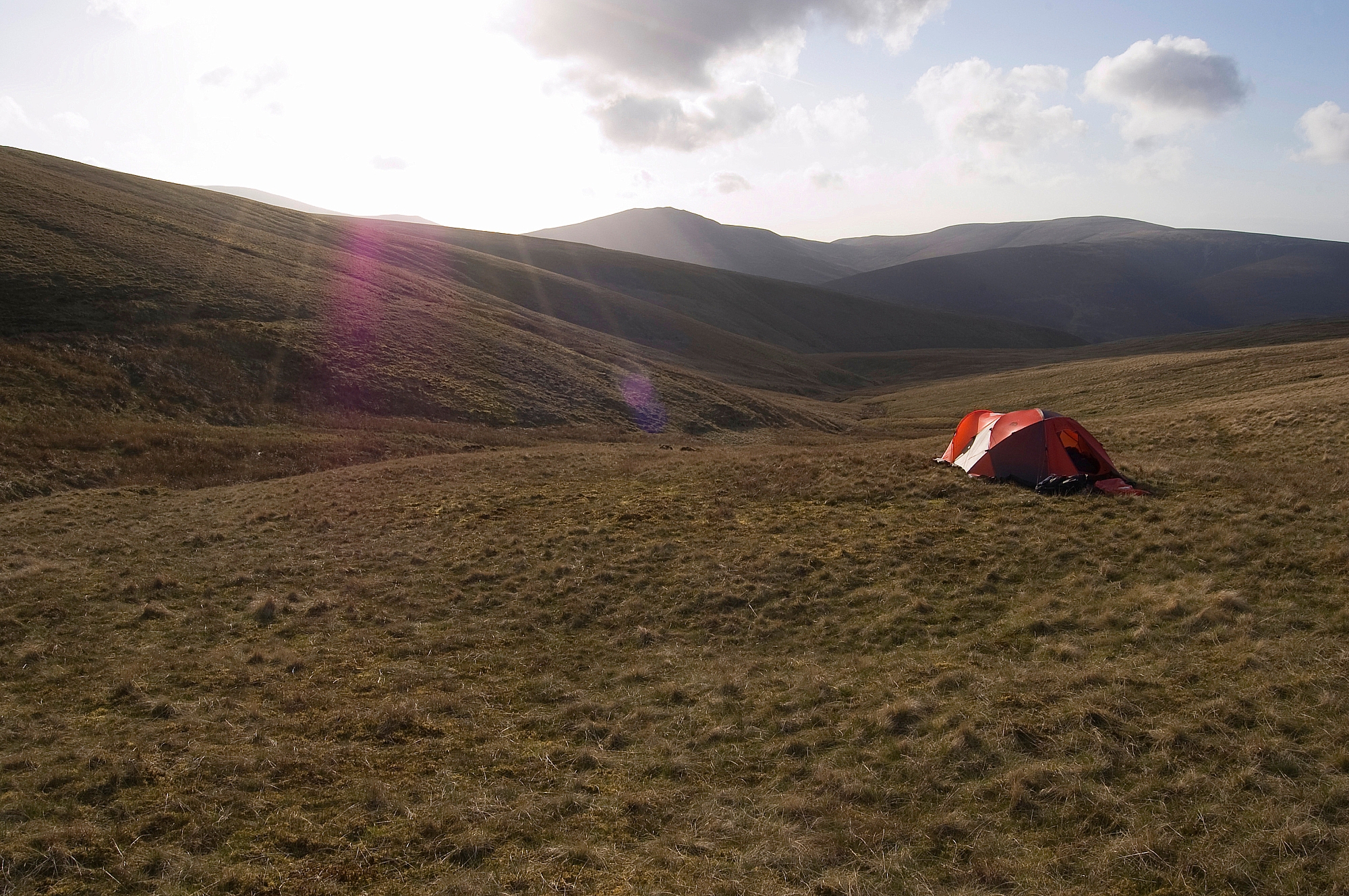
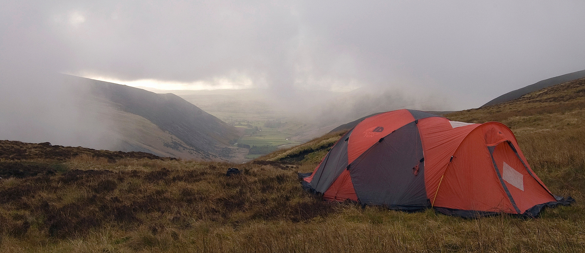
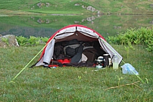
and onwards to a nice dry pitch on the north-west side of the col, looking down Blackhazel Beck.

Pitched above Blackhazel Beck


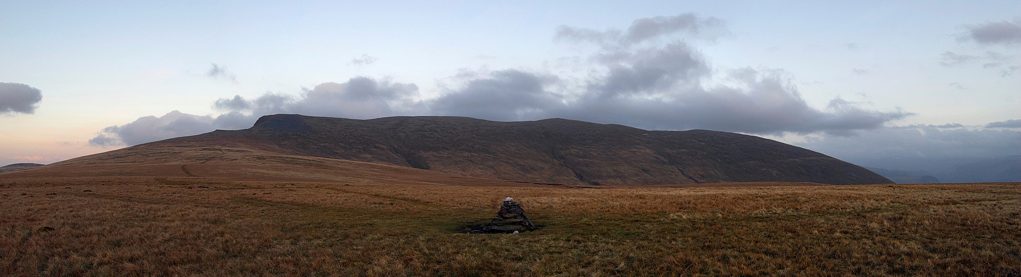
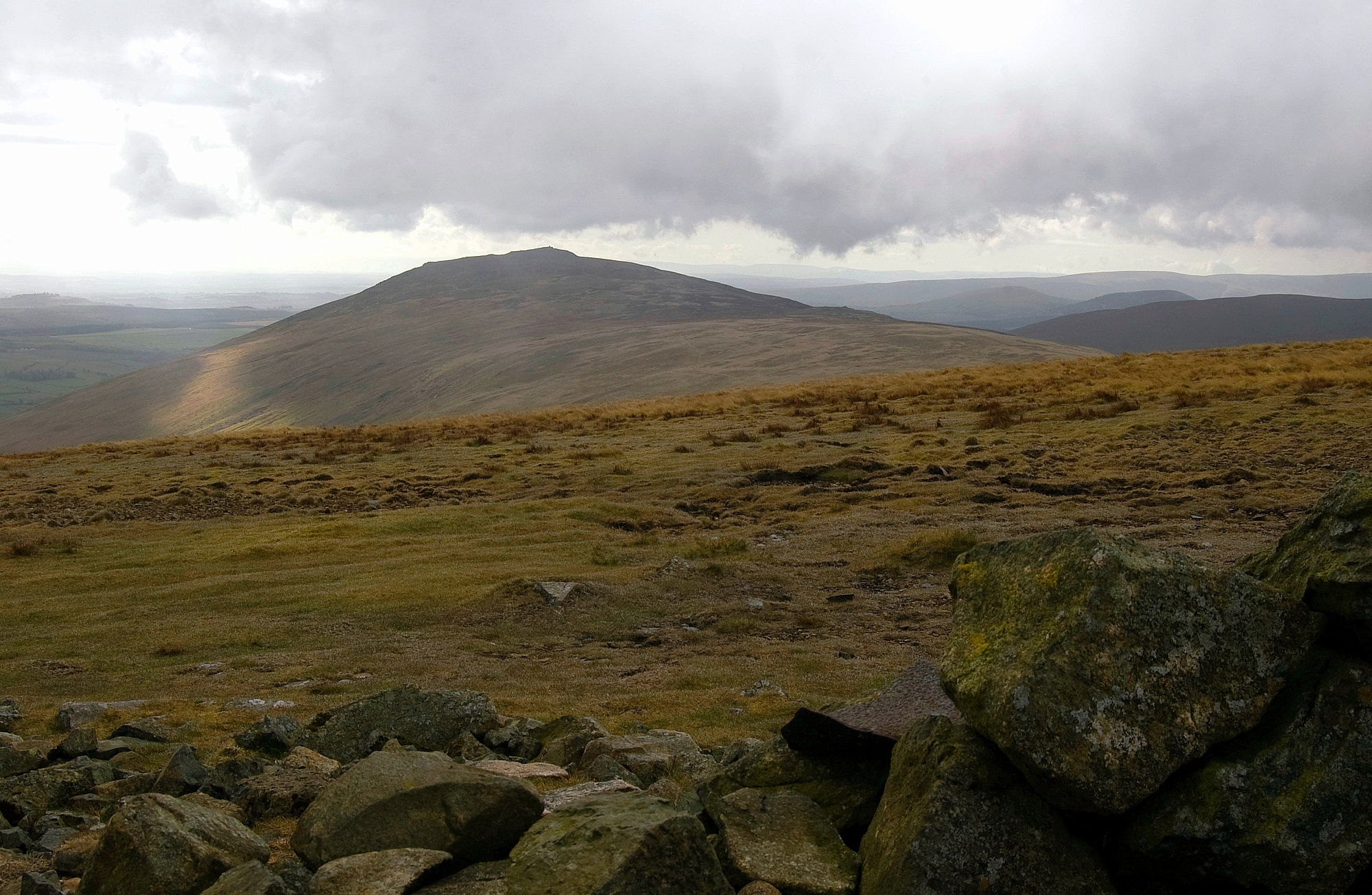
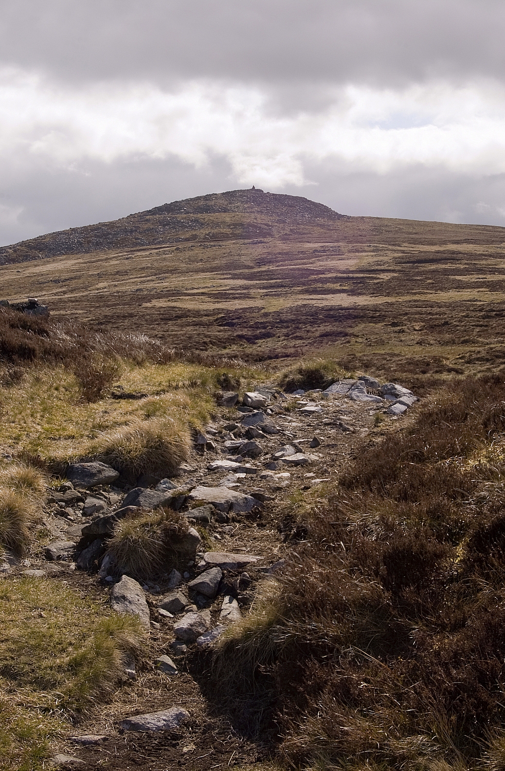
After another good meal and a lot of rehydration, Chris settled down early while I went out for an easy evening stroll to the cairn atop Mungrisdale Common:

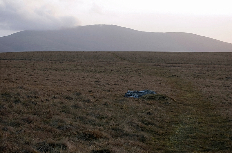
Approaching the Mungrisdale Common cairn, with Skiddaw in the background

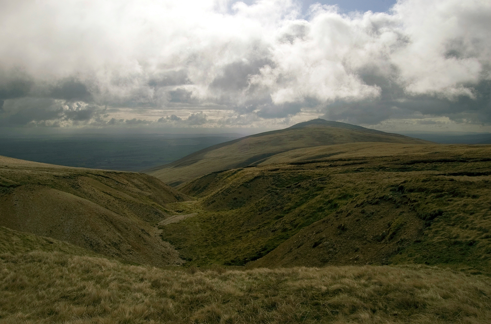
The back of Blencathra from Mungrisdale Common
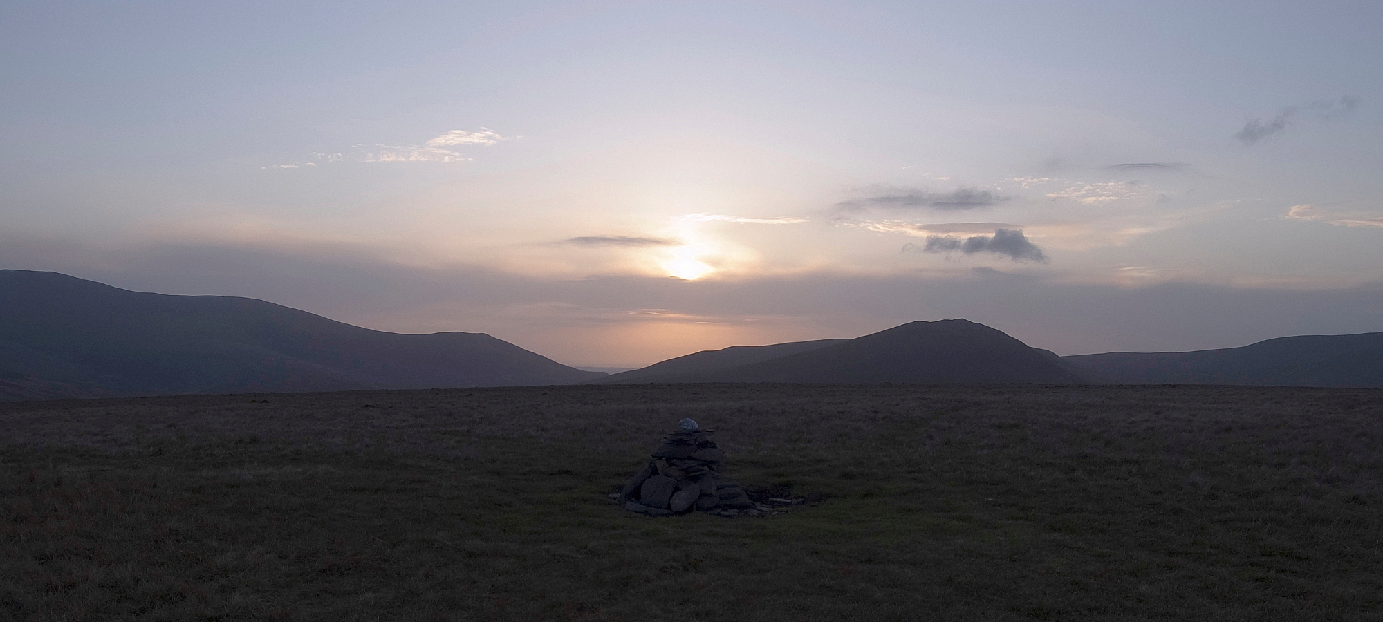
Losing the light

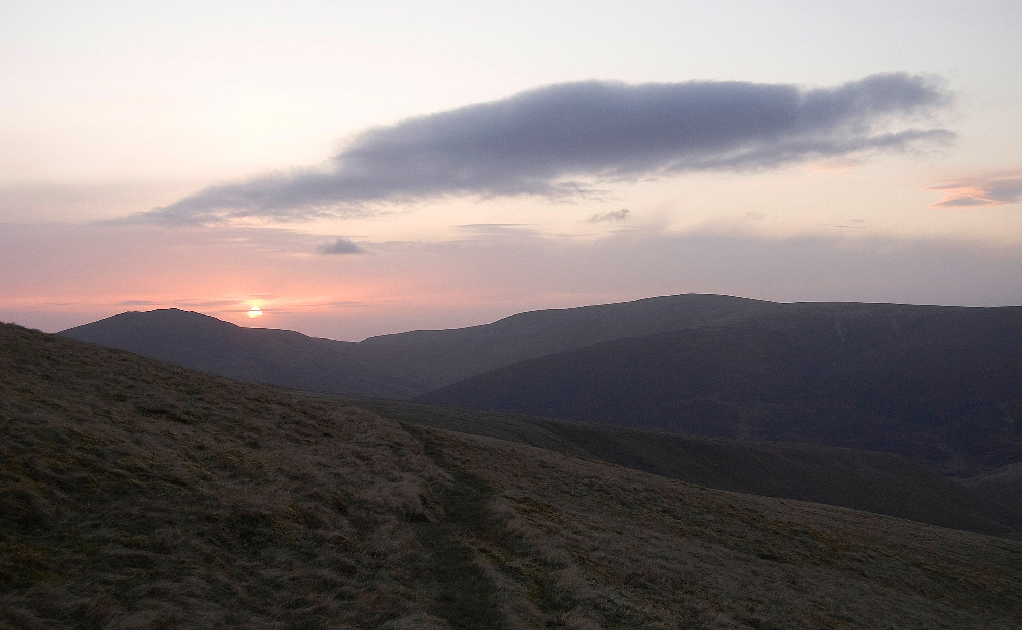
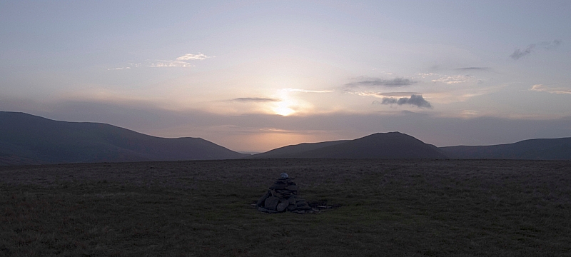
After spending a while there appreciating the utter quietness of the place, I headed back to the tent, pondering the fact that we'd only seen three other walkers during the day. I was hoping for a sunset worthy of our efforts, but this was the best that could be mustered:


The sun setting over Great Calva

To be continued.

Northern Fells Wildcamping – Part 2 – On The Caldbeck Fells

Posted by on May 20th 2010 in Annual Wildie, Great Escapes, Lakes Escapes, Wildcamping

After a good night's sleep in very windy conditions we woke fairly early to find that the weather was still cold, breezy and drizzly. The views down to the valley were good but intermittent:


Morning clag

Great Lingy Hill bothy-hut from the first pitch

We had a hearty breakfast and packed away sharpish. After pausing for a photo-opportunity near the bothy-hut...

The bothy-hut


we branched off the Cumbria Way and took the easy approach to High Pike:


Chris starts up towards High Pike


Chris huddled in the shelter, staying out of the icy wind...

High Pike shelter and summit

while I wandered off to take some pics of the fell and its surroundings:


Carrock Fell from High Pike

High Pike trig-point, cairn and memorial bench

The Bench, in memory of Mick Lewis
The inscription reads:
HE IS A PORTION OF THAT LOVLINESS THAT ONCE HE MADE MORE LOVELY

The next objective was Carrock Fell. We descended to the Cumbria Way and skirted the top of the Drygill ravines...

Drygill ravines

where we got our first glimpse of Bowscale Tarn overlooked by its guard of impressive crags:

Bowscale Fell and Tarn from High Pike

After a slog along the wide ridge, taking in Miton Hill and Round Knott, we arrived at Carrock Fell's summit. It's an impressive place with extensive views in most directions, well-worth a visit:

Carrock Fell summit cairn

Skiddaw and its subordinates from Carrock Fell

We dropped back down to Round Knott and had a discussion about our next course of action. We wanted to walk the fells on the other side of the Caldew, but there were a few ways of getting there. There was much procrastination...


The descent from Carrock Fell


To be continued.