Posts tagged 'Wainwrights'

More Far Eastern Fells Wildcamping

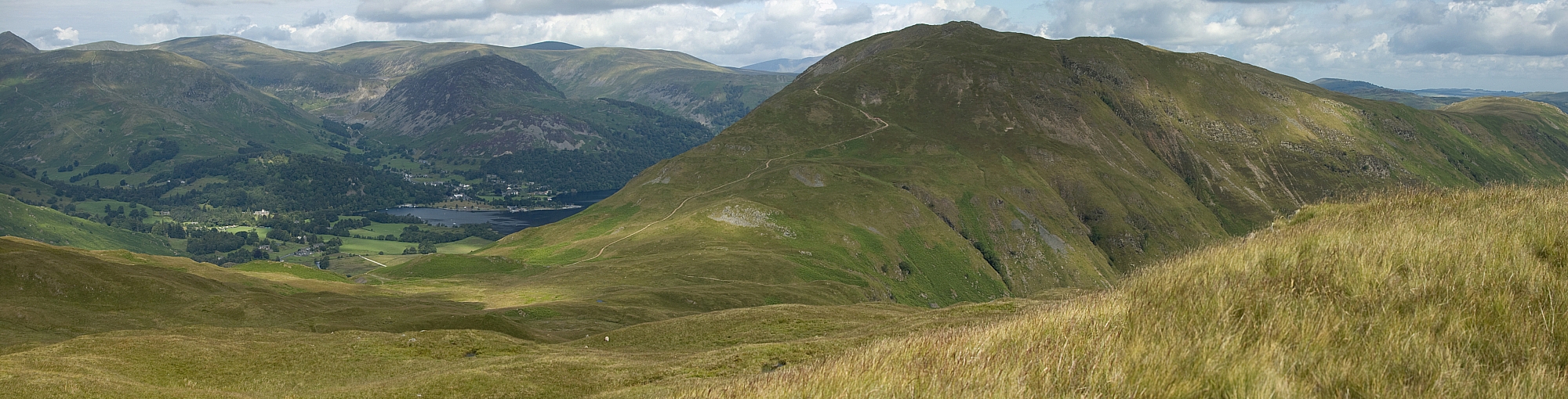
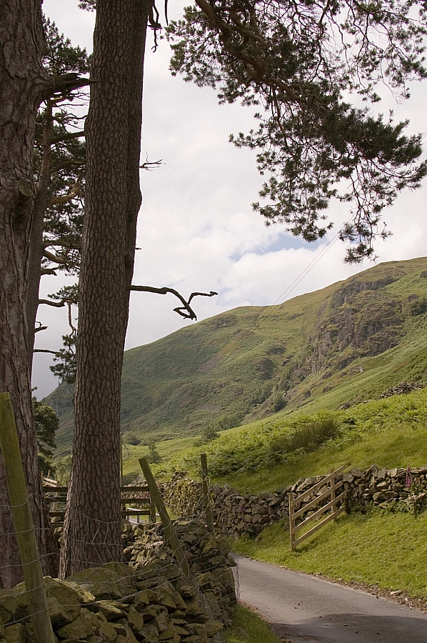
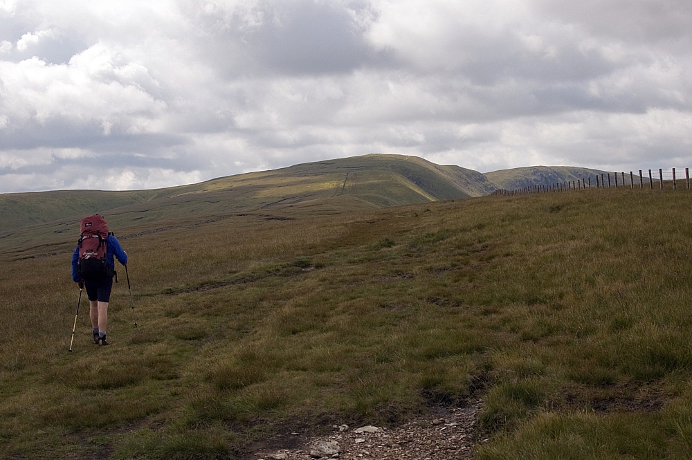
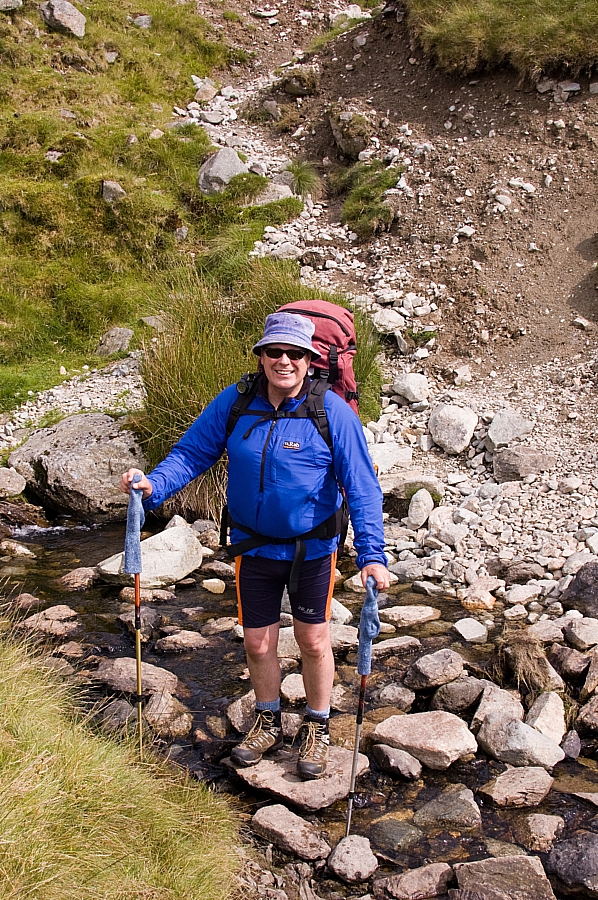
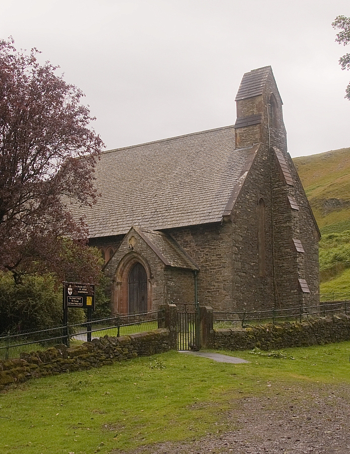
After the Friday drag up the M6 and the traditional fill-up at the Ings Little Chef we nabbed a roadside car-parking space at Church Bridge, Troutbeck. Having changed into our scruffs we hoisted our packs and set off past the church and along field-paths past High Green and Town Head, using Ing Lane to access the fells via Hagg Gill.


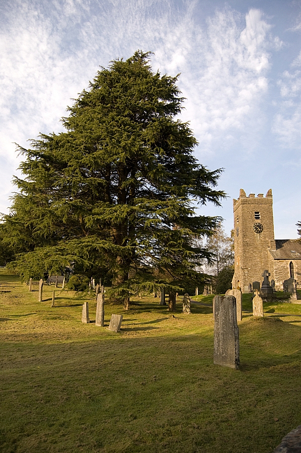
Church Bridge church.


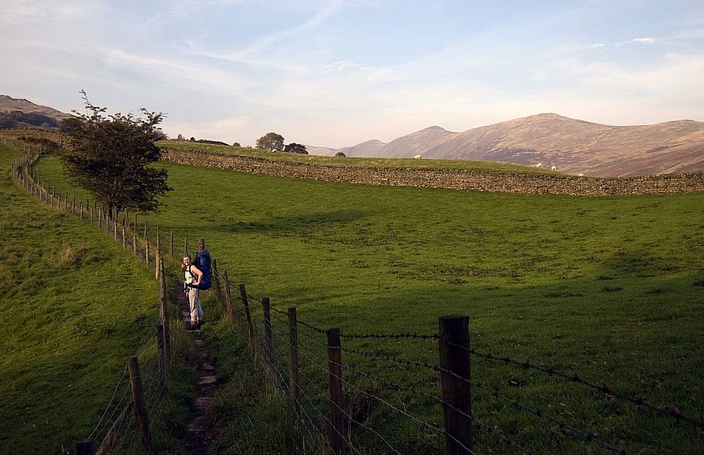
On the field-path heading towards High Green.


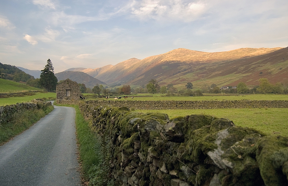
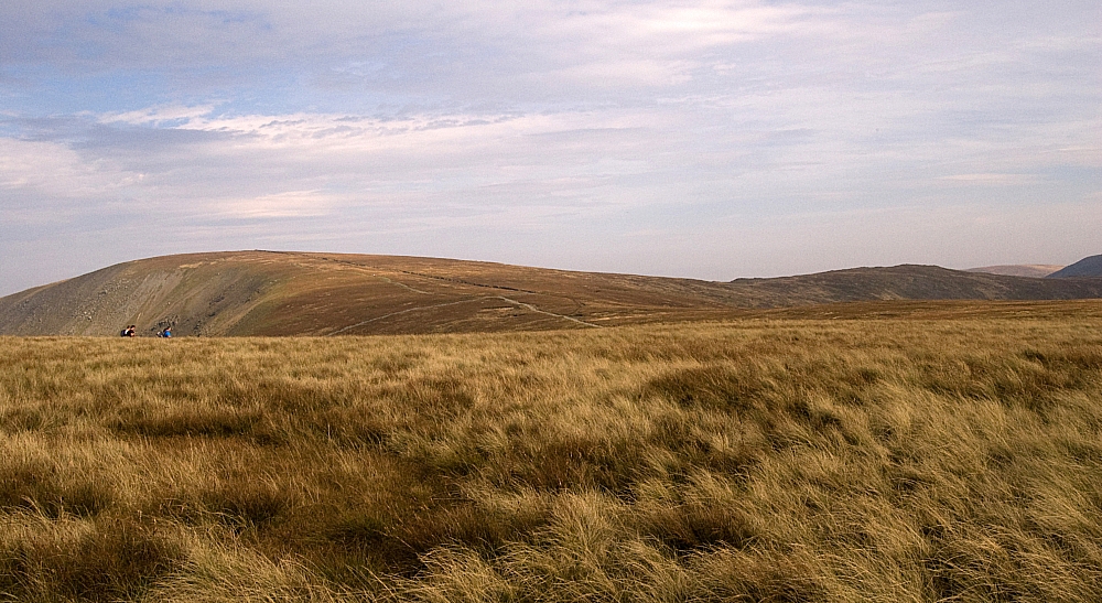
Ing Lane with the lowering Sun lighting up the tops of the Ill Bell Ridge.
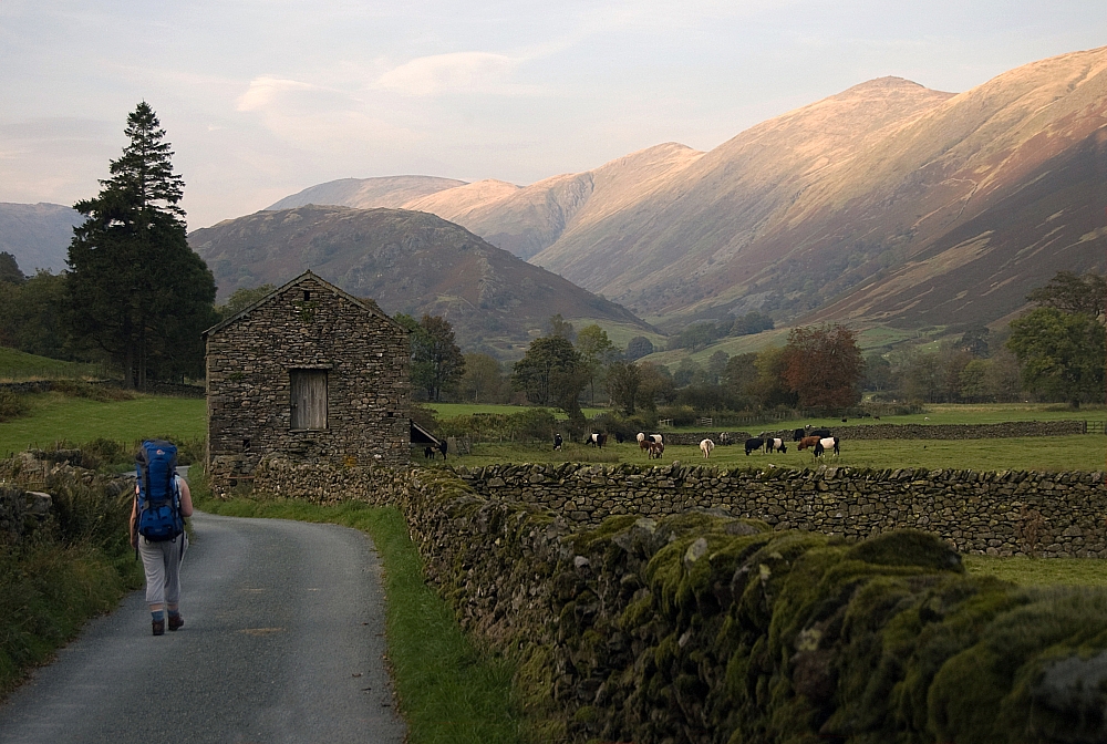
 

As before.


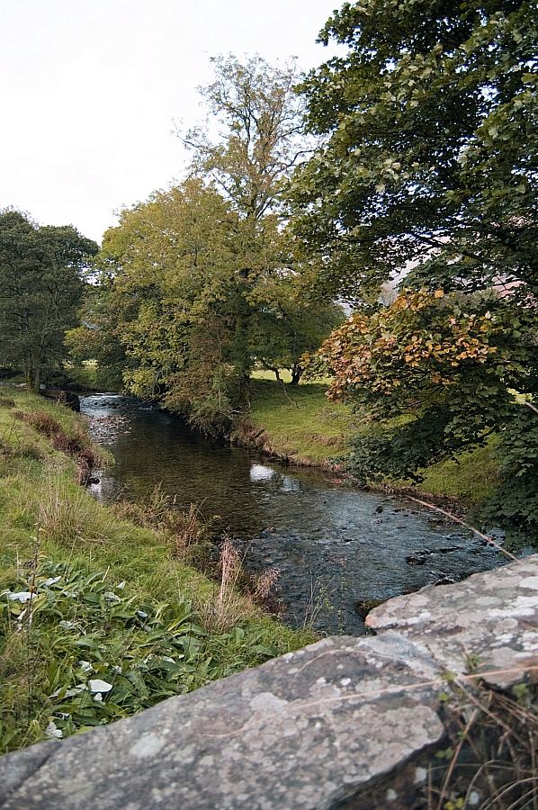
The view from Ing Bridge.


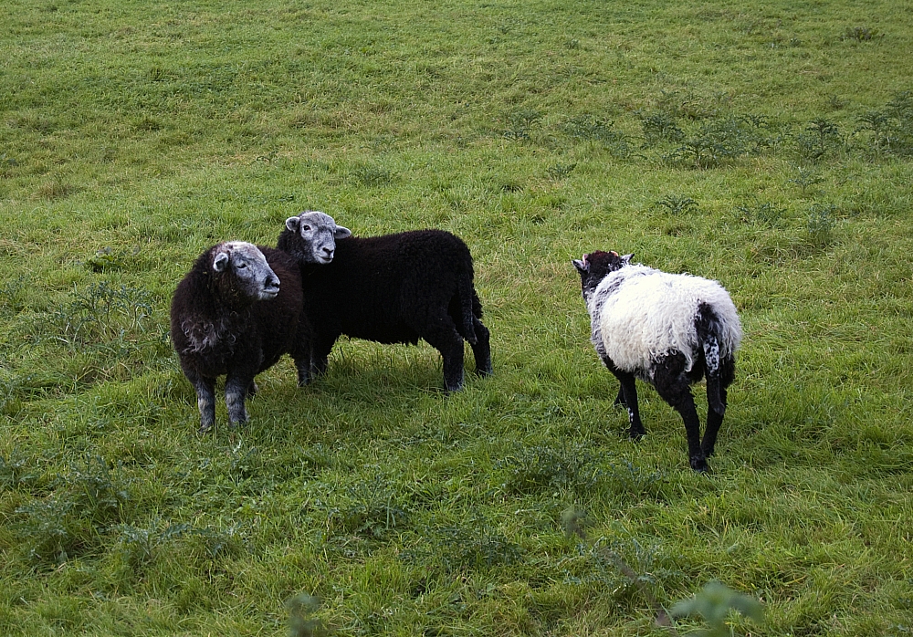
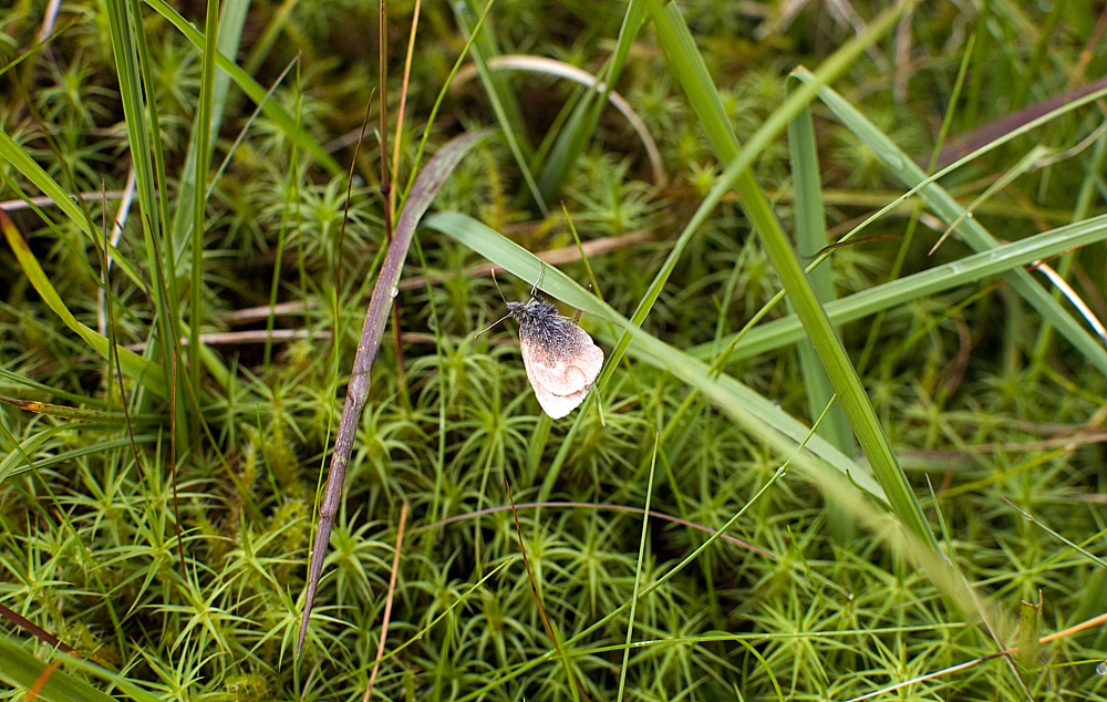
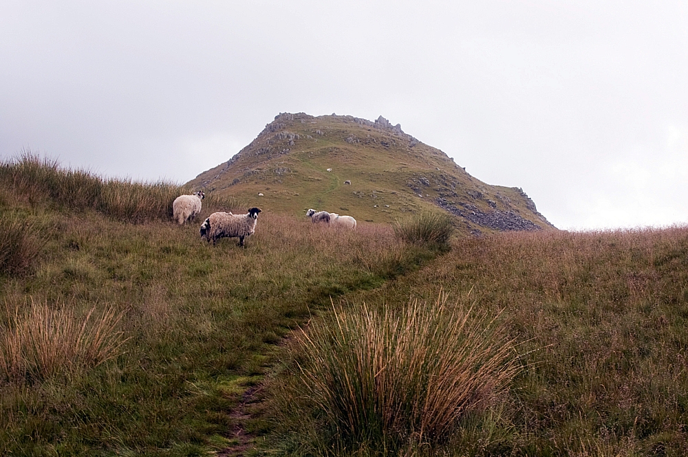
The white sheep of the family.


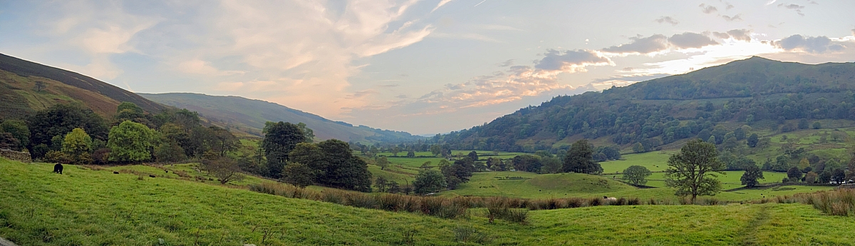
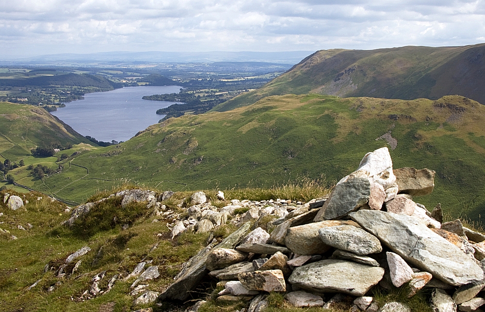
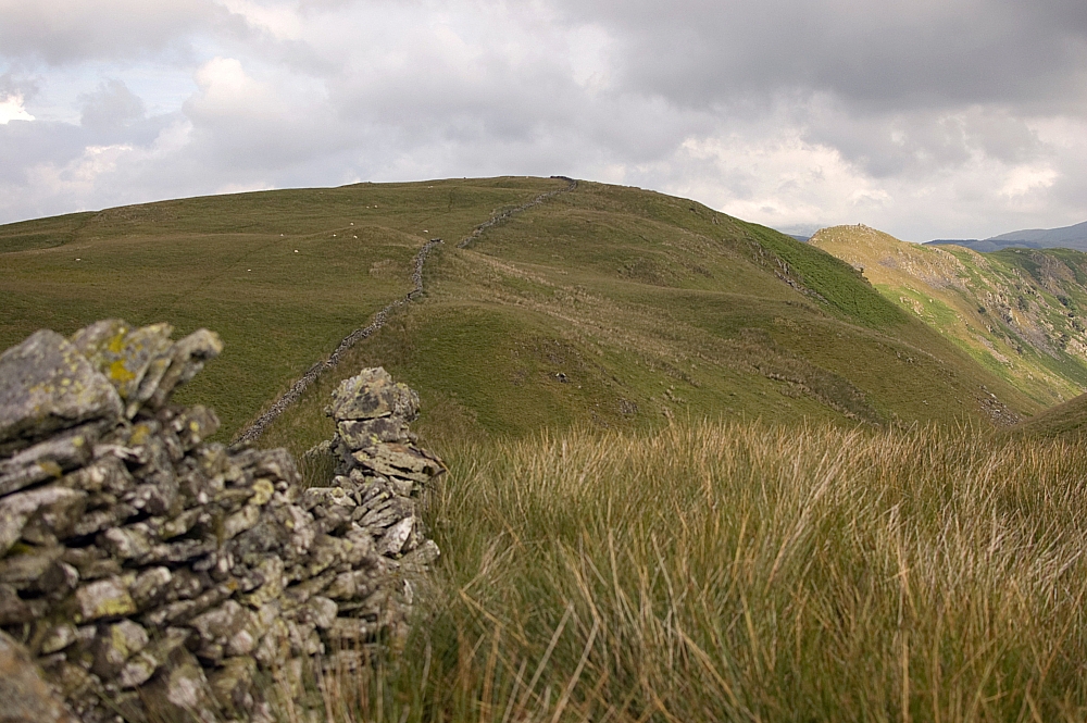
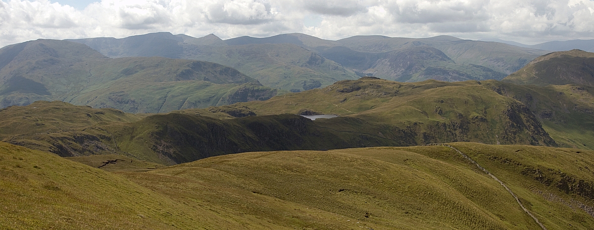
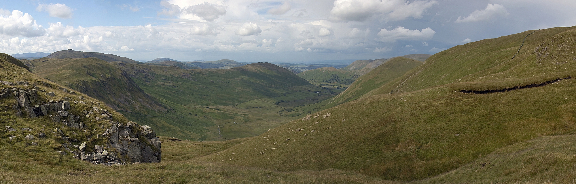
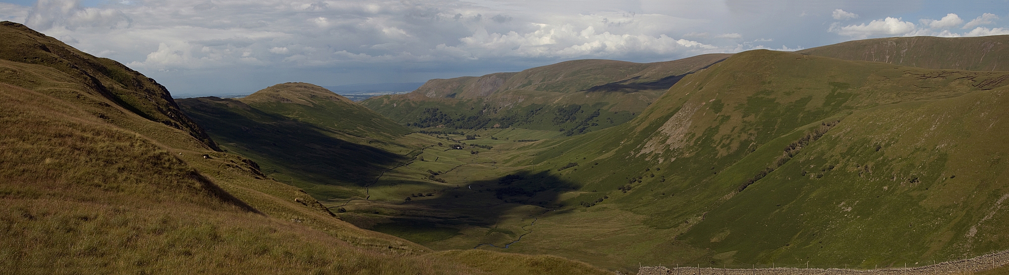
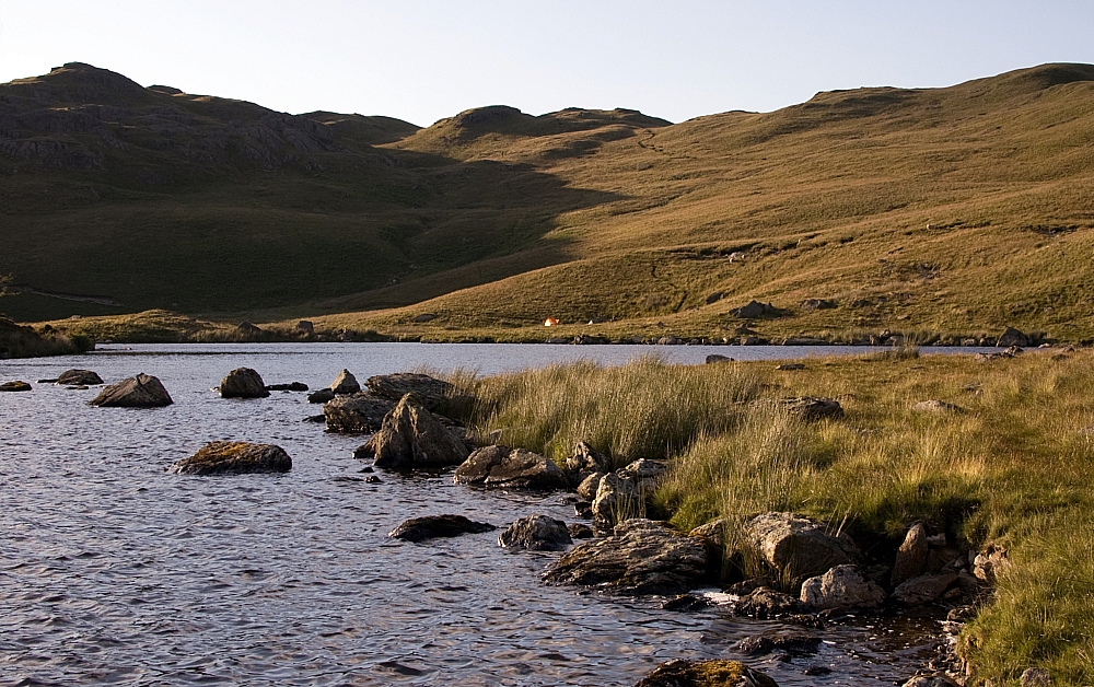
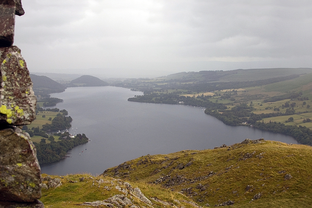
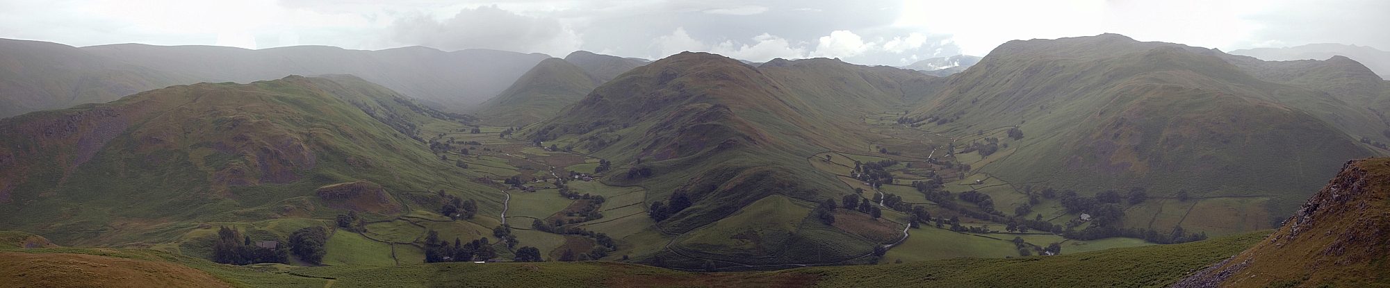
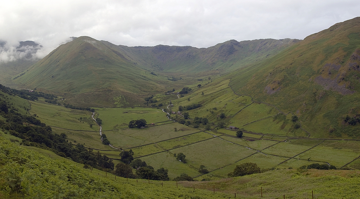
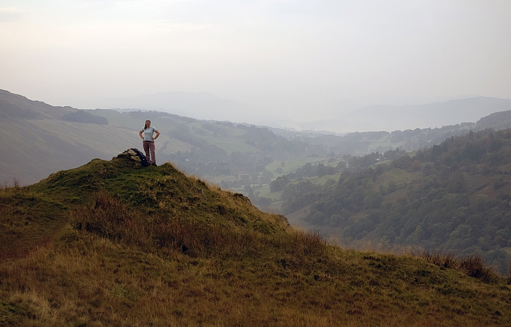
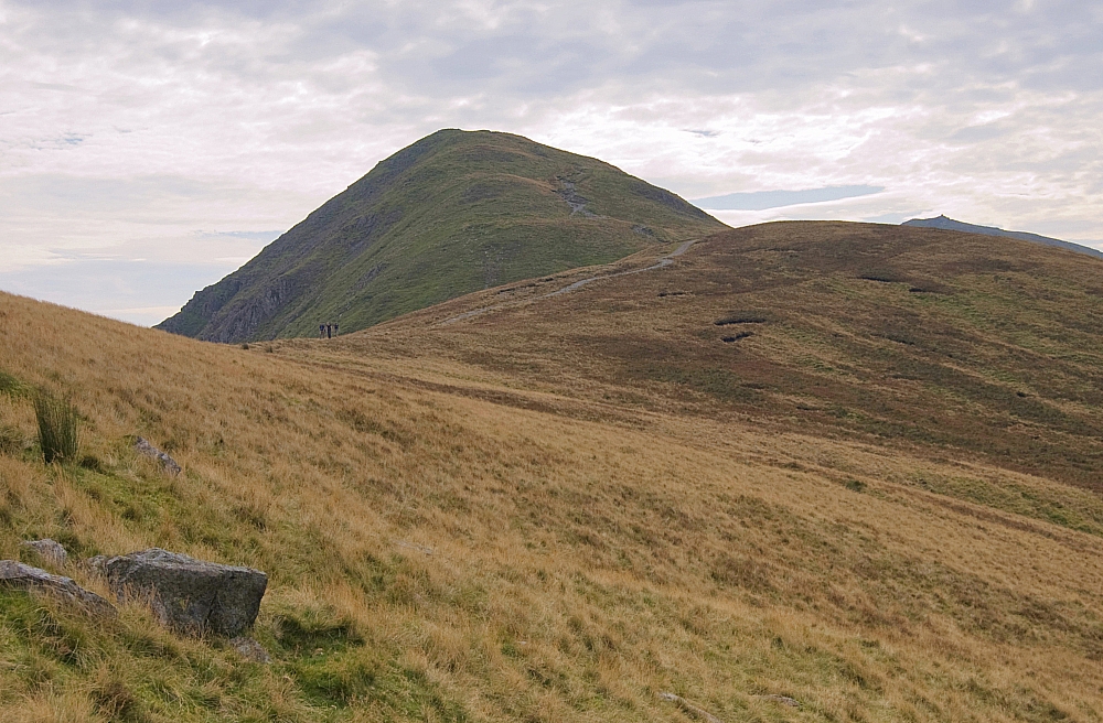
Looking back down the Troutbeck Valley from Hall Hill.


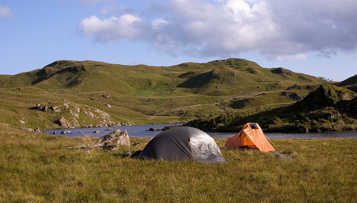
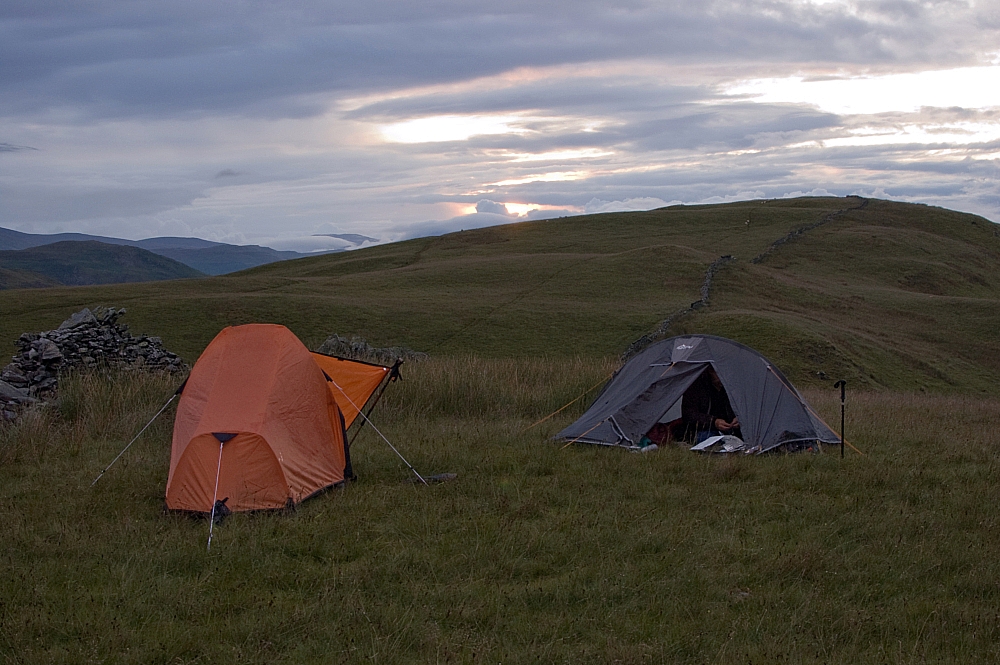
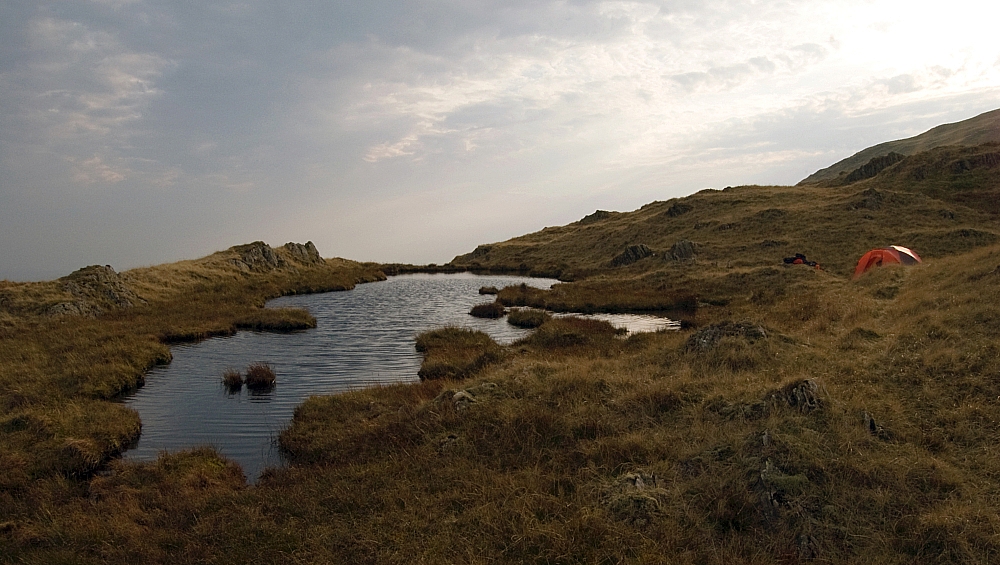
We had intended to nip up to the top of Troutbeck Tongue and to walk off the ridge northwards to find a suitable pitch near the sheepfold. Unfortunately we were losing the light and Chris wanted to get settled for the night, so we continued up along Hagg Gill and found a nice place to set up camp. While setting up we noticed that we weren't alone - there was a small tent set up a bit further up the Gill, so I went off to ask if the owner minded if we set up where we had chosen. The owner was Linda, she said that she didn't mind where we pitched and we had a fine chat about fellwalking and other stuff. After a while I returned to finish setting up camp while Chris went off for a chinwag with Linda.

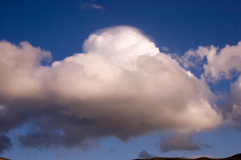
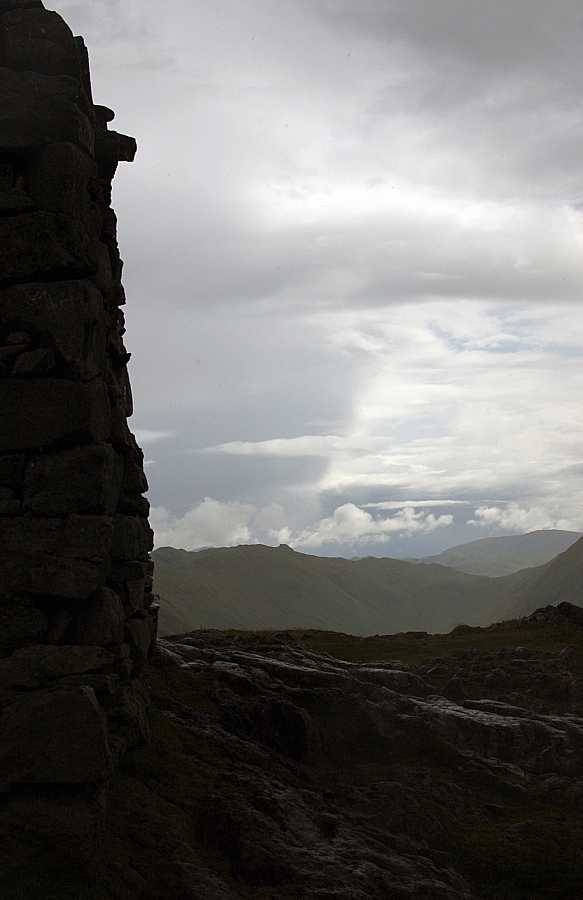
After dark we stood outside watching the sky before turning in for some sleep - although there were a few small clouds about, there were prolonged clear spells during which the stars were amazingly bright. We could see fantastic detail in the Milky Way, much better than we can see at home in the light-polluted Midlands.

The night was quiet and uneventful but the first light of dawn was heralded by the echoing roars of rutting deer - we couldn't see them but we were fairly certain that the commotion was coming from high on the slopes of Ill Bell, directly East of us.

After breakfast we headed off packless to bag Troutbeck Tongue before sun-up.


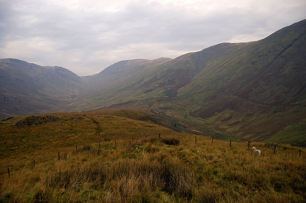
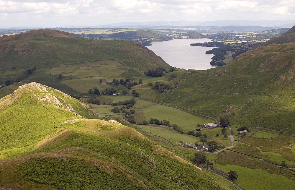
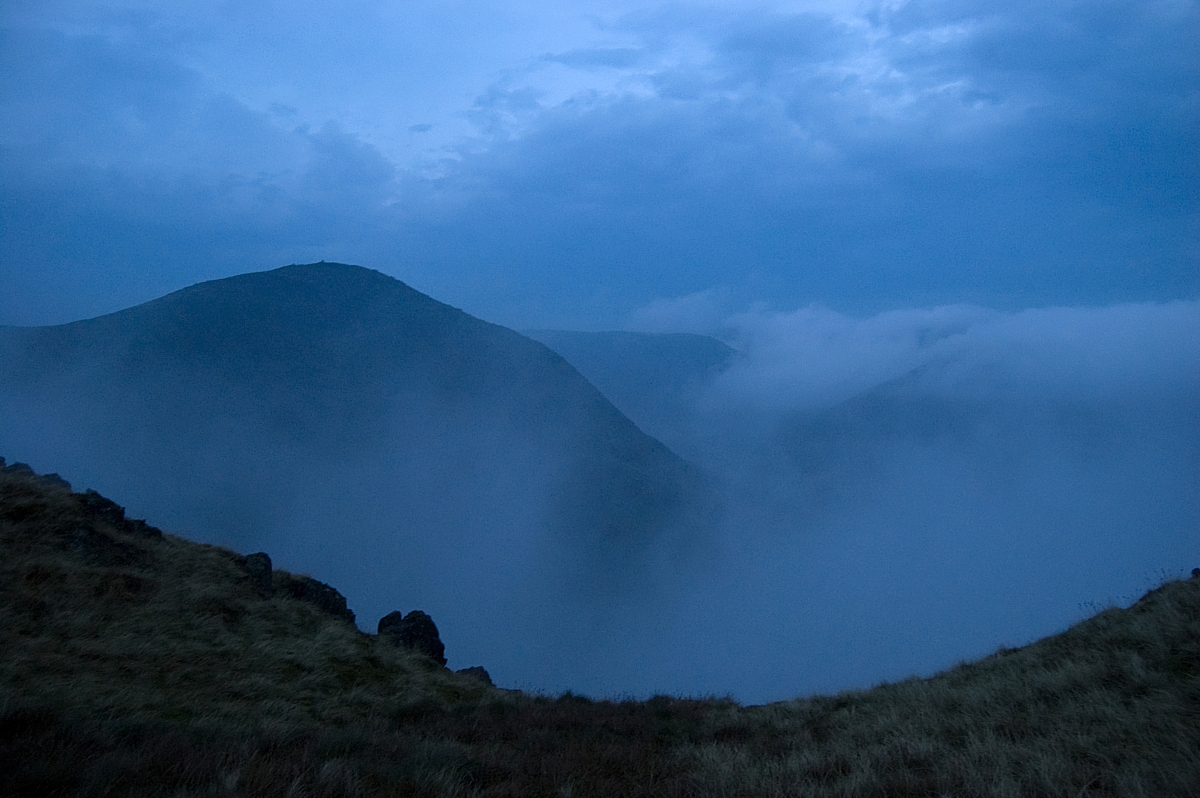
Looking towards Threshthwaite Mouth from the low ridge along Troutbeck Tongue.
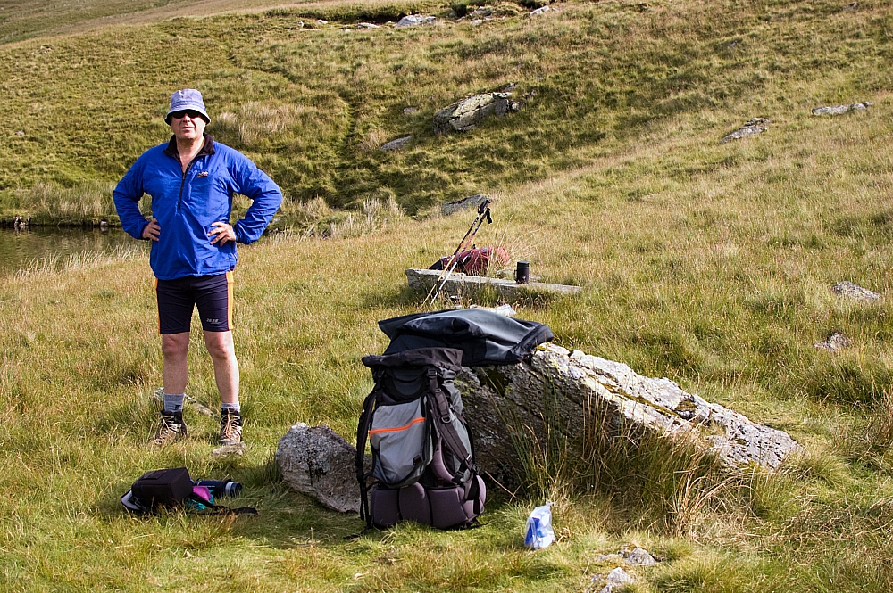
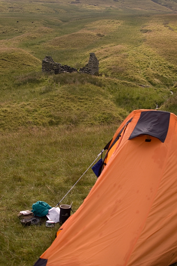
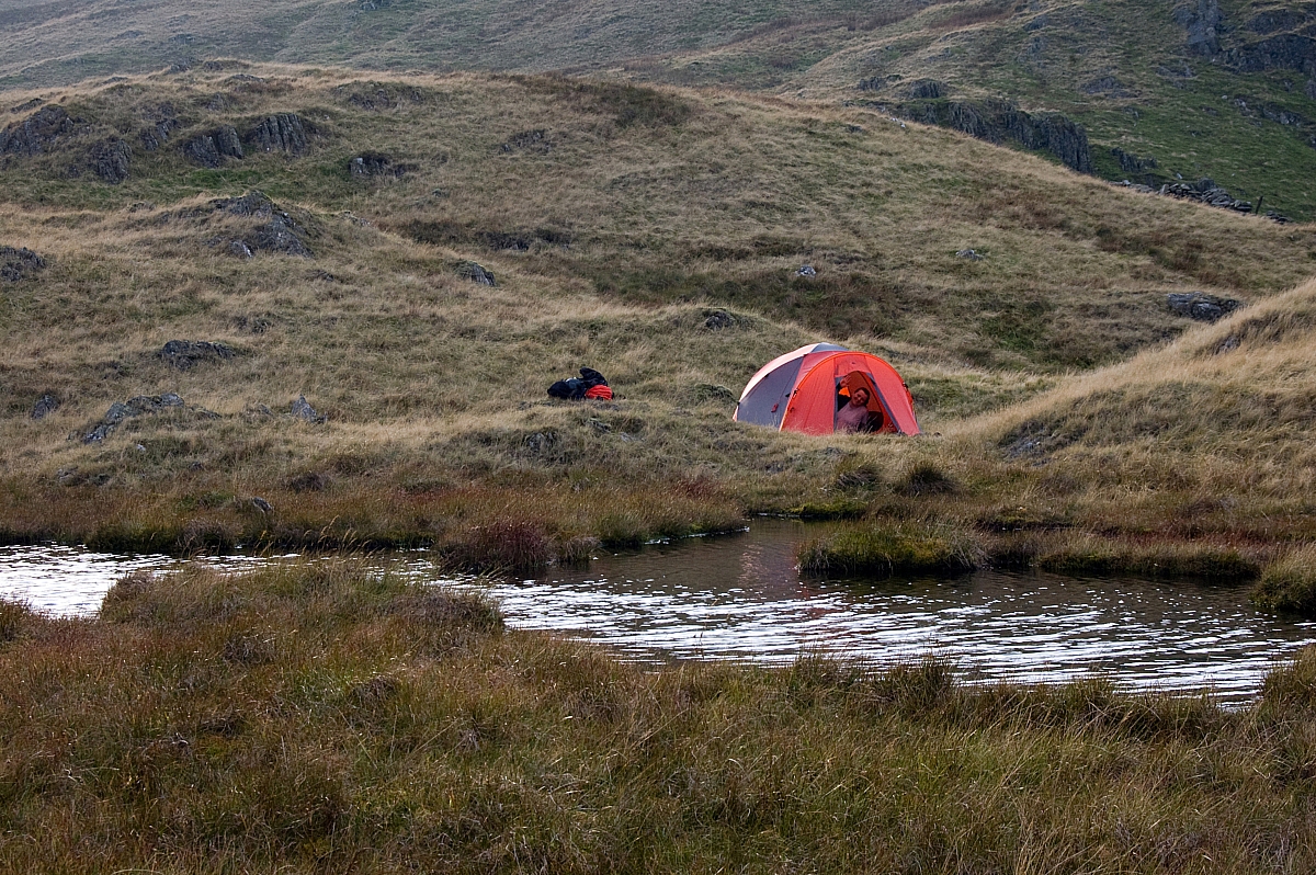
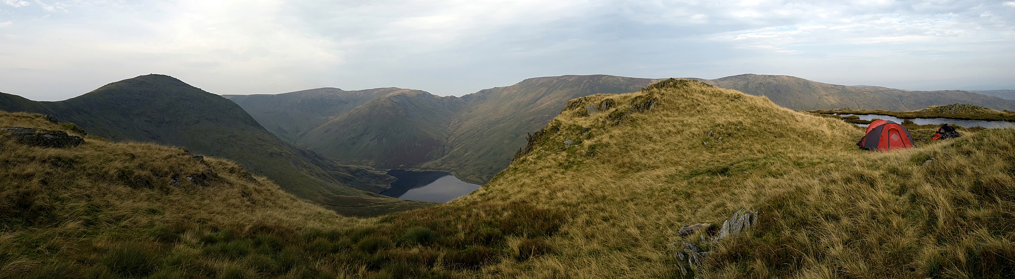
Mouseover the pic if you want to see where our highly-conspicuous bright orange landscape-defiling tent was pitched.


Some way along the ridge Nature called so we ducked away from the track for some privacy. Attending to one of the most basic human needs, Muggins here made a stupid mistake that was to cause intense pain for quite a while, and ongoing stinging and regret for the rest of the day - I decided that, in the interests of good hygiene, it would be a good idea to use the water-free hand-cleaning gel on my arse. Trouble was, it wasn't the alcohol-free sort that I usually carry, it was the heavy-duty solvent-laced stuff that I use at work. Of course, by the time I found out, it was too late - by then I was jumping around the fellside like a madman, trousers and kegs around ankles, shouting expletives that echoed around the hills and imploring the powers above to make the burning stop! I don't know if Linda heard the commotion, but if she did I've no idea what she would have thought was going on.

Eventually I could walk again (albeit like John Wayne) and we reached the top after a few more minutes:


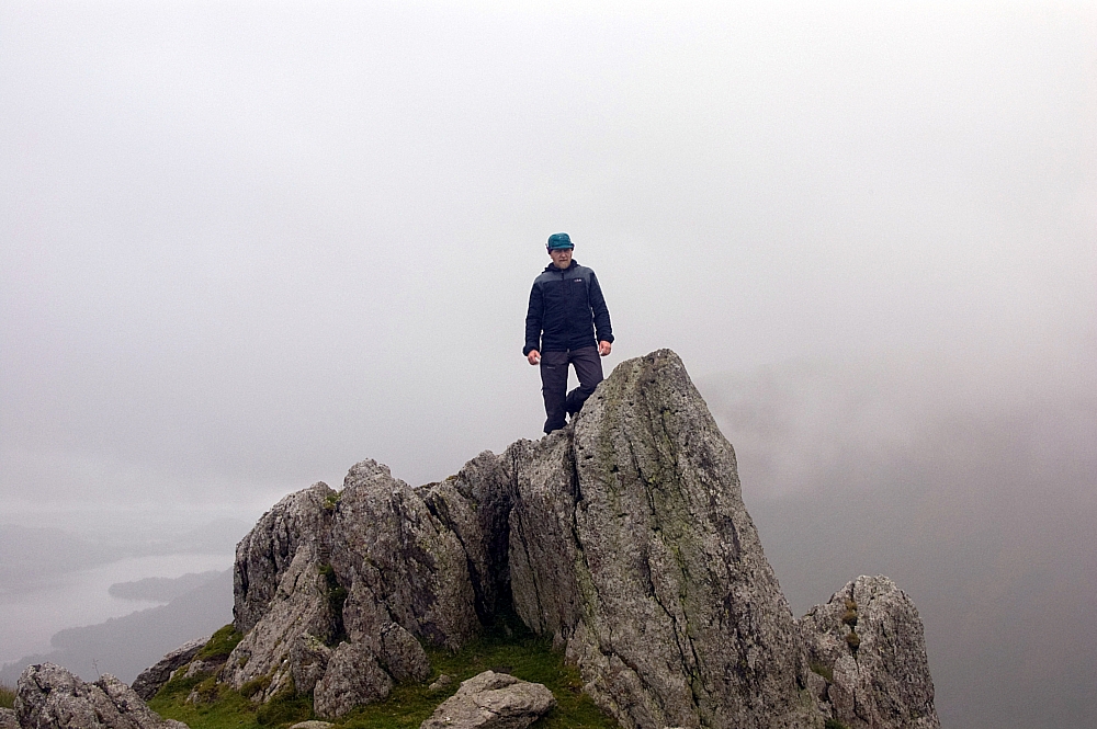
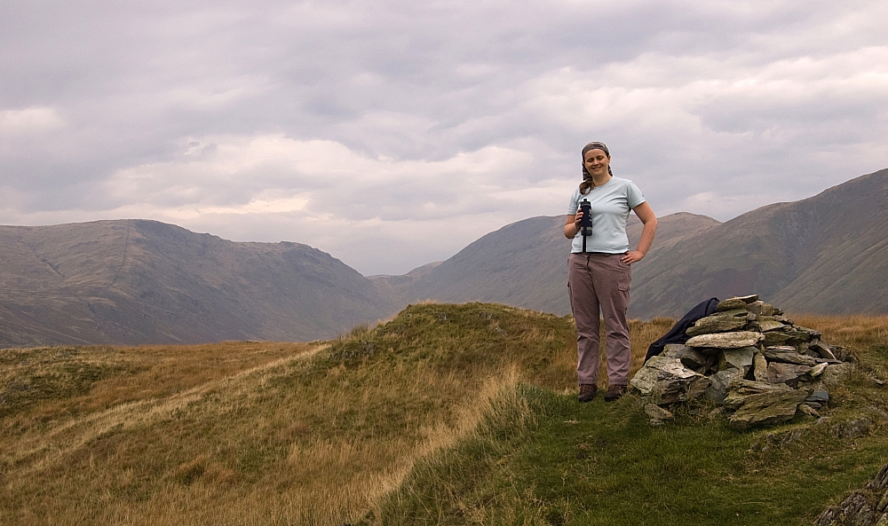
Chris on Troutbeck Tongue, mist in the valleys.


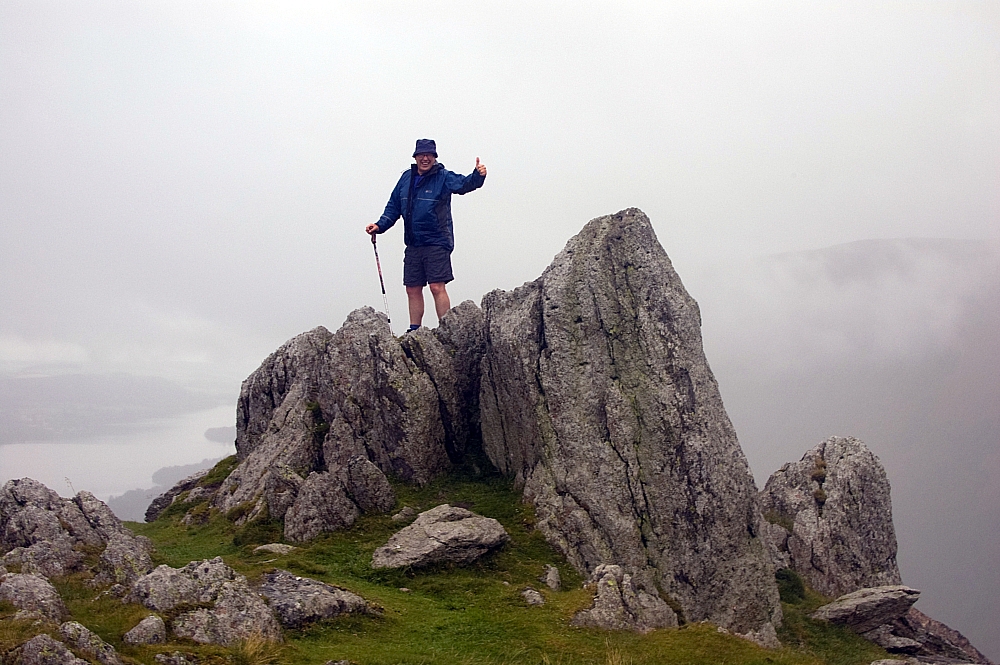
At the the top of Troutbeck Tongue, Chris was still giggling at the hand-gel incident.


We strolled back down to the tent to start packing up. Linda was up and about, she struck her camp and was away up Scot Rake well before we set out.


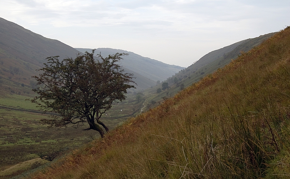
Lone tree on the slopes back down to the tent.


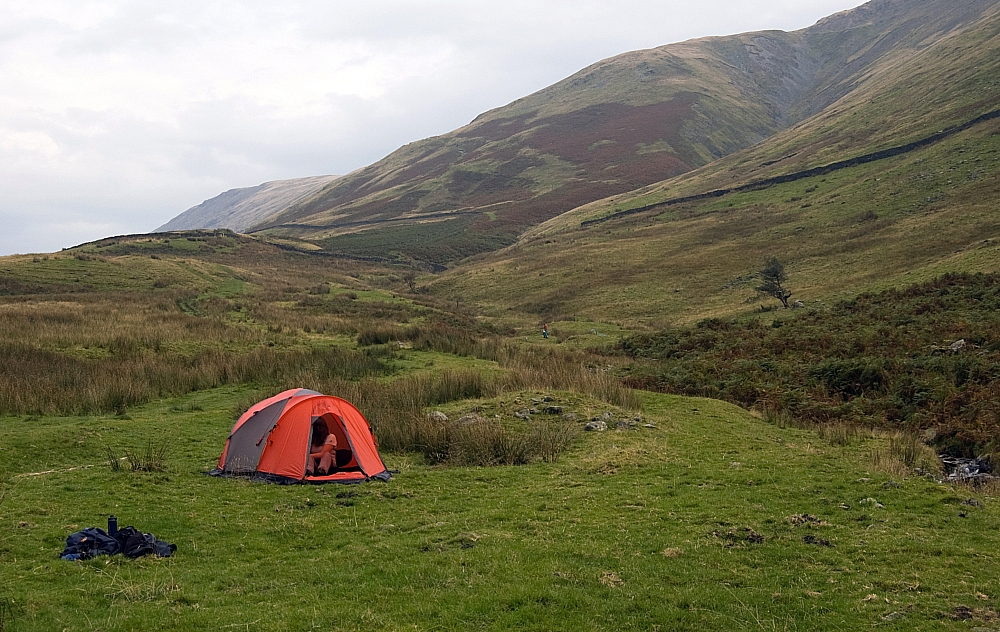
Striking camp next to Hagg Gill. A bit further up is Linda at her pitch.


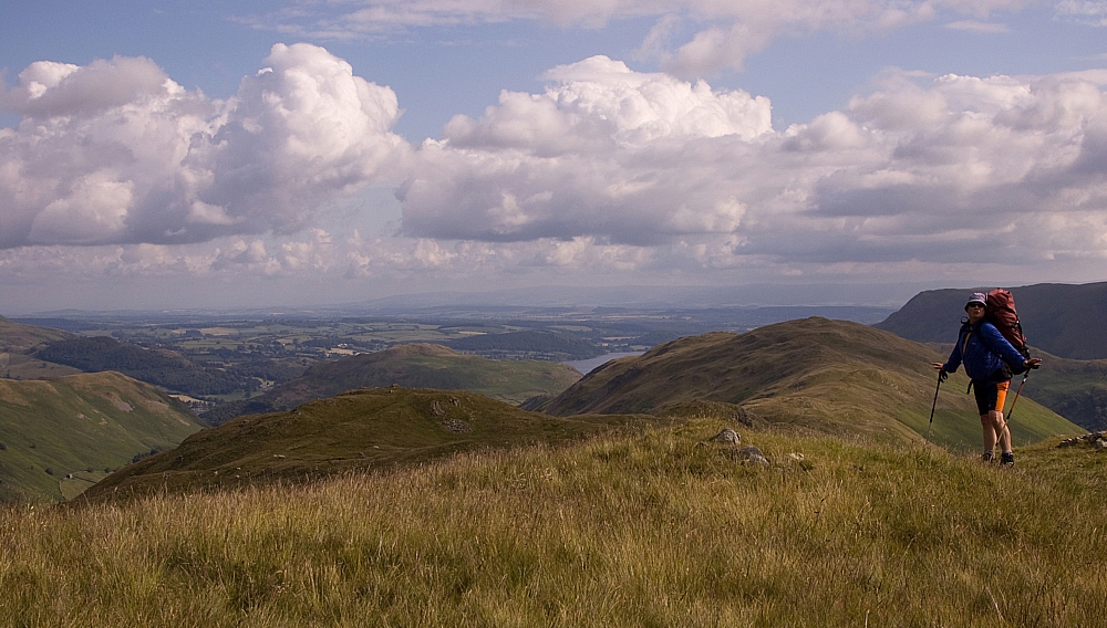
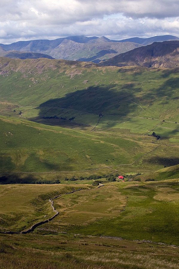
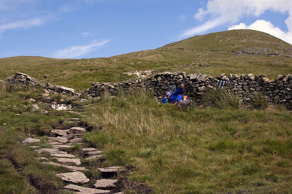
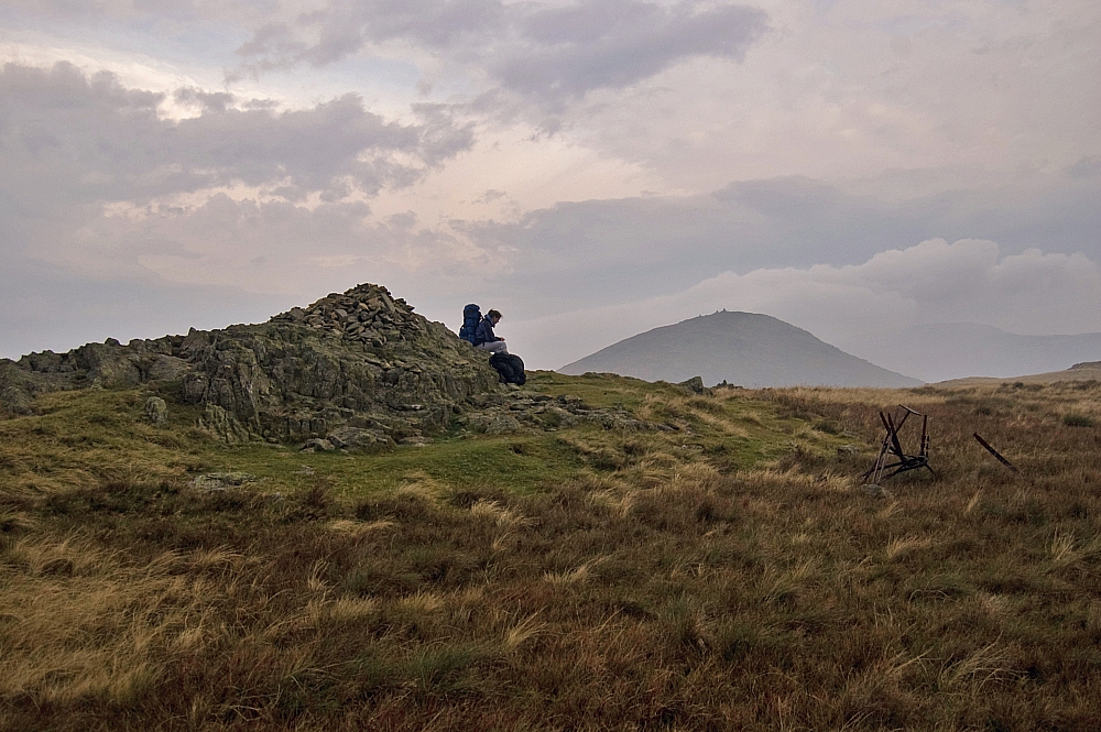
Nearing the top of the harder-work-than-expected Scot Rake we paused for a snack-break where there was a fine view of Froswick.


Froswick from the Scot Rake path.


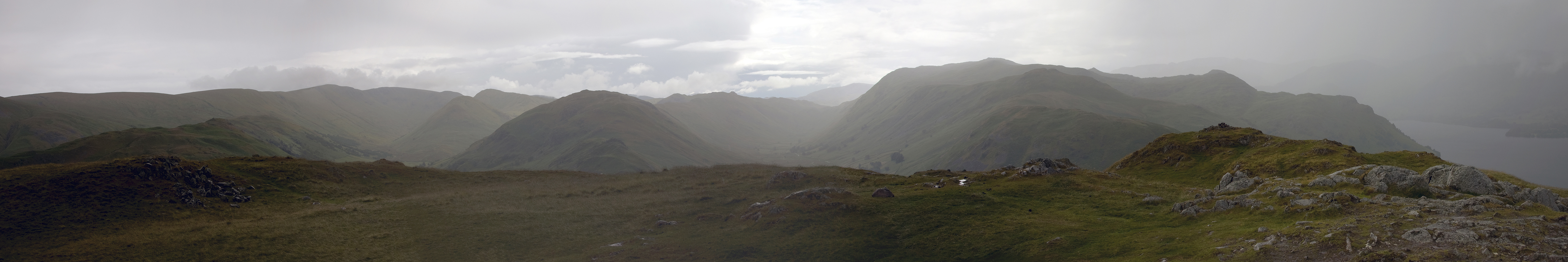
Although we would be going that way later, we were going to Thornthwaite Crag first. As the weather improved the crowds grew - at one point I counted 56 people around the summit. We settled behind a wall a short distance from the crowds and had our main meals.


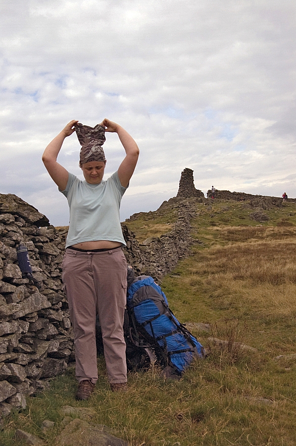
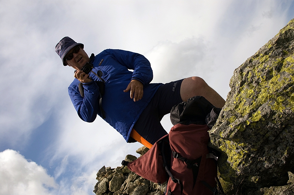
Buff-adjustment, Thornthwaite Crag.


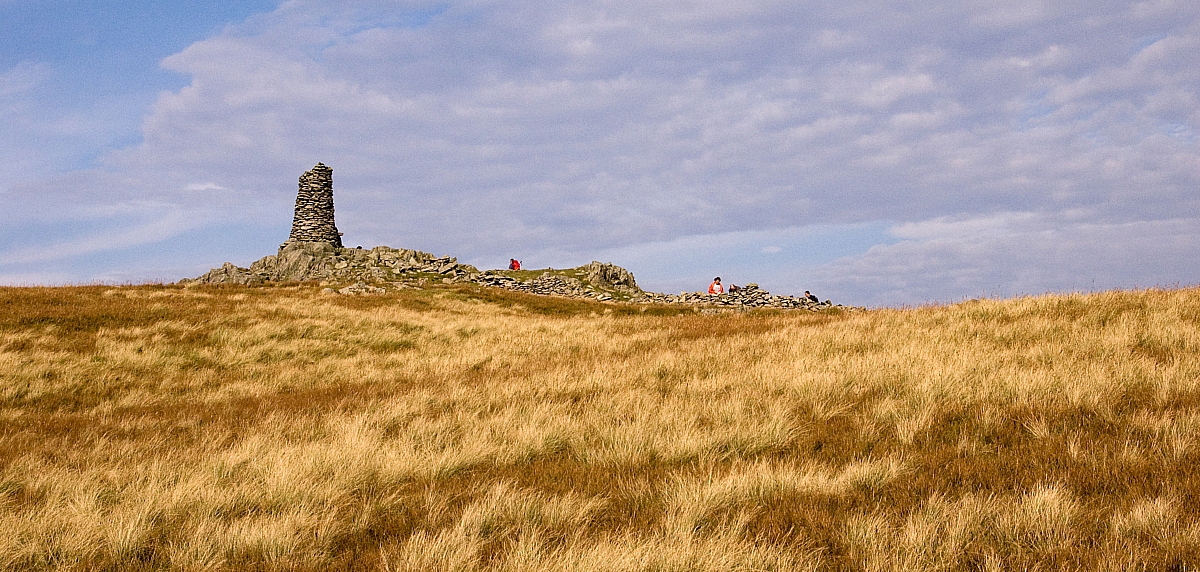
The Sun lighting up the beacon atop Thornthwaite Crag.
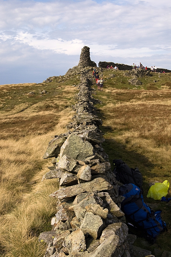
 

A busy place.


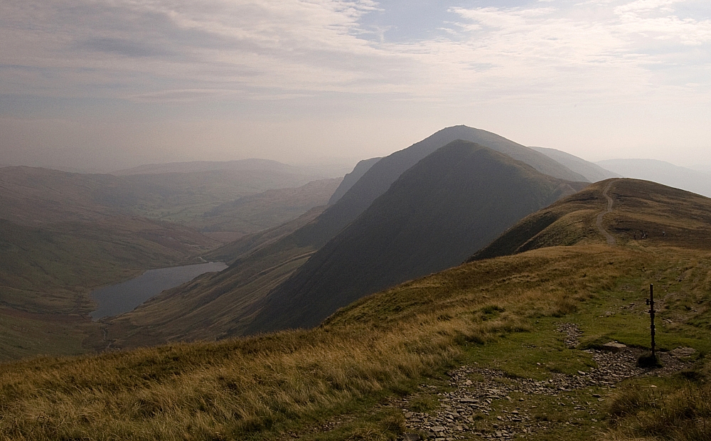
Easy slopes heading towards High Street (L) and Mardale Ill Bell (R).


Suitably fed and watered, we set off along the Ill Bell Ridge in increasingly-good weather.


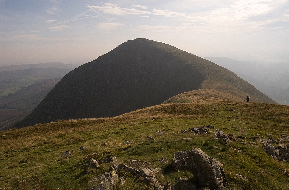
The Kentmere Valley, Froswick and Ill Bell.


Froswick, Ill Bell and Yoke.


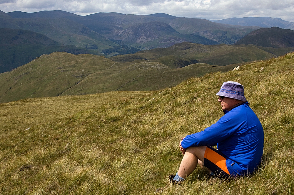
Muggins atop Froswick, with Thornthwaite Crag in the background. This was my 200th Wainwright.


Ill Bell from Froswick.


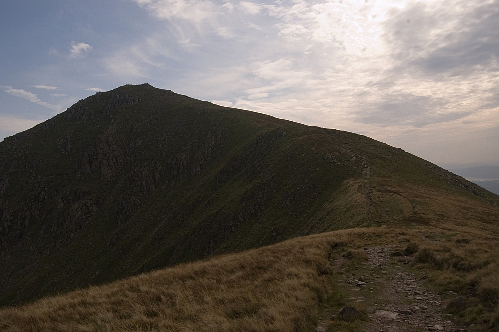
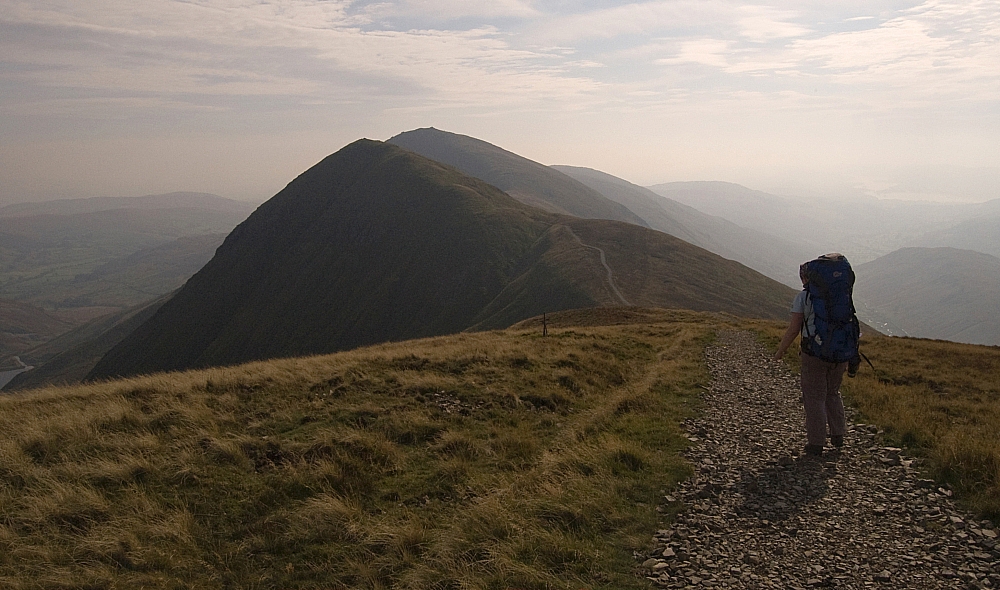
A closer look at the path up Ill Bell.


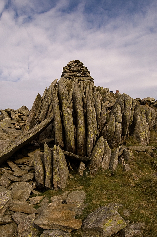
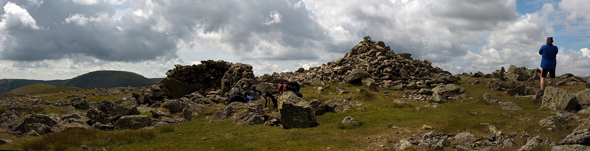
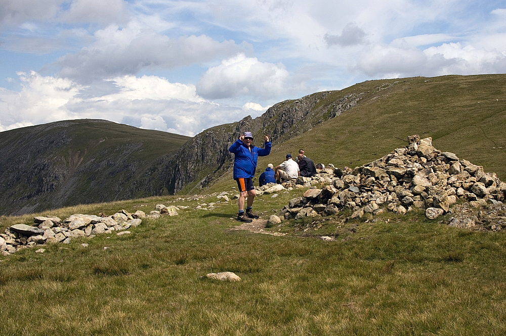
Ill Bell's North Cairn.


Ill Bell's Main and South Cairns.


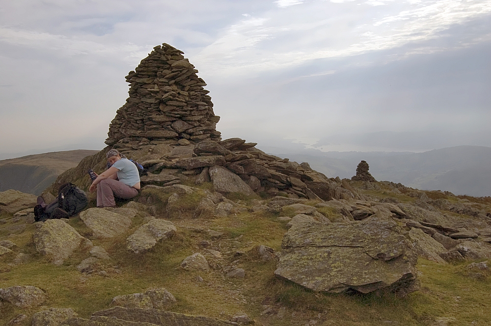
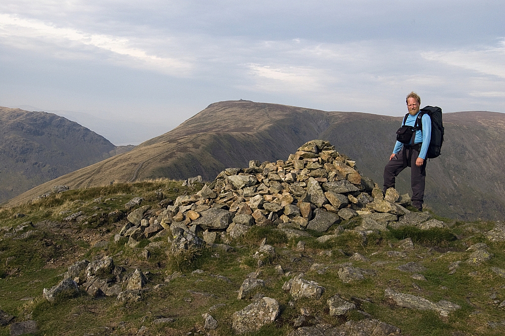
Having a breather at the Main Cairn.
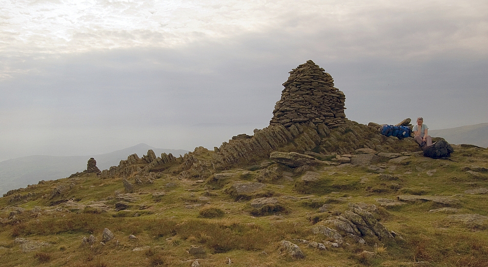
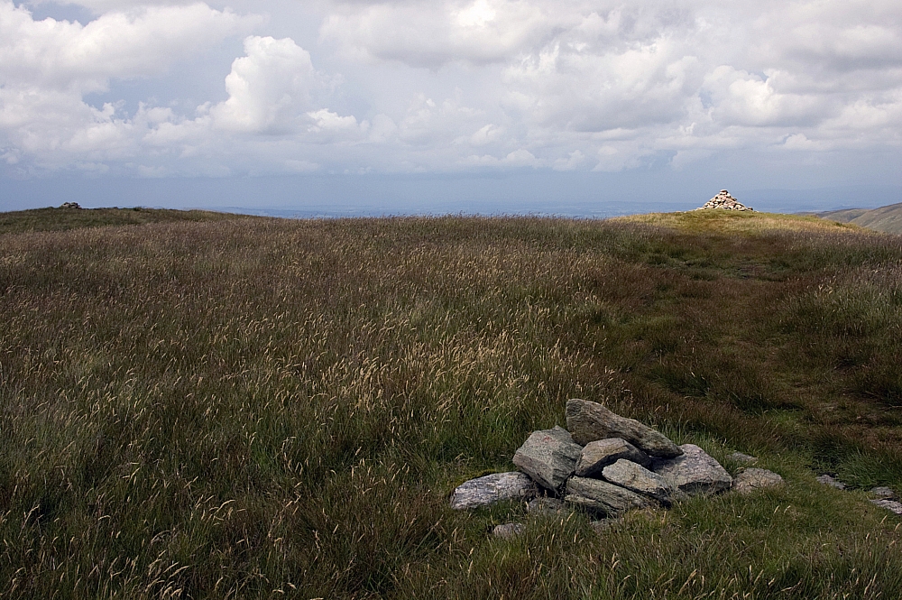
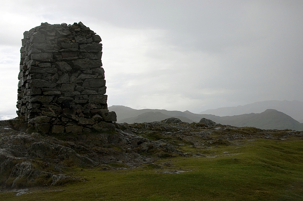
 

The Main Cairn.


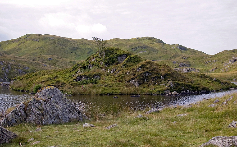
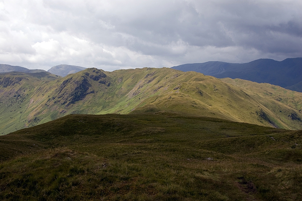
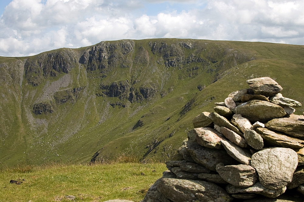
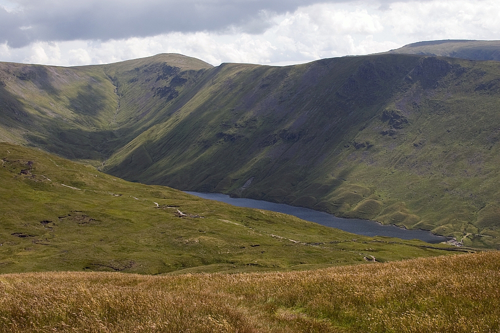
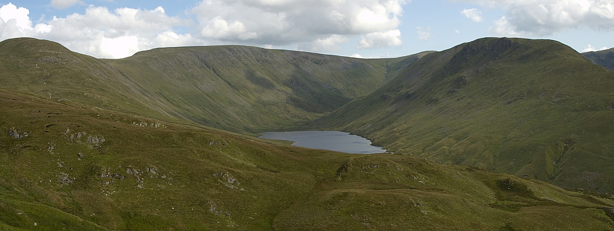
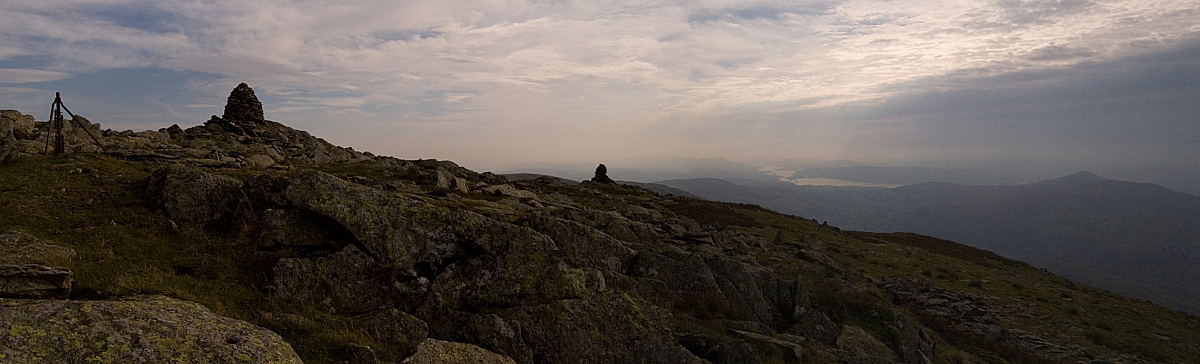
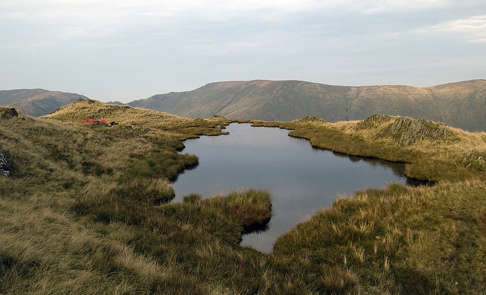
From Ill Bell we could see one of the options for our next tent pitch - the tarn on Rainsborrow Crag, the western spur of Yoke.


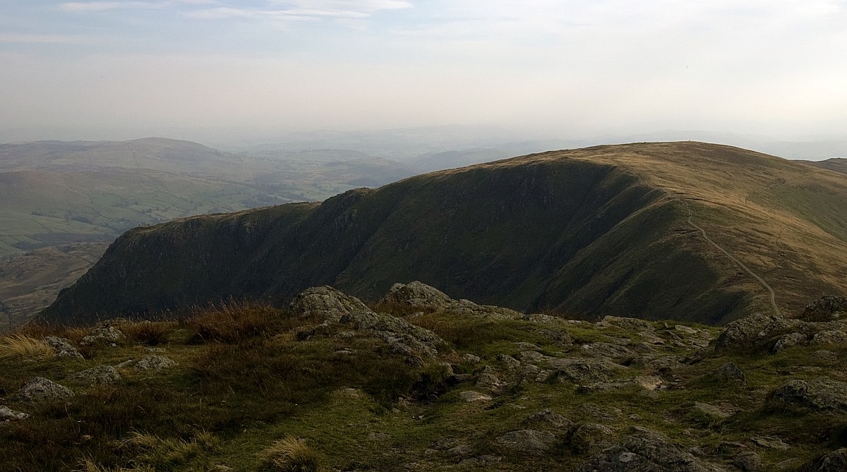
Rainsborrow Crag and Yoke.
Mouseover the pic if you want to see the location of the tarn.


At Yoke's summit-cairn we paused for a while to consider our options. We could carry on down the ridge to the Garburn Road, reach the car by twilight, find a mild-camping site and walk more fells in the morning, or we could pitch early at Rainsborrow Tarn, have a leisurely evening and, if the night was clear, maybe see the Aurora Borealis that was tentatively forecast to be on show in the small hours. We took the lazy option and headed for the Tarn.


Chris heading towards Rainsborrow Tarn.


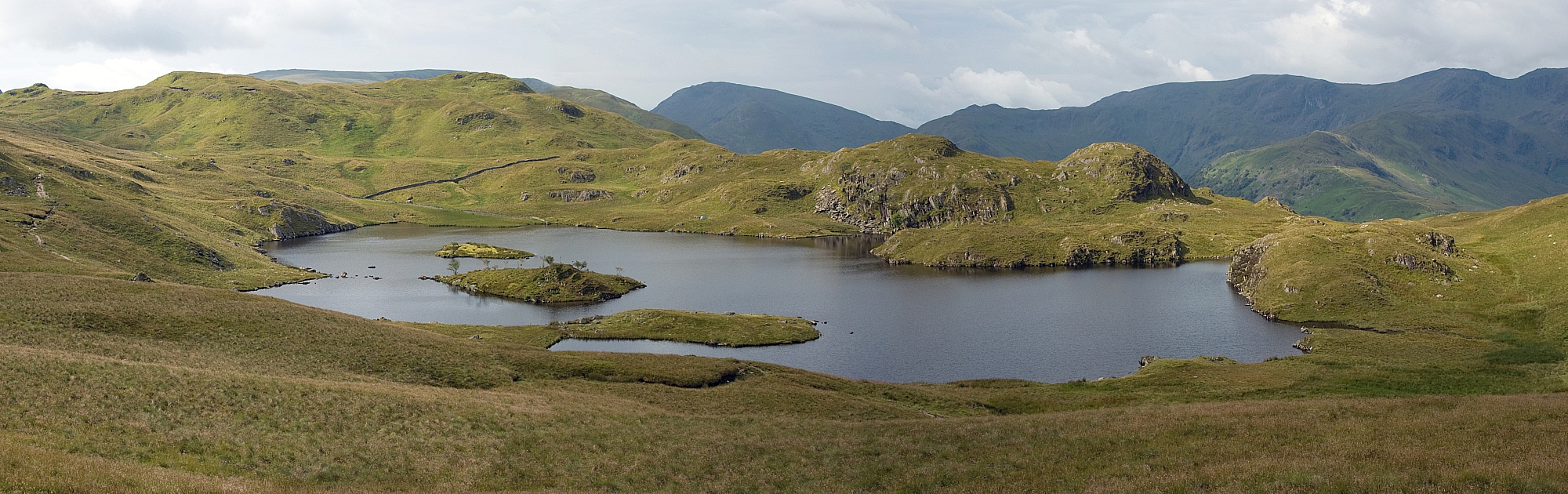
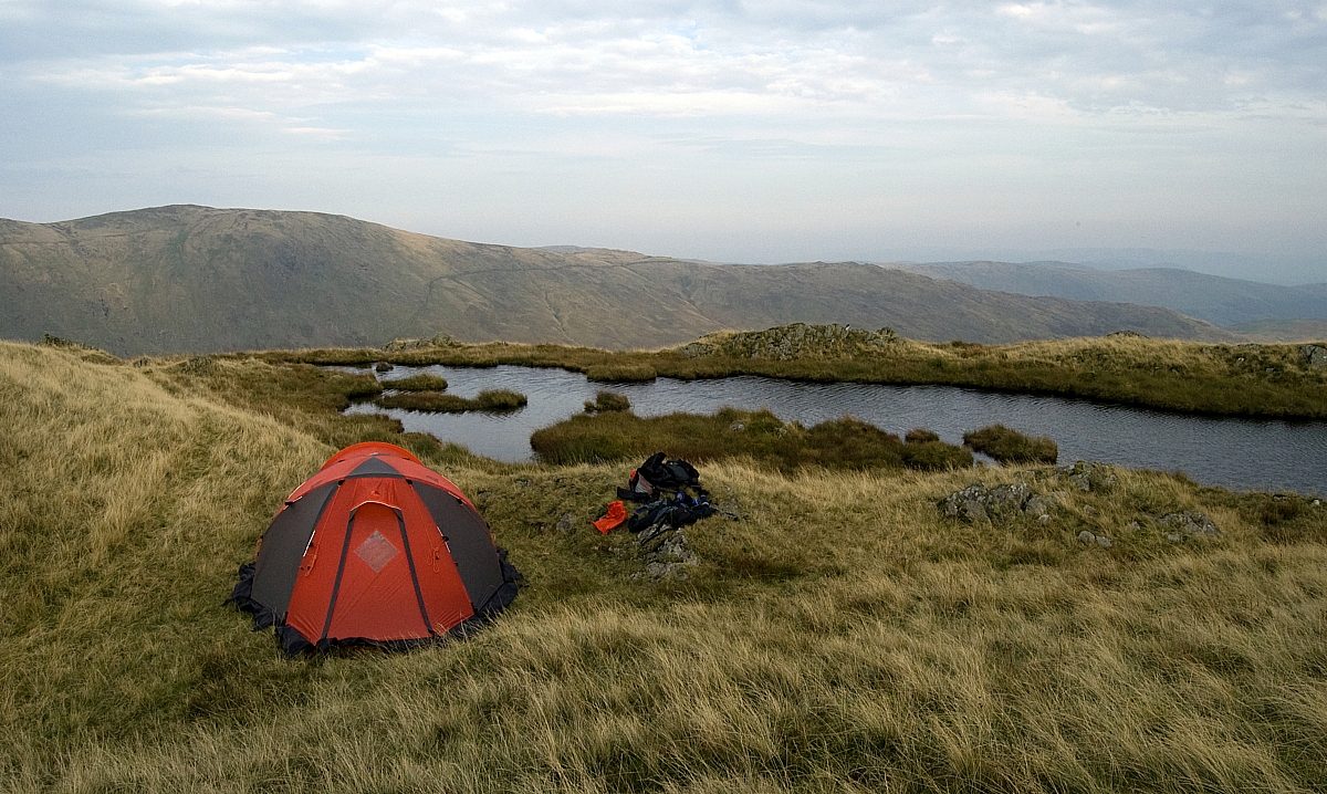
The tarn is a jewel in the hills - surrounded on three sides by long steep drops, it sits in a rut almost at the end of Rainsborrow Crag. The views from there are immense and there's a real feel of wilderness about the place. Needless to say, we saw nobody else there - it was our own little bit of Lakeland. After pitching I went walkabouts with the camera:


Looking southwards.


Wave!


Looking north towards Harter Fell.


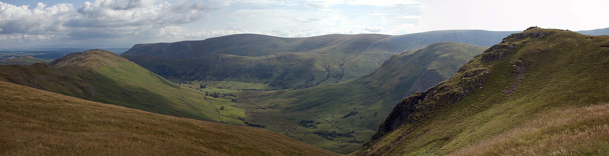
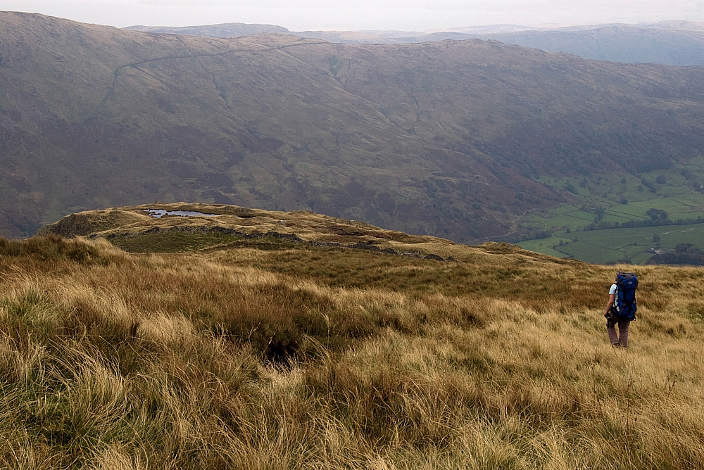
Looking east towards Kentmere Pike and Shipman Knotts.


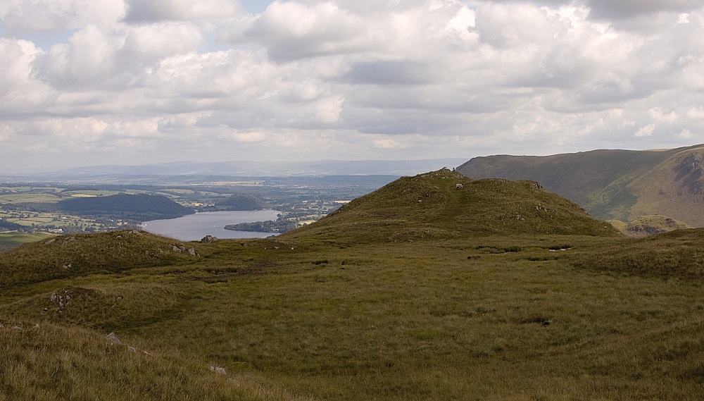
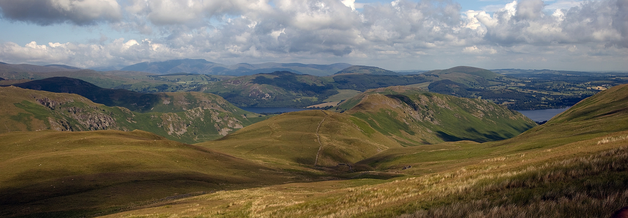
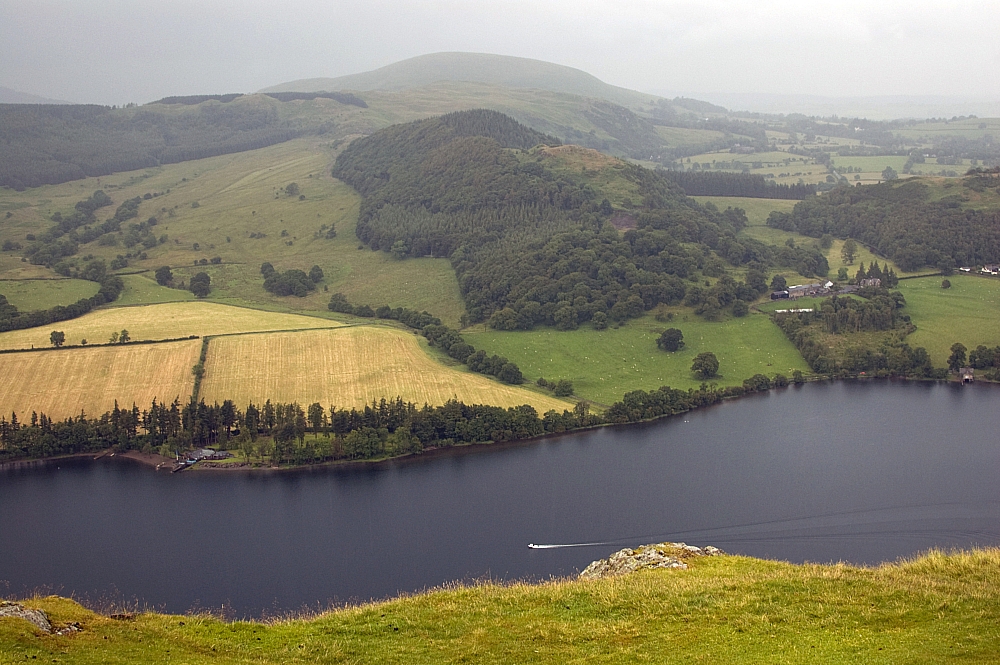
From Ill Bell to Shipman Knotts, with a view of Kentmere Reservoir.


After a leisurely evening meal we sat up waiting for the sky to put on a display but late on it clouded over and started drizzling. Even so, it was warm and calm, and we slept well.

On Sunday I woke just before dawn and ventured outside. The drizzle had stopped and the valleys were full of clouds being driven up and over the ridges and cols by the light breeze. It was utterly silent for an hour or so while I sat there watching in wonder and taking pics that don't do the scenes any justice whatsoever. It's times like that when I pity the folk at home in their beds:


Ill Bell, Mardale Ill Bell and the Nan Bield Pass wreathed in cloud.


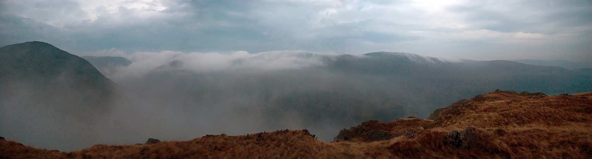
Cloud being driven up and over the eastern arm of the Kentmere Round.


Breakfasted, we shook the dew from the tent and packed it away with the rest of our kit. After trudging back up the damp grassy slope to reach Yoke's cairn again we were overheating in the still, warm air so we stopped for a breather:


The summit of Yoke, with Ill Bell in the background.


A few pics later we headed down the newly-repaired path that leads to the Garburn Road. From there it was an easy downhill stroll all the way back to the car, followed by retail therapy at Windermere's Lakeland shop, another Little Chef at Ings and a manic drive back down the M6 and A5.


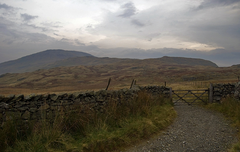
Looking back towards Yoke from the gate at Garburn Nook.


Summary:

Distance: 13.9 miles
Total ascent/descent: 3879 ft
Wainwright tops reached:
Troutbeck Tongue (1191 ft)
Thornthwaite Crag (2569 ft)
Froswick (2359 ft)
Ill Bell (2476 ft)
Yoke (2309 ft) twice
Those in bold were first-ascents for me.
Number of Wainwrights still to do: 12

Yes, I know that this was a walk that many folk would easily do in a day, but I'm happy that we took our time about it. I'll never forget the overnight at Rainsborrow Tarn, it's a place that few one-dayers bother to visit and I'd have regretted omitting it during a walk against the clock.
Indeed, it was Wainwright himself who said "Time is intended to be spent, not saved".

Regarding gear taken for test-and-review... I took two items supplied by Adam Smith representing Go Outdoors. While the Lifeventure Downlight 900 sleeping bag didn't have to contend with low temperatures, the mild nights meant that it had to put up with a fair degree of condensation and sweat. I'm happy to report that it fared well, at no point did it feel clammy or damp. As for the windproof, I still maintain that the mere act of carrying that Montane Lite-Speed H2O jacket is enough to deter inclement weather! I'm sorry, Adam, yet again I took it and never got the opportunity to wear it!

The Keeltappers and Grunters Social Club 2011 Wildcamp Weekend – Part 4 – Facts and Figures

Posted by on July 16th 2011 in Great Escapes, Lakes Escapes, Testing for review, Wildcamping
Tags:

Some lists, numbers and thoughts about last weekend's outing...

Kit carried:

  • LA Warp 70 pack
  • Argos Pro Action Hike Lite tent
  • Sleeping: Lifeventure Downlight 900 sleeping bag, POE Max-Thermo mat, Ajungilak air-pillow
  • Jetboil PCS with spare half-full Coleman 100 canister, plaggy legs and long-handled spoon
  • Clothing: Rab Corrie eVENT jacket, Montane Featherlite windproof trousers, 1 spare kegs, 1 pair spare socks, 1 spare baselayer top, Buff
  • Food: 2 Decathlon Aptonia dehydrated meals, 4 cereal bars, 4 Pepperamis, 2 packs instant custard, 4 Cofresh coconut bars
  • Drink: teabags, sugar, milk-powder
  • Navigation: Maps (printed on A4), A5 mapcase, compass, HTC Wildfire running MMTracker
  • Wash-kit
  • 5h1t-kit
  • First-Aid kit
  • e+Lite headtorch
  • D50 dSLR in LowePro bag
  • Hipflask (Drambuie)
  • Ciggies

Total carry-weight at start: 11.7kg

Kit worn:

  • Rab VR Climb jacket
  • Quechua Bionnassay trousers
  • Baselayer top
  • LA Mountain Cap
  • Aku Croda boots
  • Socks
  • Kegs

Taken but not used:

  • Rab Corrie eVENT jacket
  • Montane Featherlite windproof trousers
  • Buff
  • Compass

A few observations:

  • Crumble a Cofresh coconut bar into a pack of Sainsbury's Instant Custard (the "Basics" 6p a pack stuff), rehydrate it and it makes a simple, quick and tasty hot breakfast. Next time I'll take some dried fruit to add too. Papaya and banana, perhaps?
  • The Downlight 900 sleeping bag was excellent, but I've told you that already.
  • The Decathlon Aptonia dehydrated meals (Chicken and Rice Curry, Shepherd's Pie) were much better than any other brands that I've tried before. More taste, more chunks, quicker to rehydrate. More e-numbers, though - I don't know if that's a good or a bad thing. The integral holding-area on the side of the bags was a useful touch, as was the printing of the fill-lines inside the bags.

According to Memory-Map:

  • Total distance: 14.3 miles
  • Total ascent: 4302 ft
  • Total descent: 4292 ft (where the missing 10ft are is anybody's guess!)

Miscellaneous:

  • Wainwright tops vistited: 7 (Hallin Fell, Steel Knotts, High Raise, Rampsgill Head, The Knott, Rest Dodd, Beda Fell)
  • Wainwright tops considered optional but not visited: 6 (Wether Hill, Kidsty Pike, The Nab, Brock Crags, Angletarn Pikes, Place Fell)
  • Wainwright tops ticked off the to-do list: 4 (Hallin Fell, Steel Knotts, Rest Dodd, Beda Fell)


[umap id="106156" tp="9" size="c" w="600px" h="800px" alignment="center"]

The Keeltappers and Grunters Social Club 2011 Wildcamp Weekend – Part 3 – Sunday

Posted by on July 14th 2011 in Great Escapes, Lakes Escapes, Testing for review, Wildcamping

Saturday night was dry but a little more chilly than Friday, with a cool breeze coming from over the tarn. I woke briefly at first light and saw some Red Deer on the slopes above us, but unlike back in 2007 they didn't wait for me to get the camera out. I'd been warm enough with the flysheet open all night, but Mike had been cold again despite being fully-dressed in his bag. Again, sitting in the sunshine while demolishing a decent breakfast and lashings of tea was the cure.


Almost ready for action


One last shot of the island


By the time we'd struck camp the sun was well up and it was clear that it was going to be a hot day. The short pull up to the eastern shoulder of Angletarn Pikes afforded us a fine view of the tarn:


Angle Tarn


Once over the shoulder we got great views - on one side Heck Crag and Bannerdale, on the other Place Fell and Glenridding:


Bannerdale and Heck Crag


Glenridding and Place Fell


We plodded on past Heckbeck Head and up to the first cairn where the view of the ridge ahead opens out. Mike was clearly afflicted with some sort of madness, maybe the thought of going home had caused delirium:


The ridge to Beda Head


We parted company where a good path led off and down to the right - Mike had to be back at the car by noon and so would take the valley route, I wanted to walk the rest of the ridge. After our farewells the walk along the saddle and up the final rise to Beda Head was a doddle:


Looking back along the saddle to Heck Crag and Angletarn Pikes


Beda Head and the last bit of up


Beda Head cairn


Hallin Fell and Eastern Ullswater from Beda Head


That was enough high stuff for me. I descended the craggy northern ridge until I got to Nickles where a track led off to the right, down a steep bracken-clad slope. I was almost back at valley level when I noticed Mike dawdling along the Howe Grain road so I yelled to him and he waited a few minutes for me to reach the road.

We finished the walk together and after reaching the cars just before noon Mike reached into his car-boot and played his aces - he had a boxful of beers that had stayed ice-cold all weekend, thanks to the superb cool-box that he was testing/reviewing for Adam Smith / Go Outdoors. Needless to say, I had to help him to consume them, it's what friends are for.

Goodbyes were said again and we went our separate ways. It had been an excellent adventure - I'd had a great time in good company. 14.3 miles, seven Wainwrights visited (four that I can tick off the to-do list) and a couple of nights out might not be much for some folk, but it's good in my book.

Thanks, Mike.


Scots Pines at Knicklethorns

To be continued...

The Keeltappers and Grunters Social Club 2011 Wildcamp Weekend – Part 2 – Saturday

Posted by on July 13th 2011 in Great Escapes, Lakes Escapes, Testing for review, Wildcamping

Friday night was uneventful - some light breeze and some occasional drizzle but not enough to warrant closing the flysheet. I'd been snug as a bug, the Lifeventure Downlight 900 bag on test being on the warm side of comfy. Mike said that he'd been a bit cold and was regretting having left his down bag in Wales the previous weekend. Nothing that a good breakfast couldn't cure, though.


Drying the gear in the morning sunshine


Looking back at Brownthwaite Crag and Pikeawassa from the overnight pitch


By the time we'd packed up and checked that we'd left no lasting trace the morning was heating up nicely and it was only a matter of time before the sun would break through the clouds. We wanted to be on the High Street before it got too hot so we crossed the shoulder of Gowk Hill to intercept the track to the Keasgill Groove, scattering many moths and Small Heath butterflies from the grass as we went:


Small Heath (Coenonympha pamphilus)


On the track to the Groove we stopped for a breather and were rewarded with great views behind and below us:


The Gowk Hill - Steel Knotts ridge, our first-night pitch is in the dip below centre


Looking down on The Bungalow that was built for Kaiser Wilhelm


After reaching the ridge we headed southwards and after drawing water at Redcrag Tarn we sat in the sunshine in the lee of the deer-wall. Snacks and tea were consumed while I strapped my heels. Refuelled, we struck out for High Raise to find some rocks for Mike to walk on:


Mike strides out towards Redcrag Tarn


High Raise summit


A mushroomy thing


Snapping him snapping me


We considered a detour to Kidsty Pike but opted for the direct track to Rampsgill Head instead. After that we headed for the Straits of Riggindale and after a good look down the valley we made our way to the easy summit of The Knott:


Mike contemplates the scenery


At the summit of The Knott, Mike gets over-enthusiastic


We made our way down to the wall near Sulphury Gill where Mike had a doze while I nipped up to the top of Rest Dodd:


The three cairns on Rest Dodd


Rampsgill Head crags from Rest Dodd


A glimpse of Angle Tarn


I had intended to bag The Nab from there but I wasn't sure that I had enough water or energy for the return trudge. The day was hot and I didn't want to get Mike worried if I got myself into hassle, so I retraced my steps back down. The Hayeswater valley looked particularly good in the dappled sunlight:


Thornthwaite Crag, Gray Crag and Hayeswater


Another Small Heath


R & R


From the wall we made our way down the track towards Angle Tarn:


Mike crossing Cheesygrin Beck


From the track there were fine views back towards High Street:


Hayeswater and surrounding fells


We paused for a while on Satura Crag, and even contemplated overnighting there. It's a curious place with good views, small tarns, outcrops with interesting geology and quite a few secluded places to pitch small tents:


Bannerdale from Satura Crag


Gray Crag from Satura Crag


Outcrops


Small tarns on Satura Crag


From there it was a simple stroll down to Angle Tarn. We could see two other tents set up there but it's a big enough place for pitching without encroaching on anybody else's privacy. On the way down I took a small detour for a look down into Bannerdale:


Bannerdale


Down by the tarn we were soon set up for our second night. Before long we were fed and watered, the rest of the evening was devoted to sitting in the sunshine, shooting the breeze and a little exploring with the camera:


Pitched at Angle Tarn


Towards Angletarn Pikes


A big cloud with fuzzy little cloud on top - quite an odd thing. A pileus cloud, perhaps?


Camo bird


Down by the waterside


Rock


Moon over Tracy Island

To be continued...

The Keeltappers and Grunters Social Club 2011 Wildcamp Weekend – Part 1 – Friday

Posted by on July 12th 2011 in Great Escapes, Lakes Escapes, Wildcamping

I managed a reasonably early getaway on Friday but still arrived at the M6 in time to be caught up in a major snarl-up near J12. After being backed off the slip-road by the Feds I lost a lot of time detouring cross-country to J14 so it was still a race to get to J40 before mid-afternoon. After a stop for a quick bite at the Penrith Little Chef I set off again for Howtown and eventually parked up near the church at the top of the twisting road:


The Church of St. Peter, Martindale


With Mike not due to arrive for an hour or so I grabbed the camera, stowed the rest of the gear in the car and strolled up the easy slopes of Hallin Fell. I started off in warm sunshine but within minutes it was hemping it down and I was thoroughly soaked. No matter, I spent a while at the top rain-dodging and taking a few pics. I'd imagine that on a clear day the views from the top would be excellent but this wasn't such a day. I did have the place to myself, though, which was unexpected as the fell-top is usually a popular place:


Rain over Martindale


Looking along Ullswater towards Pooley Bridge


Looking across Ullswater towards a distant Little Mell Fell


Moody skies over Angletarn Pikes


The Obelisk atop Hallin Fell


On the way back down the rain eased a bit and the southwards view opened up. My camera-skills don't do the vista any justice whatsoever:


Martindale, Boredale and surrounding fells


A few minutes after I'd returned to the car Mike signalled his arrival with a two-fingered salute. After a more customary handshake I changed into proper (dry) walking attire and we shouldered our contra-lightweight loads to head for the hills.

Passing the church we skirted crags and waded through sodden bracken along a thin trod that led towards Gowk Hill. The rain had set in and Mike was soon regretting his decision to wear shorts. At the first wall we stopped for a breather before nipping up to the neat top of Pikeawassa, the summit of Steel Knotts:


Pikeawassa


Me "bagging" Pikeawassa


Despite him not being a "bagger", Mike seemed pleased to get to the top...
or maybe he was taking the piss out of me


Back at the wall Mike started acting a bit strange. I think he needs professional help:


"Look! Up there! Two Swedish blondes!"


From the wall the view up the valley was excellent with clouds grazing the fell-tops and ridges:


Looking over Martindale and into Bannerdale


We continued along the path towards Gowk Hill, skirting Brownthwaite Crag and heading for the derelict buildings at the watersmeet at the head of Fusedale. After squelching around for a while we found a fairly well-drained level area and set up camp for the night as the rain started to ease. We shot the breeze as evening fell and the midges rose... there was much talk of Sudocrem, Swedish blondes, sea-kayaks and work (or lack thereof) - basically, we put the world to rights. After watching the clouds obscure a fine sunset we retired for the night:


The first pitch


Mike's crapper 🙂

To be continued...

Not going the extra mile

Posted by on April 30th 2011 in Great Escapes, Lakes Escapes, Maps, Rambling on...
Tags:

One of the minor hassles of walking the Wainwrights is that there are times when I'm up on the fells and I get to thinking "I'm happy, I've done enough, I don't really fancy going up that next bit just for the sake of another tick on a list". At the time it seems the right thing to do, there's no point in over-stretching, it takes the fun out of it. After all, we've probably all heard, and possibly even used, phrases like "the hills will still be there tomorrow". Fell-walking is supposed to be about pleasure, not pressure.

Trouble is, it plays with my mind, especially straight after the choice becomes irrevocable, usually on the walk-out. Those nagging thoughts that it would have been easy, that I've let myself down, that I'll have to walk large bits again for less gain. It needles me, it makes me regretful, and eventually it starts to rob me of the pleasure that I thought I'd had.

The problems become even more apparent later when an OCD list-ticker such as myself, 200 miles away from the fells, looks at the map and at the "to do" list and thinks...

  • twice I've been up Skiddaw and twice I've not continued northwards that extra mile to visit Bakestall...
  • if I'd detoured the extra mile to Lonscale Fell the first time I went up Skiddaw, I wouldn't have had to go up there again last week...
  • if I'd just walked that extra mile further during the 2008 wildcamp with Chris, I would have got to Shipman Knotts...
  • if my mind hadn't been preoccupied with other things, I wouldn't have turned back half a mile short of Green Crag way back in 2006...
  • if I'd been a bit more strict with myself, I wouldn't have declined the half-mile detour to Rest Dodd during the 2007 wildcamp with Chris...
  • the further mile or so from there to The Nab would have been doable too...
  • and as for the first two circuits of Seat Sandal, before the third attempt when I actually did reach the top, the less said, the better.

So now, apart from a couple of decent-length walks during each of which I can pull in a handful of currently-unascended tops, I'm left with several singletons or pairs of unvisited short-walk fells, linked only to places that I've trodden before. "Fragmented" is the word that springs to mind.

I suppose that a weekend dedicated solely to nabbing these scattered things would be effective, but there'd be as much time spent driving as would be spent walking - where's the fun in that?


Rest Dodd


Maybe I should simply chill out, bin the list and just walk for the hell of it.

Mind you, I'm only 20 shy of the finish - that's the stats-equivalent of the last mile...

Maybe a beer would help?