Posts tagged 'Wainwrights'

The Keeltappers and Grunters Social Club 2010 Patterdale Meet – Sunday

Posted by on February 11th 2010 in Great Escapes, Lakes Escapes, YHA

After a good sleep we woke to overcast skies and low cloud. Frank and Mike left soon after breakfast - Mike needed to be home for his Sunday dinner, and Frank was on a promise.

I considered my options... I didn't have time for the walk that I had intended to do on the Saturday, and I wasn't entirely sure that the steamer would be sailing anyway, so I headed to the north side of Ullswater. Approaching the NW corner of the lake I spotted a familiar campervan in the car-park - it was Phil, chilling with a newspaper and a smoke, and considering what he would do with the day. As I left him he seemed intent on getting on the water to do some pike-fishing.

I said my farewell and drove a short way up the Dockray road to get a feel for the weather. It was going to be a grey day...


Ullswater and St. Sunday Crag from the Park Brow on the Dockray road


Gowbarrow fell was the obvious target. I left the motor in the NT car-park and made my way up to the open fellside above Aira Beck, with the bands of cloud clearing occasionally to allow more views back to Ullswater and Glenridding:


Ullswater from the slopes of Gowbarrow Fell


Further up the clag was constant and the tangle of paths was confusing so I needed to pay more attention to navigation. After finding many a false summit I reached the top and managed a pic just before the sleet started:


The top of Gowbarrow Fell


I beat a hasty retreat down to High Force where I mingled with the sightseers to get a snap of the falls before getting back to the car:


High Force, Aira Beck


It was nearing time for lunch, and I just didn't fancy sitting in the car to munch the remains of the food-stash. I studied the map and took a chance on a little top that I'd noticed before but had never considered visiting - The Knotts, just outside Watermillock. I parked up on roadside to the west and scrambled (trespassed?) up a steep wooded slope for five minutes to reach a barrier of gorse and a barbed-wire fence. No matter, I just walked alongside the fence until I found a section that collapsed, and then it was a two-minute stroll to the top.

And what a fine top it is. Not so low as to feel surrounded by fells, and not so high as to feel detached, it has soft grass, a significant cairn and is a fine place from where to view the fells around Howtown:


Hallin Fell and Ullswater from The Knotts


After lunch I descended northwards on a fair track that led me to a caravan park, so I legged it down their driveway to the road to avoid trespass hassles. It was an hour well-spent.

I was feeling good and I still had time for one more short walk. The only other Wainwright nearby and still to be ascended was Little Mell Fell. It's not the most photogenic of places, so the only pic I took was of the top which is fairly devoid of features. I walked a small loop around the summit, searching for views, but there was little to see through the mist. The whole round-trip from The Hause took just under an hour:


The top of Little Mell Fell


And that was it. I changed my boots back at the car and went home.

It had been a great weekend, in good company, and I was pleased that everybody got to do a bit of what they liked. Bagging-wise, I'd been up four Wainwrights, of which two were new to me.

Unlike the others, my Sunday dinner wasn't waiting for me, and I wasn't on a promise 🙁

The Keeltappers and Grunters Social Club 2010 Patterdale Meet – Saturday

Posted by on February 10th 2010 in Great Escapes, Lakes Escapes, YHA

The morning was bright and sunny with a low mist when we prepped for our days out. Mike was going out on the water, having brought his self-built sea-kayak "Tootega". Phil would be joining him on the water. Frank was happy to accompany me on a walk from Howtown back to the hostel via Hallin Fell and Beda Head (Wainwrights that I'd not been up), so we made off to the Glenridding boat-landings to catch the first steamer to Howtown. Somehow we managed to pass the pub without going in, despite the enticing aroma of another cooked breakfast...


White Lion, Patterdale


At the landings we hit a snag - the first sailing was cancelled due to fog on the water. If we had waited for the next sailing then we'd have been short on time for the walk, so Frank suggested going up either Sheffield Pike or Birkhouse Moor (or maybe even both) instead, as he'd not been up them before. Sorted. We started the long trudge up towards YHA Helvellyn and the old mine-works, with me listening intently to Frank telling more tales of climbing and of shagging.

Very occasionally Frank stopped (walking) to draw breath, so I took advantage of such opportunities to take some pics from the zig-zag path:


Views of Catstycam +/- Frank


After taking a deliberate detour up the spoil-heaps we found a nice spot for a breather and a brew, at some old mine-workings near the dam just above the Swart Beck ravine:


The view from the top of the ravine


After a dryshod crossing and a trudge through some virgin heather on Lucy's Tongue we gained the ridge-path where the views were superb:


Glencoyne Head


More views of Catstycam -/+ BG!


From there it was a gentle stroll to the summit, as demonstrated here by Frank:


Frank strolling on up towards Sheffield Pike summit


The views from the top were impressive, so the camera came out yet again. Here's a 300-degree panorama, you'll have to click it to see it in detail:


Ullswater - Hart Side Panorama


We counted many folk on Helvellyn and its satellites:


Folk on the tops and ridges


but despite getting a nice view of Ullswater, we couldn't see Mike:


Ullswater from Sheffield Pike


On the way down to Glenridding Dodd we passed a potentially-good wildcamping spot:


A quiet, sheltered place


before getting a good look at the Dodd itself:


The High Street range above Glenridding Dodd


After more talk of climbing and of shagging we reached the top of the Dodd which gave us views forwards to Patterdale and backwards to Sheffield Pike:


Patterdale and Sheffield Pike from Glenridding Dodd


The rocks of the summit-cairn are obviously volcanic in origin...


🙂


The final pic of the day was of the view over Glenridding:


Glenridding, Place Fell and the Head of Ullswater


We descended The Rake above Blaes Crag and steeled ourselves for the road-walk back to the hostel, but got side-tracked while trying to pass the Traveller's Rest pub. A cool drink, a real fire in the bar and the Six Nations on the telly were just too tempting. As we were leaving, Frank spotted Mike and Phil in the lounge, so we had to stay for another drink. Just to be sociable, of course. The delay of our departure had absolutely nothing to do with Frank detecting the presence of a fine young lady who surely must be the one-and-only Melanie Frontage.

Anyway, I digress. After the beers/leers Mike gave us a lift back to the hostel where we collaborated to produce a hearty meal for the four of us. Frank cooked a seafood pasta dish and provided some nice wine, I provided a toffee pud with custard, boil-in-the-can caramel stodge and Jaffa Cakes, and Mike brought snacks, dips and beer. Top stuff! Frank retired early in preparation for his planned Sunday activity (I bet you can't guess what that was), while the rest of us stayed up chatting until it was time to sleep.

To be continued...

Doing a one-eighty-one?

Posted by on November 20th 2009 in Great Escapes, Health, or lack thereof, Lakes Escapes, YHA

I'd had an early night so I was awake well before breakfast. I got up and looked out of the window - good, it wasn't raining. Grabbing the map, I mulled over the options for a three-hour walk... Rosthwaite Fell was just over the road, I've never been up there so it seemed ideal. The hostel warden had said it was OK to leave the motor in their car-park after checking out as long as it wasn't an overnight thing, so there was no need to drive-and-hike.

After washing and dressing I got the pack ready and headed for the stairs down to the kitchen, being in need of a cuppa before breakfast, but there was a problem. I'd been walking about just fine on the flat, but the knee that I twisted the day before while descending the Lining Crag cascade just didn't want to go down any steps - it was most peculiar and most painful, although there was no visible damage. After I'd hobbled down, it was fine on the flat again, and after another good three-course hostel breakfast I went back upstairs to the dorm and all seemed OK, so I collected my gear to take it out to the car. Yes, you guessed it - the stairs beat it again.

So that was the day scuppered. Going up and along would be OK, but descending would be a nightmare and I didn't want to risk making things worse.  Ibuprofen would kill the pain but it wouldn't make the knee work, so I packed the car, said my goodbyes and started headed home, just as the heavens opened again. I was annoyed to the point of distraction, and didn't even yield to the temptations of the Ambleside gear-shops.

Suffice to say that it's all fixed now - just a couple of days of rest and the knee seems to be fighting-fit again. Even so, I'll give it a couple of weeks before I take it to the fells, just to be sure that all's well.

One-eighty-one can wait for a bit longer. How much longer depends on my injury/Wainwright ratio, which has been pretty dire this year.

Hopefully the season will end with some decent winter-walking - I can't remember ever falling or slipping in frozen conditions.

Doing a one-eighty

Posted by on November 18th 2009 in Great Escapes, Lakes Escapes, YHA

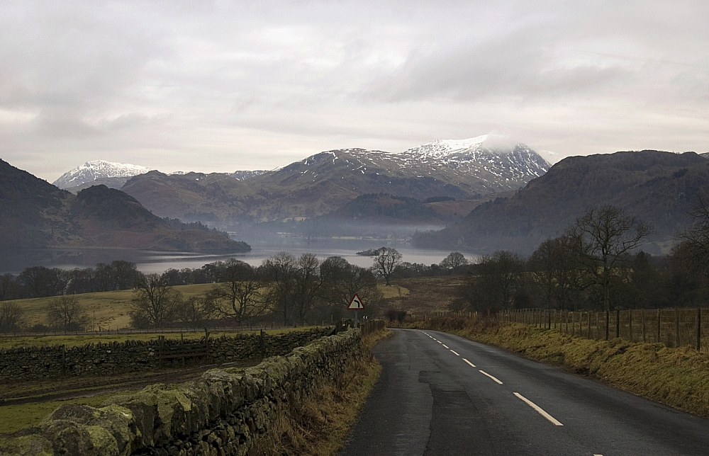
The usual battle on the M6 didn't happen - the drive up was a sedate and rainless affair, mainly due to those excellent "average speed" cameras set up along the many miles of carriageway-widening scheme works which aims to provide us with four lanes each way by first cutting us down to two. Borrowdale YHA was reached at a reasonable time, and I got the pick of the bunks in the dorm - needless to say, I nabbed the one by the radiator. While I was sorting the gear the rain started and became so strong that I decided to stay in the hostel for the evening meal instead of paddling to the nearest bar. This turned out to be a shrewd move, as the three-course hostel fare was excellent, the lamb hot-pot being the best I've had for a long time.

After an evening of chilling and route-planning, I'd decided that the objective for Saturday would be Ullscarf via Greenup Edge, with the option of doing a one-eighty and extending the route to include High Raise if time and conditions were favourable. I packed the kit accordingly and hit the sack early.

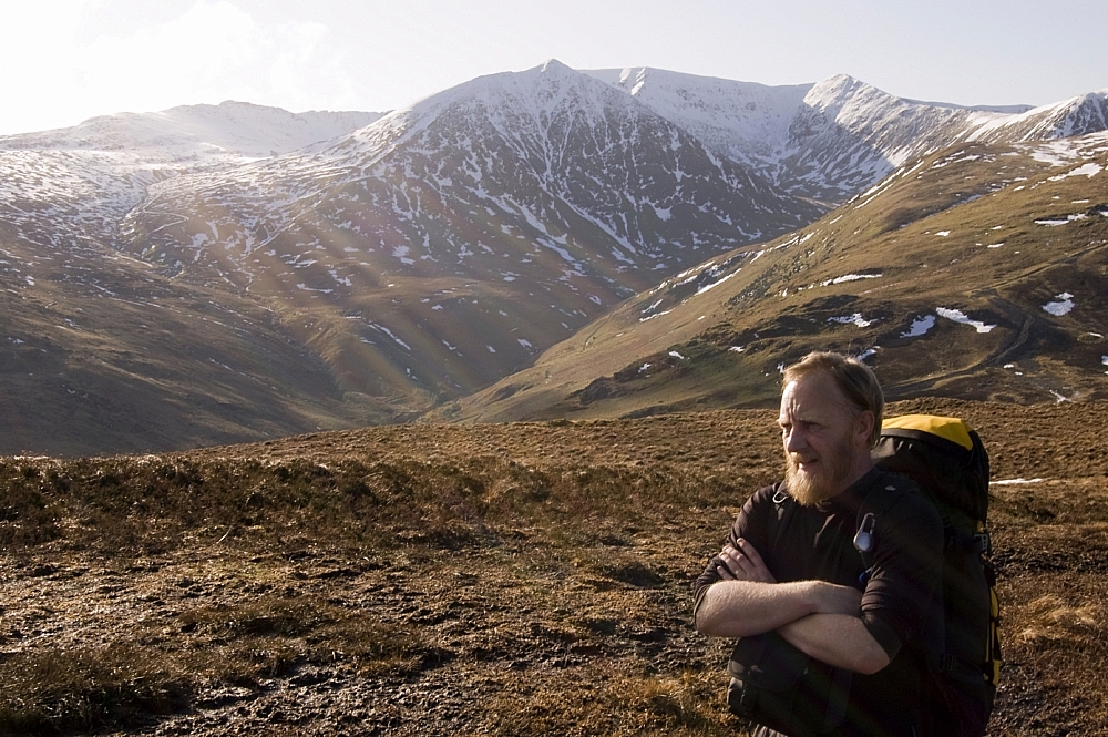
Next morning I was up bright and early. The rain had stopped and things were looking good. After a hearty three-course YHA breakfast I donned the pack and ventured outside, just as the rain started again.


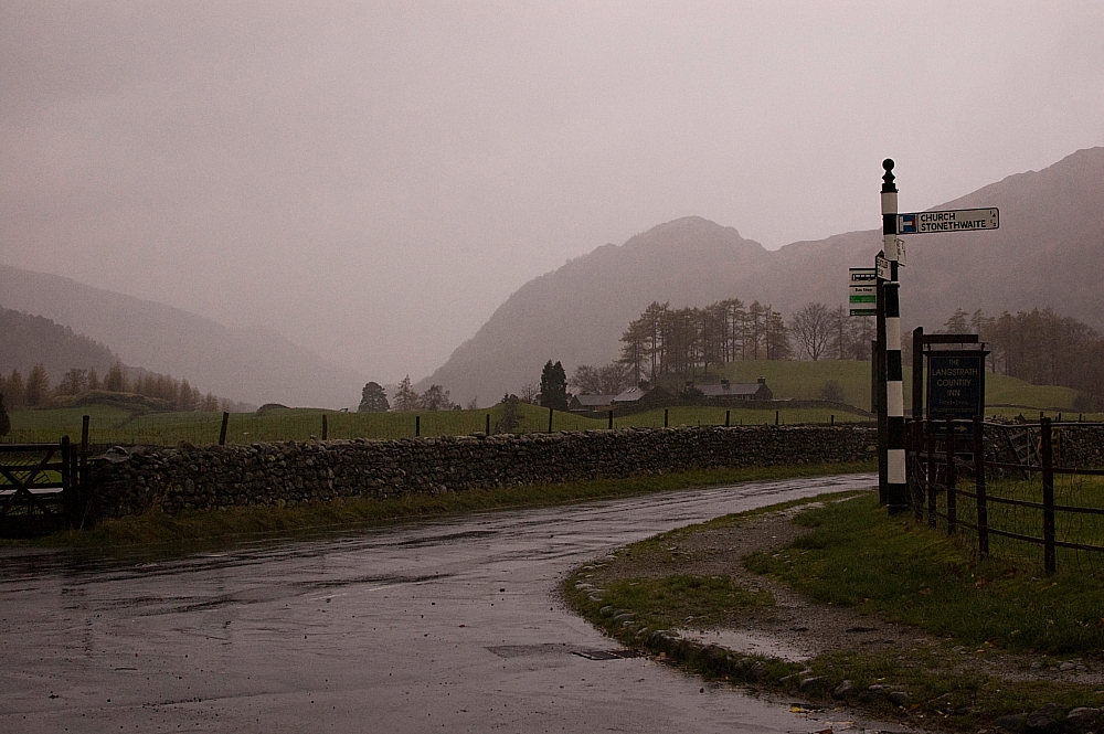
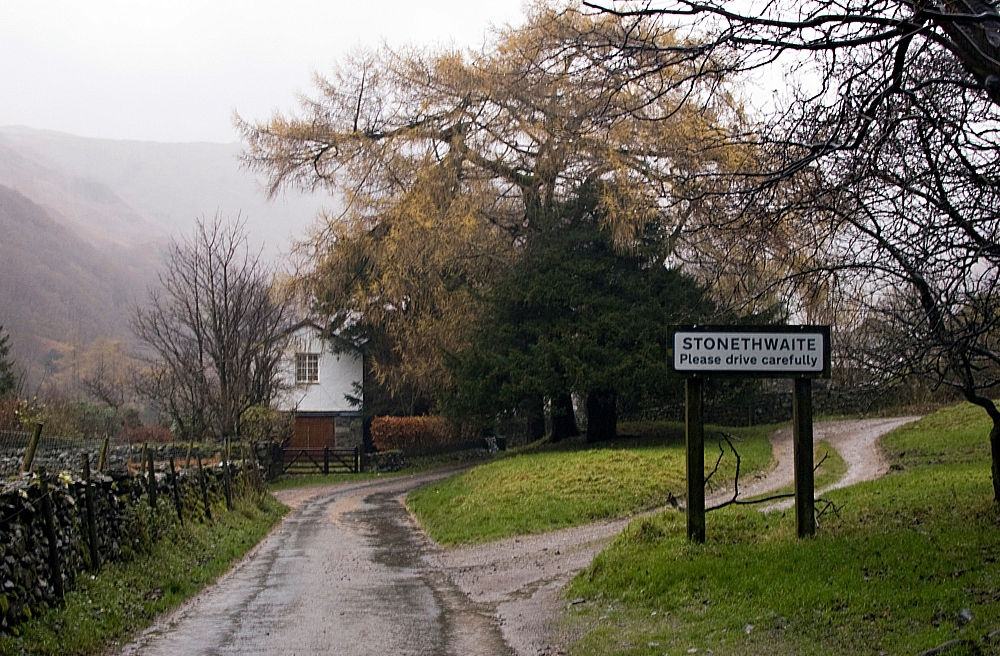
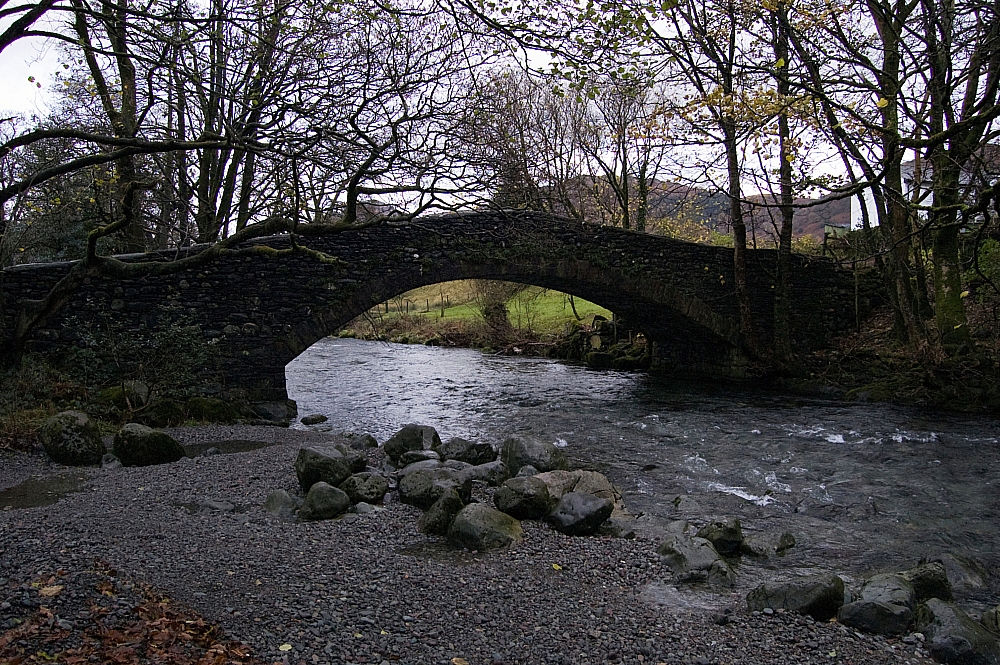
The walk through Stonethwaite, across the bridge and up Stonethwaite Beck, was sodden underfoot but for that first half-hour I was comfy using the Rab VR Climb as defence against upper-body wetness. It all changed as I passed Galleny Force, however, as the gods put the weather-machine into overdrive. The rain suddenly got much heavier and an evil wind started chucking it down the valley. As predicted, the Rab Corrie jacket had to be wielded in anger for the first time. I've never seen so much water running down the fellsides...


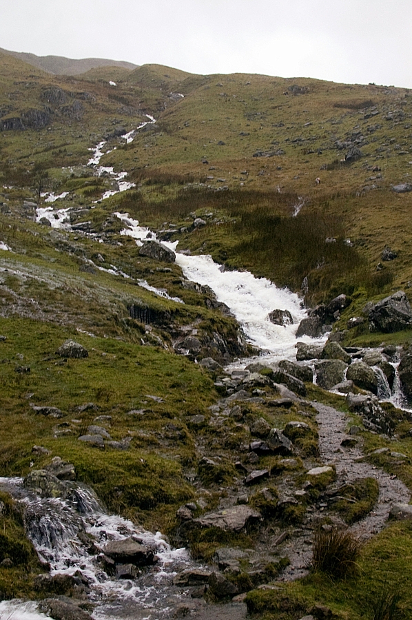
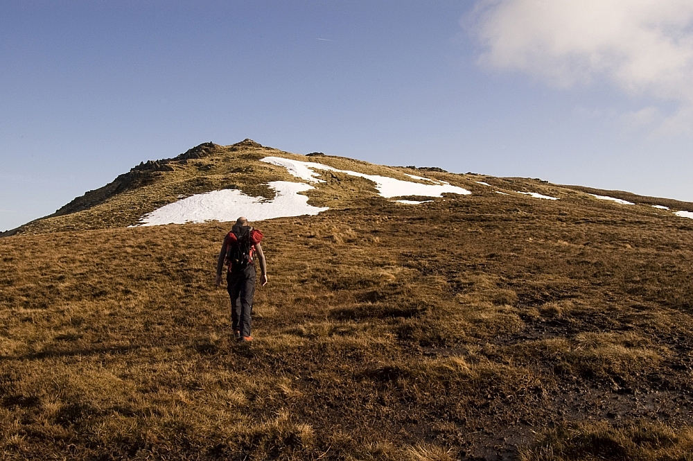
The run-off had submerged the path in many places, which meant that crossings were dodgy affairs, not so much because of the depths but more because of the force of the water. I waded the worst of the crossings as I slogged up the Greenup Gill path as far as the confluence of Greenhow and Mere Gills but there I found the water impassable without both danger and loss of dignity. After heading upslope alongside one of the two Mere Gill tributaries and finding no better options for crossing, I decided that my best option would be to change the plan and attack the fell directly, rather than via the Edge. It didn't look too steep on the map - just a few bits of 45 degree stuff, easy to zig-zag. So up I went.

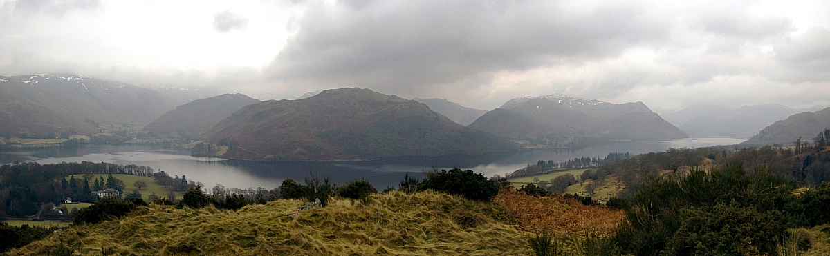
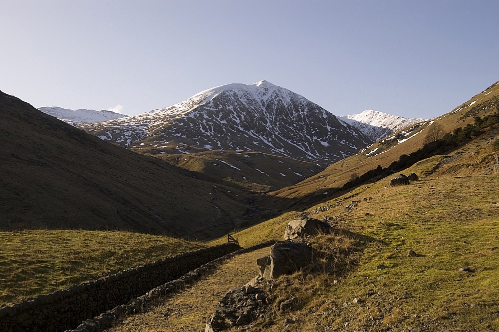
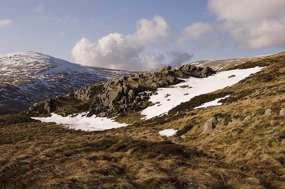
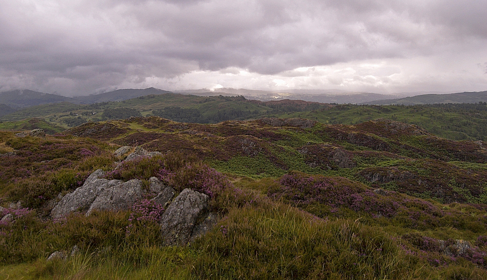
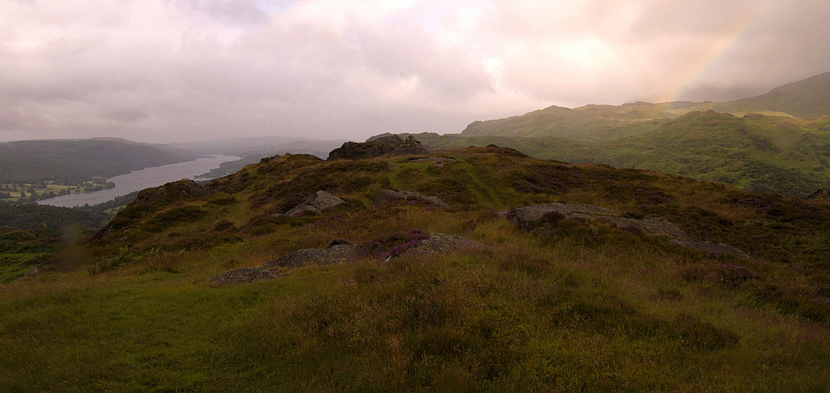
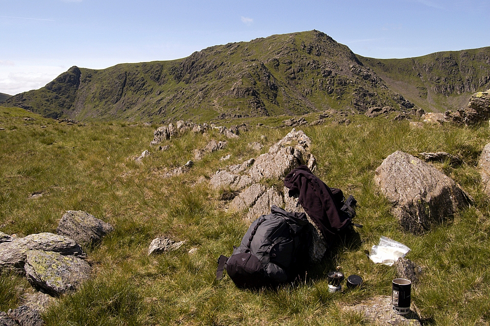
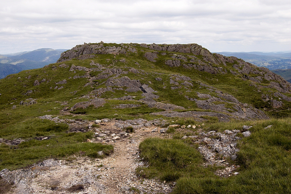
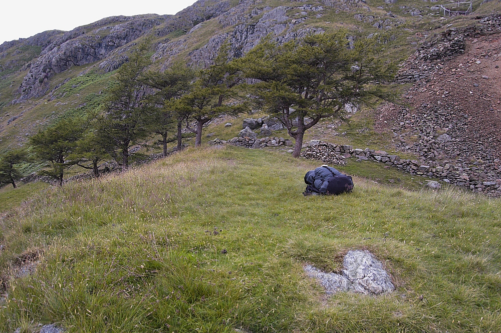
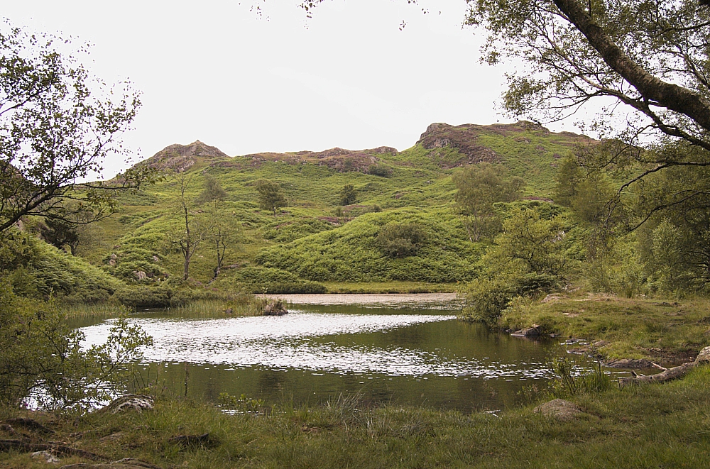
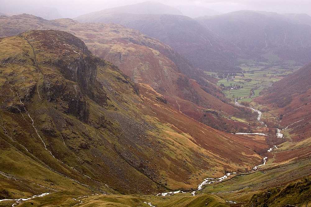
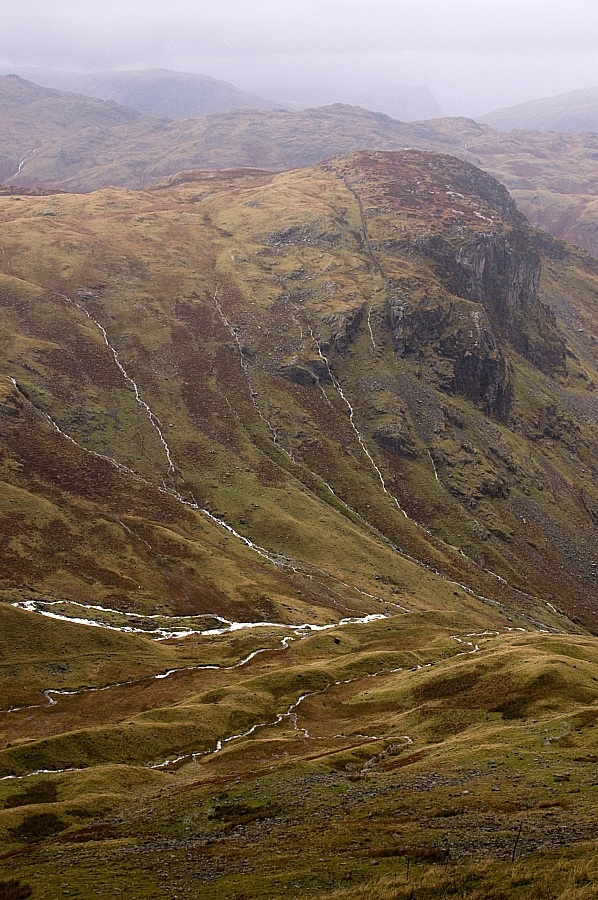
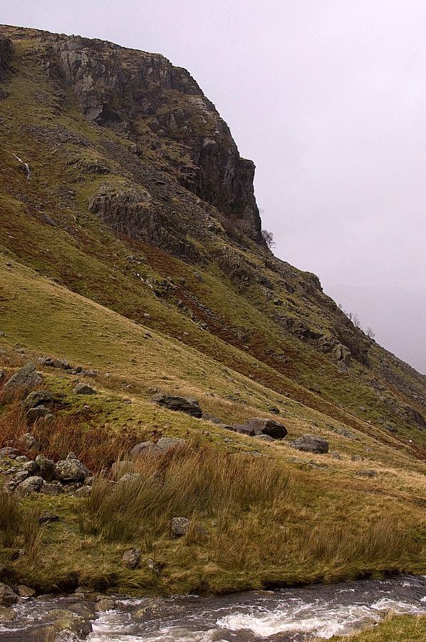
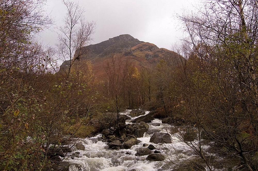
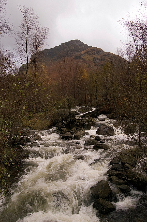
Well, it was a knackering experience, all the better for the ground being slippery enough to ensure that the adrenaline never stopped flowing. I found just one small level place, near the top of the steep stuff, where I dared to stop and take some pics. I'm glad that I went up that way though, as it's a great place from where to view the glacial features of the hanging valley and the proper proportions of Lining Crag without it all being distorted by perspective:


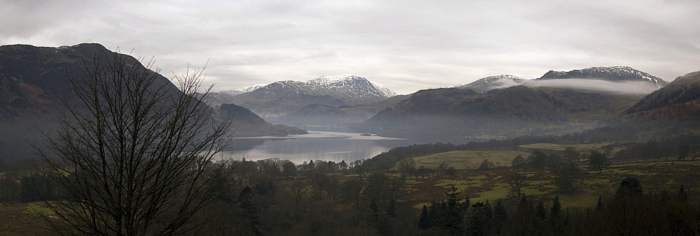
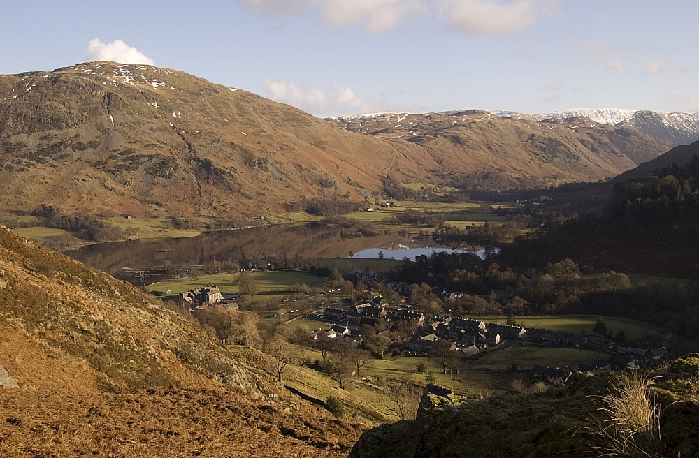
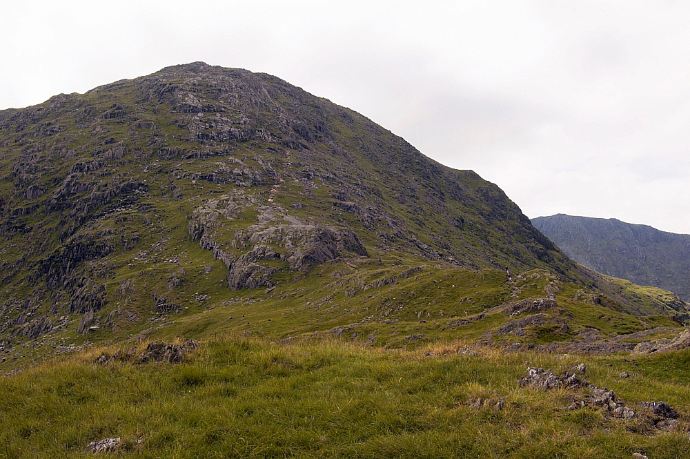
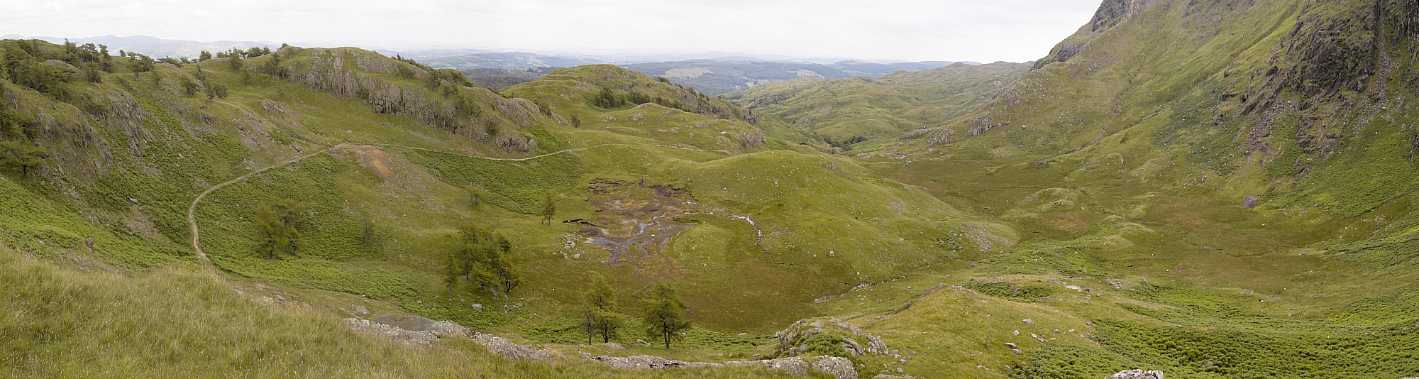
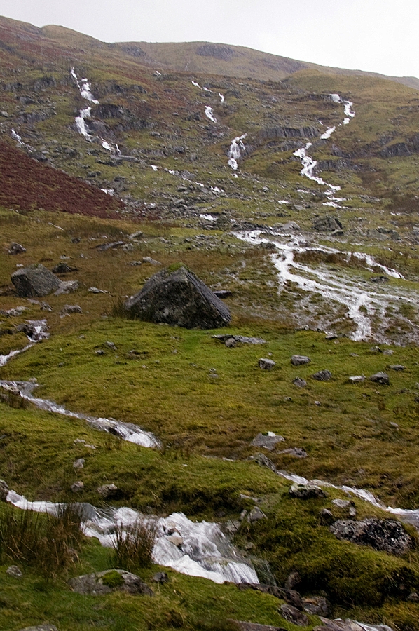
The view down to Eagle Crag and Borrowdale wasn't too bad either:


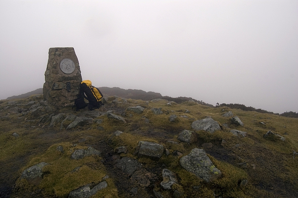
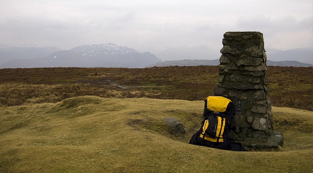
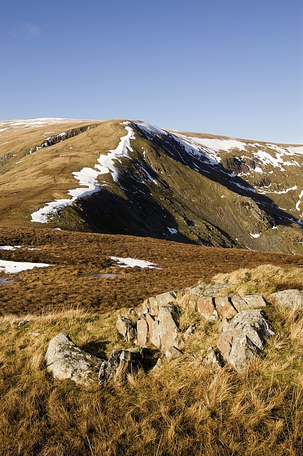
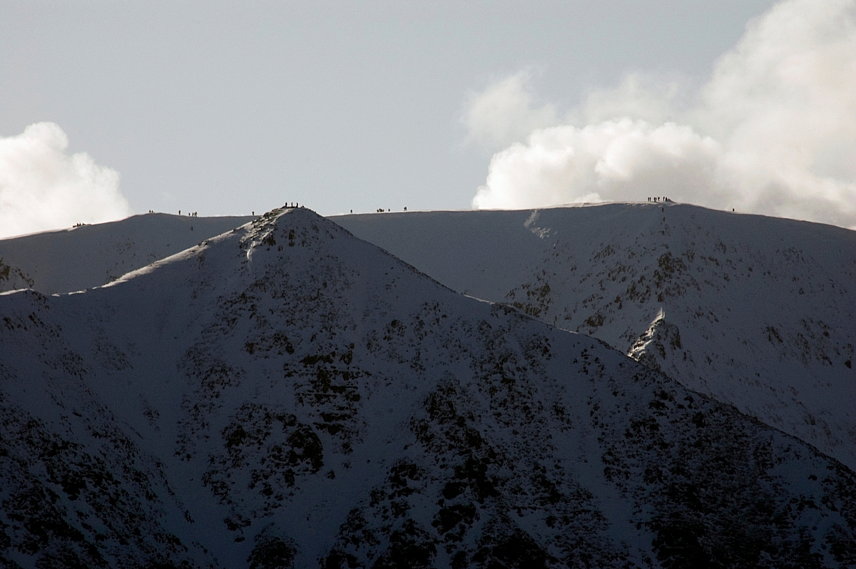
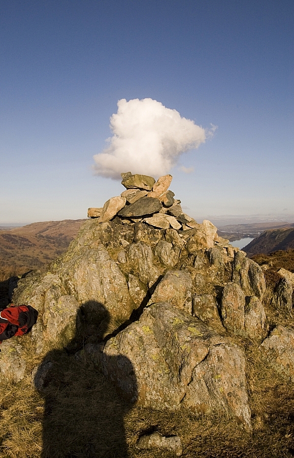
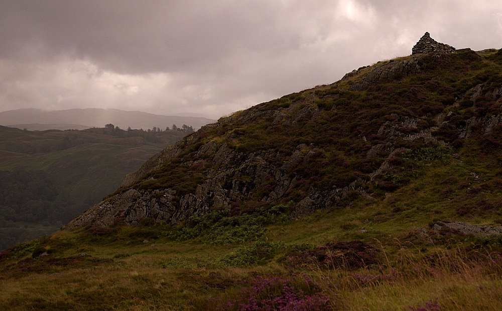
From there on it was a marshy trudge to find the ridge's line of wireless fenceposts, which crosses the summit and hence was a good guide in what was now the base of the clouds. After 20 minutes of alternating clarity and wind-whipped clag I found the summit-cairn and stopped to take pics:


Then I did a one-eighty and headed back towards Greenup Edge, into the wind-driven stinging rain and weighing-up in my mind the option of extending to High Raise. Occasionally I could make out the path up there from the Edge, but it was mostly clagged up and didn't look appealing. As I neared the decision-point deep in the flooded marshes atop the Edge it started hailing big-time, which made the decision obvious - a dignified retreat to Lining Crag and a descent from there seemed much the more sensible thing to do. After slopping and wading to the big cairn overlooking the way down to Greenup Gill I found the path and set off to Lining Crag.


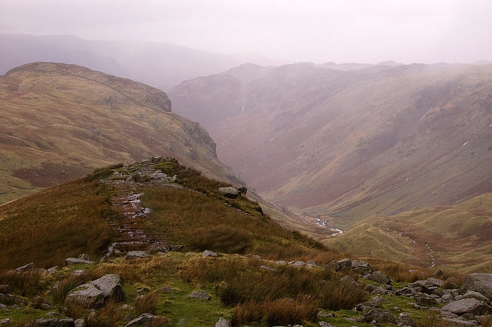
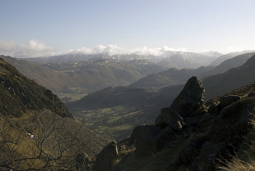
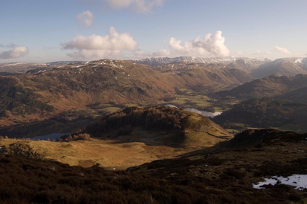
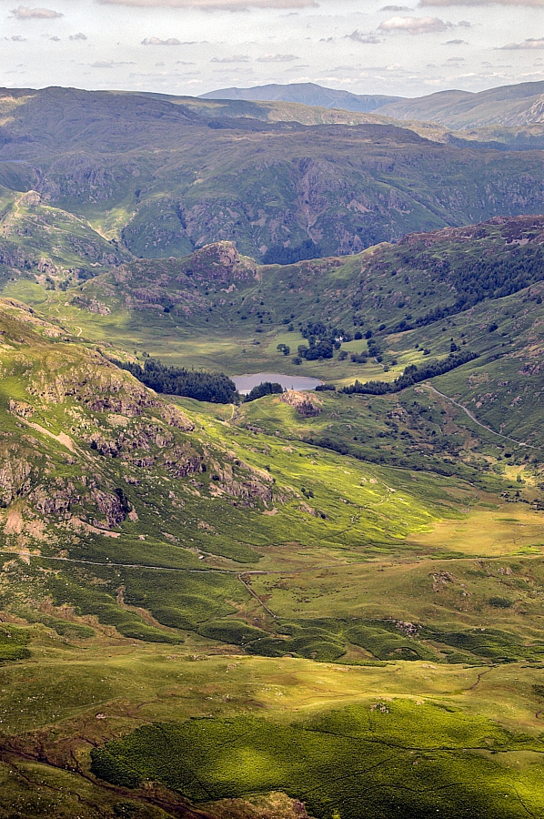
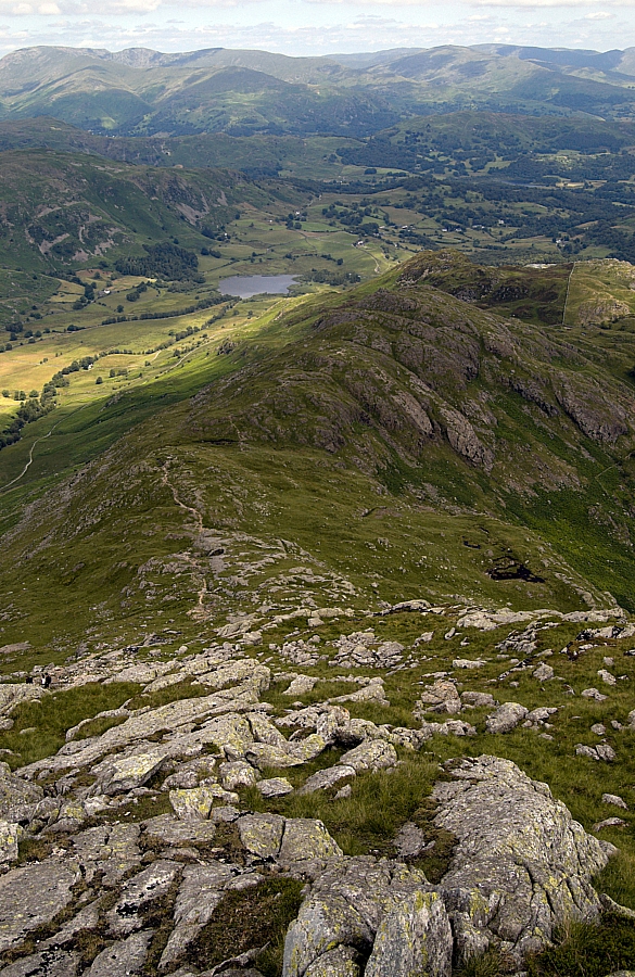
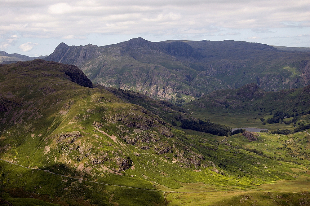
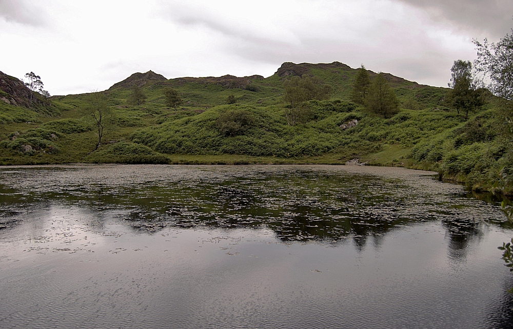
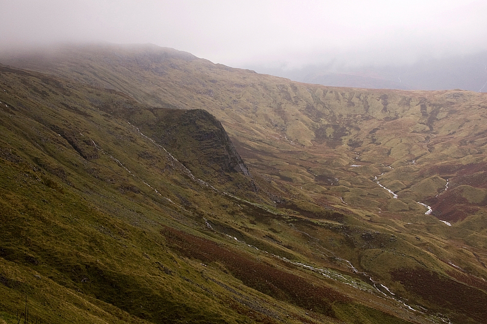
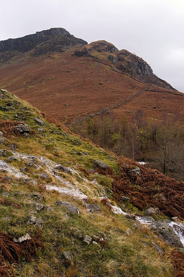
The views from the Crag were impressive during occasional breaks in the cloudbase, and I took some pics, but soon it was time to continue the descent. And that's where it all started to go bad...

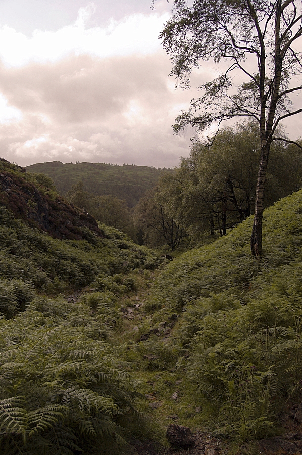
There's a made-path down the side, where the crag meets the fellside. It's near-enough a straight-line down at a severe angle and due to the incessant rain it had become a cascade (it's the stream that you can see in the first pic of Lining Crag above). The rocks used for the path have been set at a slight angle downslope so that they don't retain water, but that just makes a slip more likely in descent. And that's what happened, several times, straight into the cascade. One particular slip ended in a twisted knee which I thought was going to be a day-wrecker, but it held together quite well and didn't cause any major hassle. By the time I got to the base of the crag, I was utterly soaked and the pack was full of water. Luckily all of the important kit was in roll-top liner-bags.

At the base is a small grassy flat where two couples were having a breather before their attempt to go up the path. They didn't have much of an option as they were practising their "Coast-to-Coast" route, bound for Grasmere via Greenup and Far Easedale, but I'm sure that they thought twice about this section having watched my antics. We chatted for a few minutes, during which I told them about the conditions on the path and up on the Edge. After a few more minutes I left them to it and started off towards the valley just as the rain started to ease.

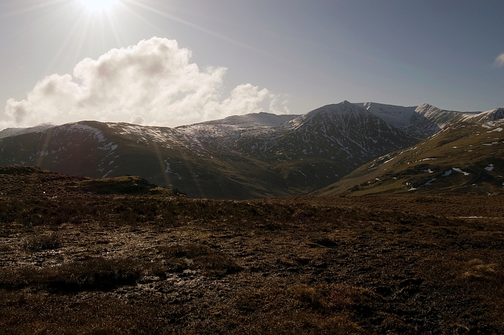
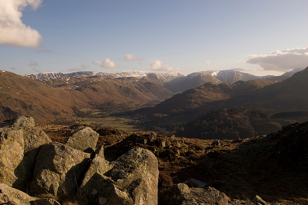
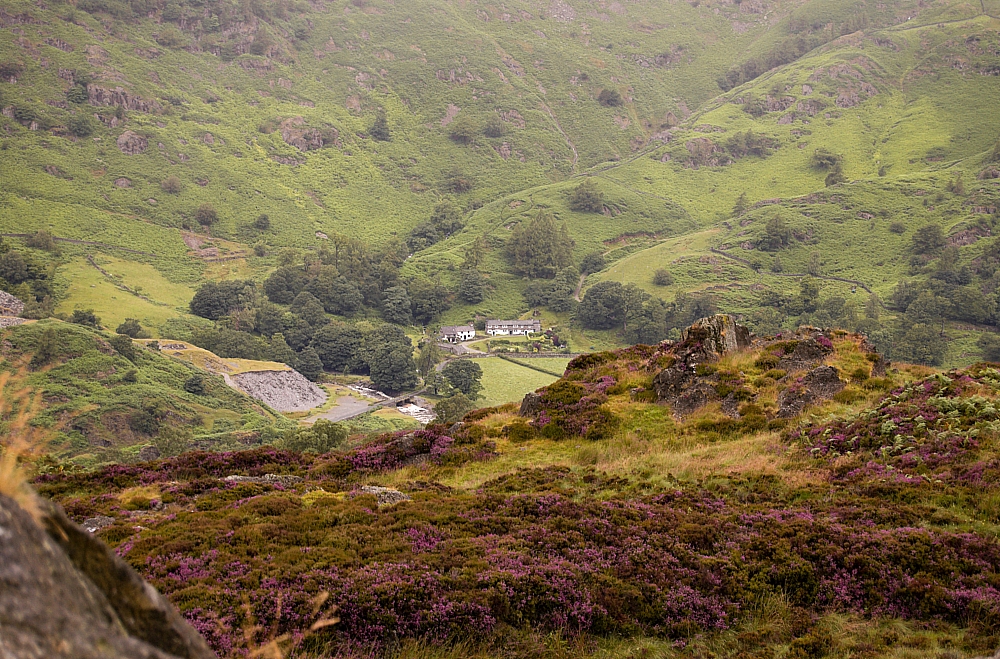
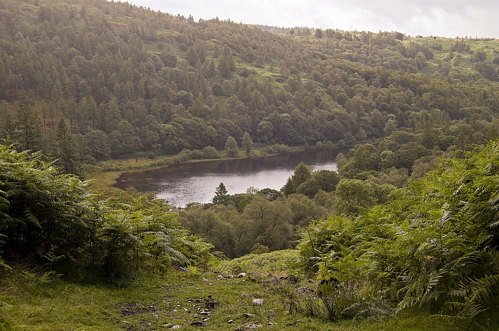
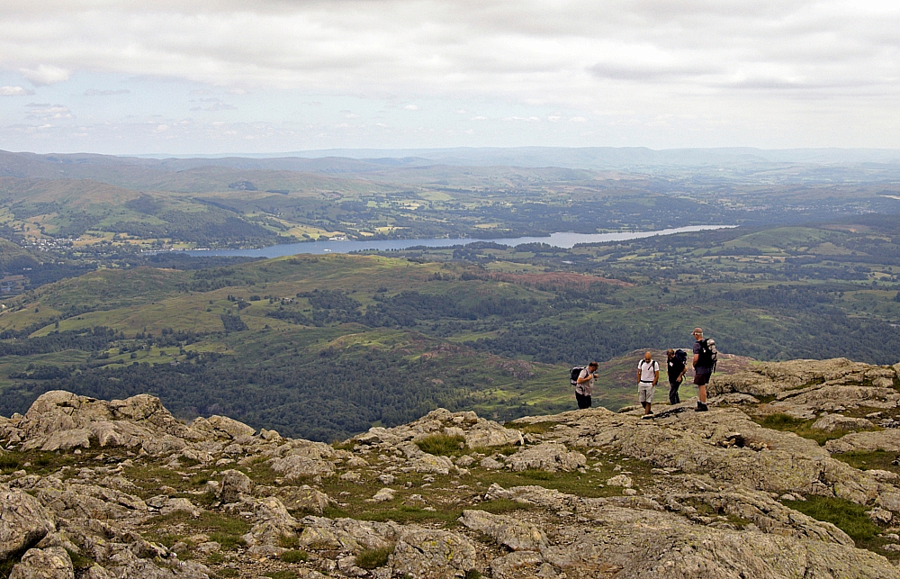
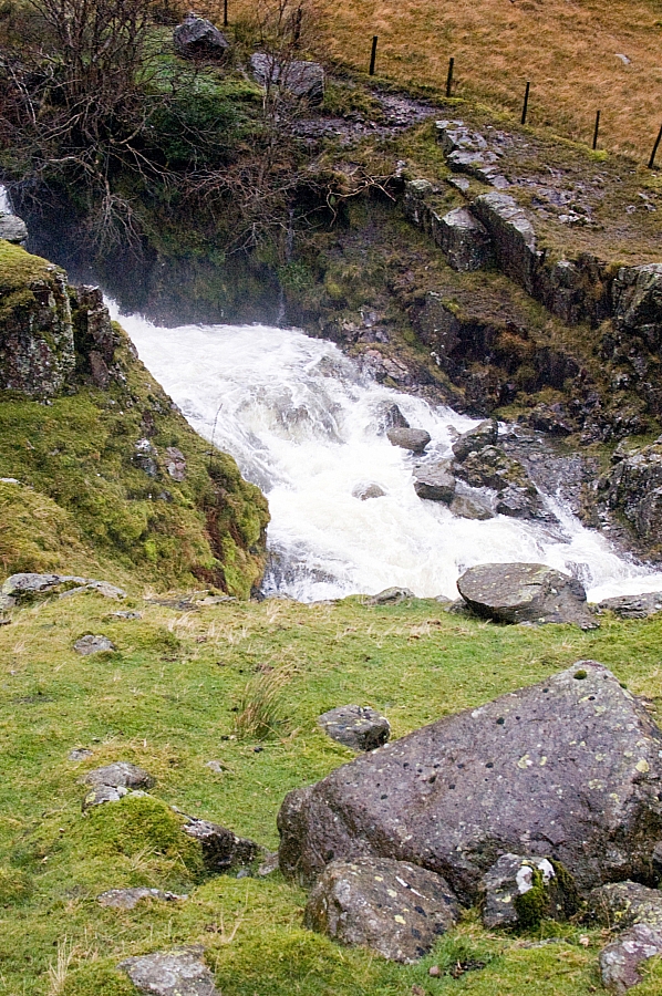
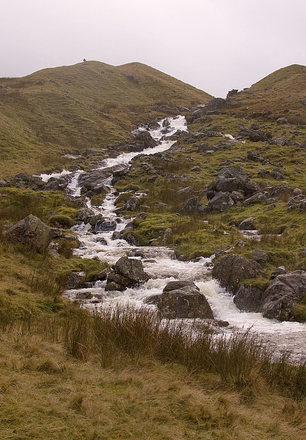
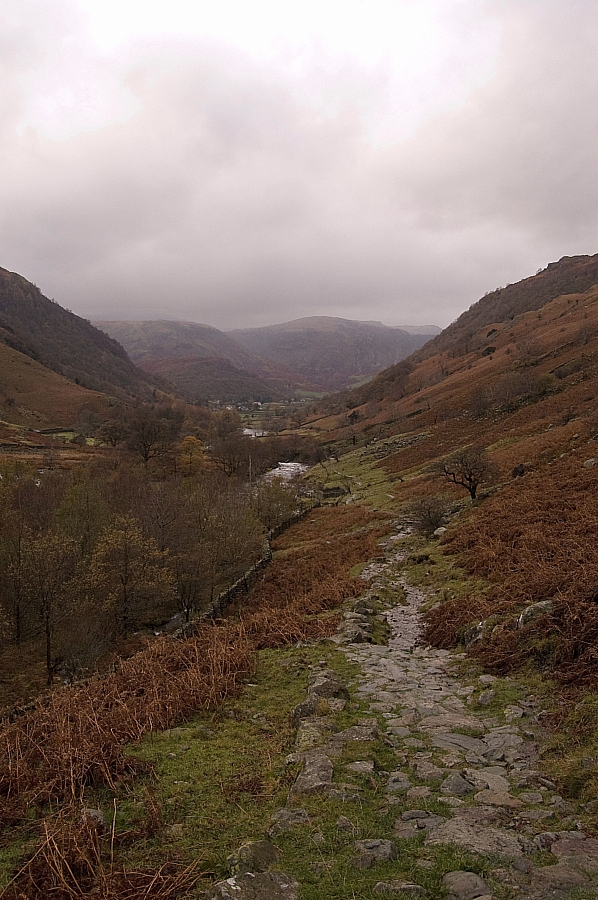
The descent was uneventful until I got to the stream that had blocked me on the way up. The level had dropped by a couple of feet and I judged it safe to cross,  but I underestimated the force of the water and was swept off the submerged stepping-stones and ended up standing in three feet of white water. It was a very effective way to clean the mud off me boots. Walking further, I grabbed a few more pics in the improving conditions:


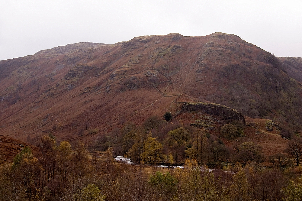
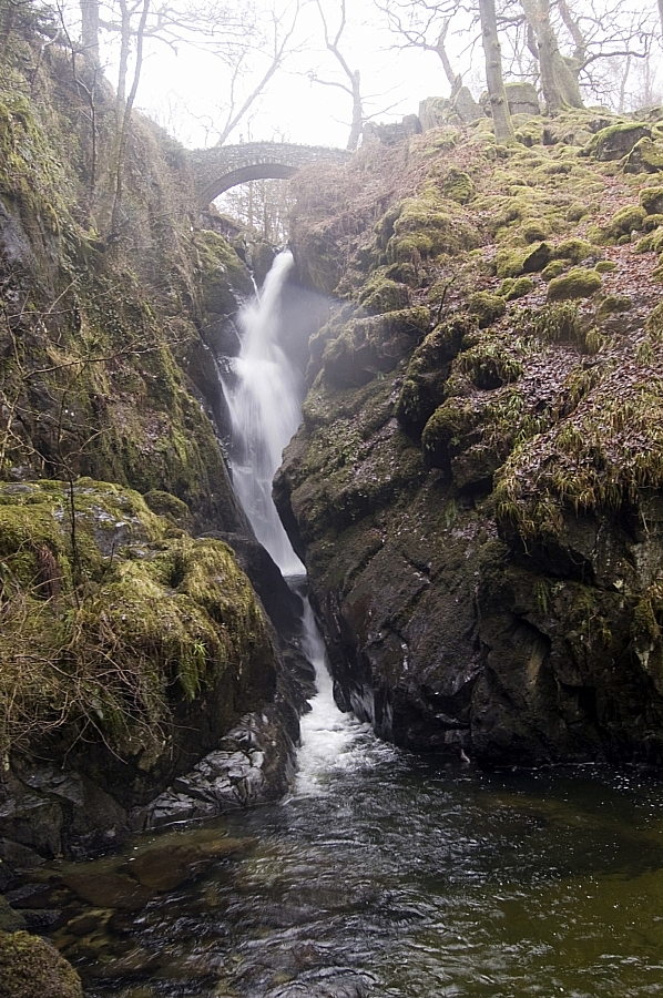
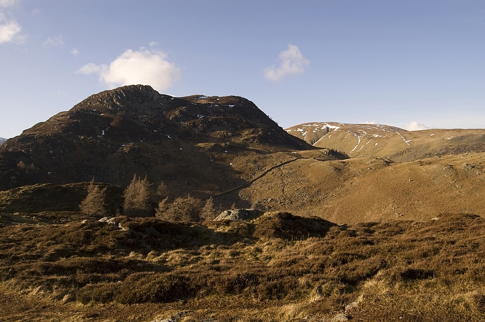
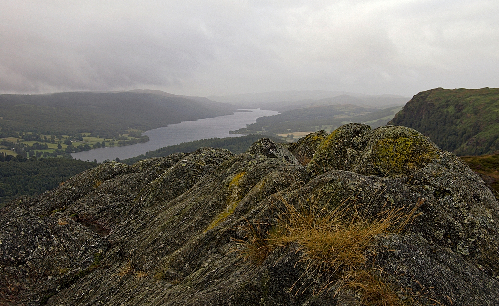
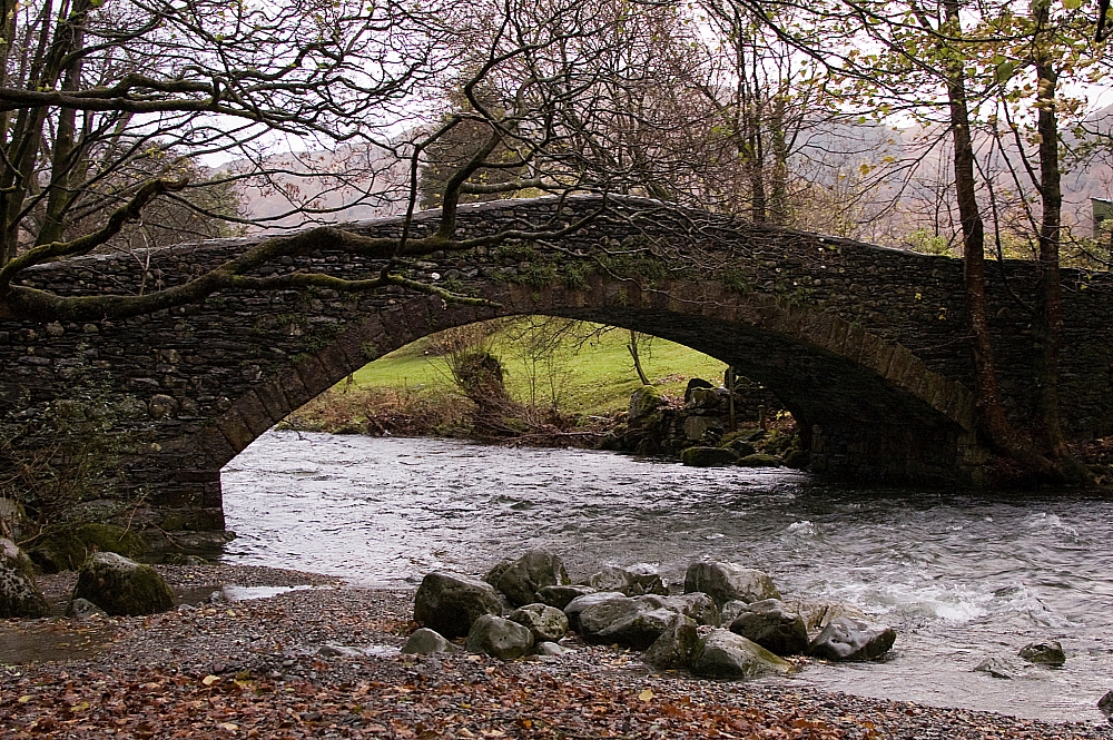
I was beginning to think that I would make it back to the hostel with no further hassle, as the wind had dropped and the rain had stopped, so I paused for a breather at the bridge just above the confluence with Langstrath Beck, where there is a magnificent view of Eagle Crag. My poor camera skills don't do it any justice whatsoever:


I started back down the easy last few miles just as the weather kicked in for the last time. The wind had done a one-eighty and was now full in the face, and the rain started stinging again.

And did I care?

Not one bit.

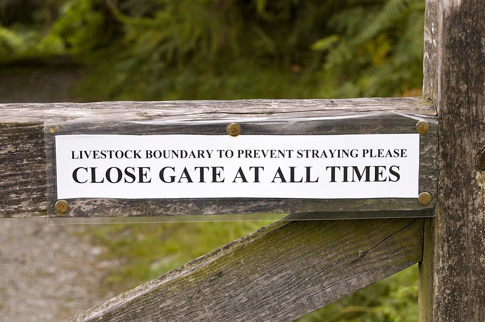
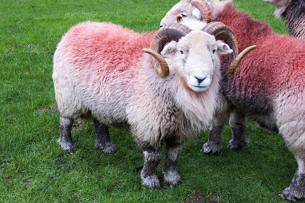
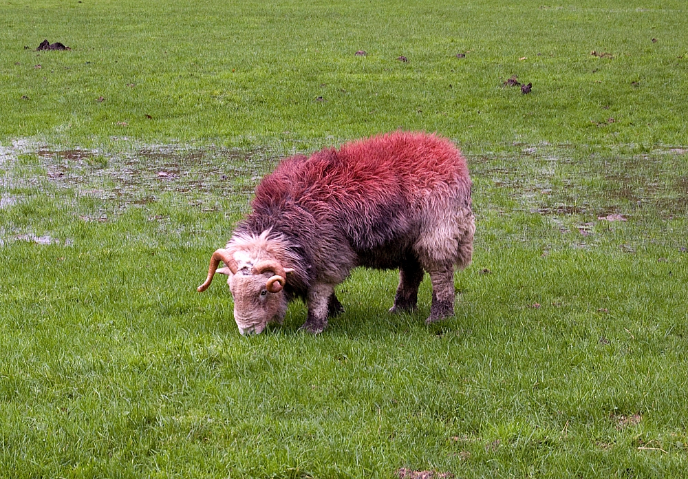
I was wet, yes, but I was warm and happy. There was no point in avoiding the streams and flooded paths, so I just waded and splashed through them, just like a big kid. Great fun! Even the livestock seemed to be enjoying the weather:


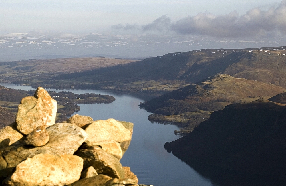
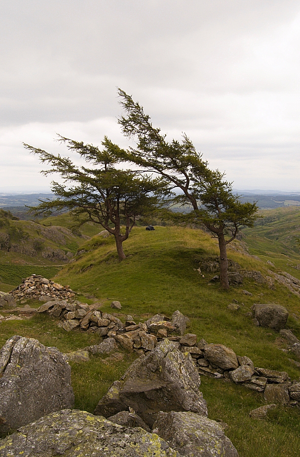
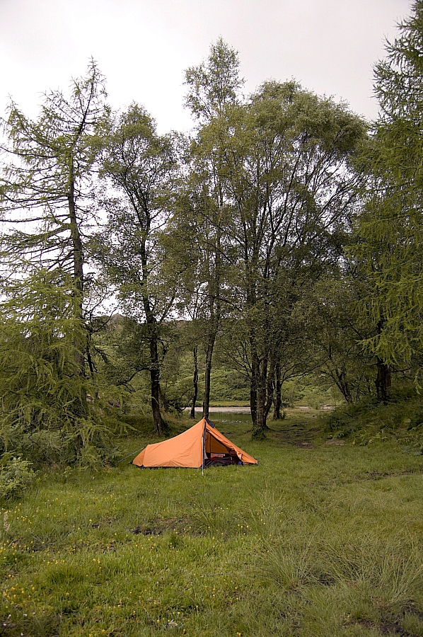
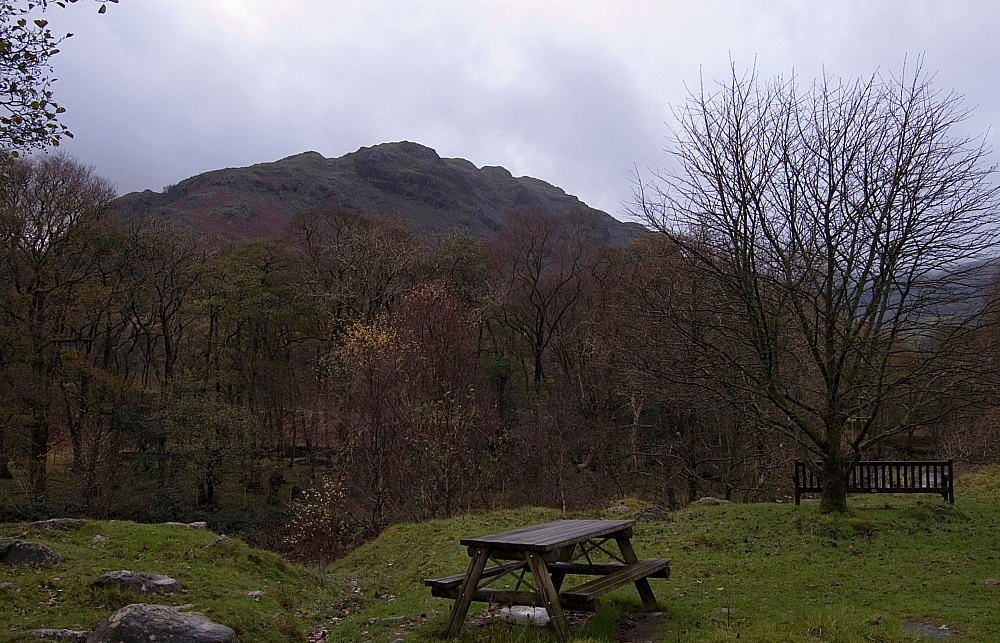
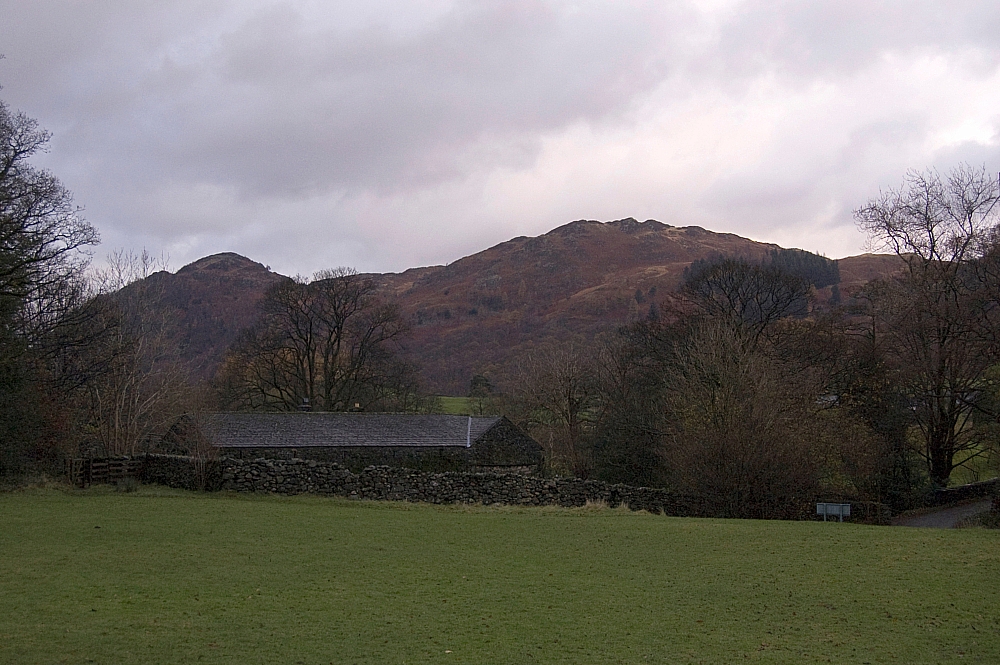
Right at the end of the walk I dragged the camera out again for a few more pics before the light failed. The views from the hostel grounds are quite good - much better than shown in these shots :


Back at the hostel my gear took up a good chunk of the drying-room. I even had to get the warden to put my camera and lenses in a safe place to dry, as they were wet through. Later, while sat in front of the open fire, I put a tick against Ullscarf on my Wainwrights list and then double-checked the total number visited so far.

The number?

One-eighty, of course.

To be continued...

.

Coniston Fells Wildcamping (again) – Part 4 – Beating the Odds

Posted by on July 23rd 2009 in Great Escapes, Lakes Escapes, Wildcamping

It was 04:30 when I was woken up by strange noises just outside the tent - something was trying to get in. I turned over slowly and peered through the mesh of the door-panel, expecting to see a hedgehog, or maybe a badger, but all I saw was a snout and tongue being pulled back from under the edge of the flysheet. The owner stayed put while I reached for the camera, and even while I unzipped the inner and fly, but as soon as I tried to get a shot, the thing (and another smaller version of it) was off like a shot. It was a couple of deer, I've no idea what sort, taking an unhealthy interest in the remains of the previous night's fish risotto.

I looked around. The rain was now a light drizzle, and it was windless again. The area around the tent was now a bit marshy and was dotted with the tracks of many deer. Mindful of the association between deer and ticks, I stayed out of the long grass and bracken as much as possible while visiting the cat-scrape.

A quick breakfast followed, and to loosen the legs I walked a circuit of the reservoir while supping a brew. The sky was telling me to get packed up and away, but I was going to get damp anyway so I took my time striking camp.

Eventually I was off again. Following the paths was easy, but a fair amount of bracken-dodging was necessary, there being quite a few ticks on the fronds just waiting to hitch a ride on my clothing.

Soon I was at the top of Holme Fell...


The top of Holme Fell


from where there was a fine view of the place where I'd camped:


The quarry reservoirs from Holme Fell


I spent some time wandering about on the top, taking a few pics when the drizzle slackened off (which wasn't often). Considering the small stature of the fell, the views are quite extensive:


Towards Windermere and Latterbarrow


Ivy Crag


Low Tilberthwaite


Coniston Water


Sunlight from the east, rain from the west and wind from the south all conspired to create this colourful scene:


Interesting weather


Then it was time to go. With the weather alternating between sunny spells and heavy showers, I skirted the north side of Ivy Crag to join the path down though the Usk Gap...


Trees in the Usk Gap


which opened out above Harry Guards Wood to allow a fine view of Yew Tree Tarn:


Yew Tree Tarn


The junction of the path with the road near Glen Mary Bridge marked the start of a fair old road-walk back into the car, and it was going to be a grind in the now-constant rain. A few folk were driving away from Coniston, but nothing was going the other way, so the chances of a hitch were small.

As I rounded the corner at Nether End the last vehicle to go by, a white van, came back and pulled over - it was Steve. If he'd been five minutes earlier I'd have still been on the hill, and five minutes later I'd have donned waterproofs (for the first time in about five years) and he wouldn't have recognised me. It was pure chance that we were both on the same stretch of road during that ten-minute window - what were the odds of that happening? He was on his way home after having spent a wild, wet and windy night pitched at Goatfoot Crags. Needing no second invitation, I slung the gear into the back and accepted his offer of a lift back to my car. Cheers, Steve!

After retrieving my gear, we said our goodbyes all over again and he went off to the shops of Ambleside.

It goes without saying that the rain had stopped and the sun was nice and bright by the time I'd changed, packed and started the car.

I felt good, so good that driving home while dodging the suicidal feckwits on the M6 has never been so much fun.

Right, that's the end of the write-up. The may be a post-trip kit and route analysis sometime, but don't hold your breath.

Coniston Fells Wildcamping (again) – Part 3 – More Roasting

Posted by on July 21st 2009 in Great Escapes, Lakes Escapes, Wildcamping

I sat in the shade of a boulder at the Fairfield col, supping tea, assessing the conditions and pondering the map. Well, the Xda Orbit to be precise - the more I use it (with MemoryMap loaded), the more I like it. It's not just that it uses the GPS to mark my position on the map, I like the way it tells me the direction of travel from that position as soon as I move away from it. And there's the huge amount of map data that can be fitted onto the tiny transflash/microSD card. And the internet access, which, signal permitting, can pull up Google Maps and the like. And...

Anyway, back to the assessing...

The thermometer was chucking out big numbers... up to 35C in the shade, and the lack of breeze wasn't helping matters. I took in 2 pints of fluids in preparation for the slog to the next known water-supply. Before getting there, there was the rather inconvenient matter of a fair bit of backtracking - a direct slog back up the grassy slope to Swirl How and a return down the Prison Band to get to a footing on Wetherlam...


Skiddaw and The Langdale Pikes from Swirl How.


Yet again I was surprised to have a summit of Swirl How to myself. I could see a small party of folk on the top of Great Carrs, but other than that the area was strangely devoid of people. Anyway, I pushed on back down the Prison Band, back to Swirl Hawse and started the pull up the slopes of Wetherlam, where the sun and lack of breeze dictated another stop as planned at the next watering-hole (NY 27995 00855, another possible wildcamping spot?):


Swirl How and the Prison Band from the Wetherlam path


With body, Platy and Aquagear bottle rehydrated from the peaty puddle, the walk up to the top of Wetherlam was a doddle. Compared to earlier, the summit was as busy as a supermarket car-park - at least fifty folk were resting their weary bodies up there. I waited a respectable distance away from the cairn, and made another brew and a meal while the summit cleared and the skies clouded over a little, offering some protection from the sun. Eventually I'd had enough, and after taking a few pics from the top...


Windermere from Wetherlam


Blea Tarn from Wetherlam


I made my way down the steep shoulder of Wetherlam Edge:


Looking down Wetherlam Edge to Little Langdale


to the neat little top of Birk Fell Man...


Birk Fell Man


before stopping for another photo-opportunity:


Looking back up Wetherlam Edge


The Langdale Pikes from Birk Fell Man


Taking the path off to the right, there was a steepish descent to a strange tree-guarded grassy platform which had great views over Dry Cove Bottom. If it wasn't for the lack of readily-available water, this would have made an impressive, if exposed, wildcamp pitch:


Trees guarding the platform


Another view of the platform


Dry Cove from the platform


The original plan was to overnight in Dry Cove Bottom near to Henfoot Beck, but it was only mid-afternoon - far too early to settle down, and I was in no mood to stop walking. Besides, any heavy overnight rain would probably result in a washout, so I changed the plan on-the-fly and decided to carry on and do part of the route that I'd planned for Sunday.

I followed the path along the side of the Tilberthwaite Gill gorge and reached the road from behind the cottages of Low Tilberthwaite:


Low Tilberthwaite cottages


Although the sky was now completely clouded over, the air was still hot and still, so I had a five-minute breather next to Yewdale Beck while trying to figure where the RoWs (RsoW?) were on the ground. I decided that the path lay across fields from High Tilberthwaite to Holme Ground...


Holme Ground


and then up through gated woodland...


So, does anyone else think that a little punctuation would go a long way?


to the two disused quarry reservoirs to the north of Holme Fell:


The larger quarry reservoir


Ivy Crag and Holme Fell


Although it was only early evening, I pitched in the trees next to a swathe of Juniper bushes which gave off a most wonderful aroma. After roaming around for while I settled down to a meal and a brew just as the clouds gathered and the wind and rain started:


The pitch in the woods


Knowing that I was in a good place for an early-morning saunter up to Holme Fell, I hunkered down for the night before darkness fell, safe in the assumption that there would be no NT wardens about in such conditions. The rain during the night was constant, and driven hard by the wind, but the tent held firm and performed admirably. I had no trouble sleeping.


To be continued.