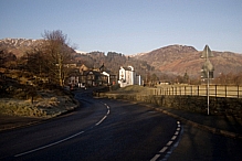
While other hardy souls are slogging it out across Scotland on the TGO Challenge, we'll be taking it easy. We've decided to do a weekend mini-tour of the Far Eastern Fells, primarily because Chris has been wanting to walk along the High Street for some time now.
I know that there are many people out there who would consider this to be just a long day-walk, but we'll be taking things easy, the pace will be leisurely and we intend to savour the experience, not dash across the hills in a race to the next waypoint.
The main route takes in:
- Howtown
- Bonscale Pike 1718ft
- Arthur's Pike 1747 ft
- Loadpot Hill 2201ft
- Wether Hill 2210ft
- High Raise 2634ft
- Rampsgill Head 2581ft
- Kidsty Pike 2560ft
- High Street 2718ft
- The Knott 2423ft
- Rest Dodd 2278ft
- The Nab 1887ft
- Angletarn Pikes 1857ft
- Any pub in Patterdale or Glenridding
Optional add-ons from High Street include Thornthwaite Crag 2569ft (just to see that magenta sky again!) and Mardale Ill Bell 2496ft.
Wildcamping spots and water-gathering opportunities have yet to be finalised, but such trivial matters should sort themselves out soon enough 🙂
I'll have to get this lot plotted into Memory-Map to see what sort of totals it comes up with, then when we've done the graft I'll do a comparison with the route as recorded by the Geko 201. It'll be interesting to see if there are any major differences.
It should be a good weekend if the weather is good.
THE SMALL(ish) PRINT... (updated 23/07/2016)
By submitting a comment to this blog you grant me permission to reproduce its content and to reproduce the submitted name/URL in attribution. I will leave your content in its intended place and in its unedited form unless one or more of the following apply:
If you ask me to modify, move or delete your content, I’ll consider making the requested change(s) so long as there’s no significant alteration of the context of the content or of any debate associated with it;
If you change your email address or URL, I’ll update these details in older comments so that I'm not displaying dead links;
If I decide to change the theme or layout of this blog, thus affecting the placement and/or visibility of comments, I’ll make whatever changes I see fit for the smooth running of this blog;
If any comment contains insulting profanity or other content which I deem to be causing or likely to cause trouble, I’ll edit or delete as I see fit for the smooth running of this blog. I’ll try to remember to display the reason(s) for whatever editing I do, so that folk aren’t left hanging wondering what happened and why. If you can at least try to "disguise" your swearing, it would be much appreciated.
Other things to consider:
Comments must contain at least 3 characters;
You can use some code in comments, feel free to give it a shot and see what works;
If adding pics, the recommended maximum dimension is 600px.;
Comments containing many links will be held for moderation;
I reserve the right to amend this policy in line with proven applicable current legislation;
Free Speech: you may well have the right to it, but you've no right to compel me to a) listen to it, or b) publish it!


looks like a bit of note comparing when we mee in June then BG.
I’ve covered Patterdale/Angle Tarn and ridge’d it via T Crag across to Yoke last year, but am looking at the far eastern route post the blogger meet up.
Just not too sure how to get to Yoke (my target), without recovering old ground too much
“looks like a bit of note comparing when we meet in June then BG.”
Fine. You bring the paper and pencil, I’ll bring the bullshit 🙂 Seriously, though, feel free to email me if you want any info.
OK, will do
😉